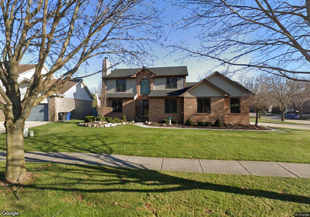
7560 Maple Dr Westland, MI 48185
Estimated Value: $414,000 - $467,000
3
Beds
3
Baths
1,977
Sq Ft
$219/Sq Ft
Est. Value
About This Home
This home is located at 7560 Maple Dr, Westland, MI 48185 and is currently estimated at $432,024, approximately $218 per square foot. 7560 Maple Dr is a home located in Wayne County with nearby schools including Rosedale Elementary, Johnson Upper Elementary School, and Frost Middle School.
Ownership History
Date
Name
Owned For
Owner Type
Purchase Details
Closed on
Apr 10, 2018
Sold by
Lenerz Michael J and Lenerz Tammy S
Bought by
Lenerz Michael J
Current Estimated Value
Purchase Details
Closed on
Dec 22, 1998
Sold by
Hix Development Inc
Bought by
D Orazio Contracting Corp
Create a Home Valuation Report for This Property
The Home Valuation Report is an in-depth analysis detailing your home's value as well as a comparison with similar homes in the area
Home Values in the Area
Average Home Value in this Area
Purchase History
| Date | Buyer | Sale Price | Title Company |
|---|---|---|---|
| Lenerz Michael J | -- | None Available | |
| D Orazio Contracting Corp | $40,000 | -- |
Source: Public Records
Tax History Compared to Growth
Tax History
| Year | Tax Paid | Tax Assessment Tax Assessment Total Assessment is a certain percentage of the fair market value that is determined by local assessors to be the total taxable value of land and additions on the property. | Land | Improvement |
|---|---|---|---|---|
| 2025 | $4,527 | $191,600 | $0 | $0 |
| 2024 | $4,527 | $192,200 | $0 | $0 |
| 2023 | $4,322 | $185,800 | $0 | $0 |
| 2022 | $5,013 | $155,200 | $0 | $0 |
| 2021 | $4,886 | $146,900 | $0 | $0 |
| 2020 | $4,834 | $137,400 | $0 | $0 |
| 2019 | $4,608 | $135,900 | $0 | $0 |
| 2018 | $3,649 | $123,700 | $0 | $0 |
| 2017 | $1,635 | $120,700 | $0 | $0 |
| 2016 | $4,352 | $117,100 | $0 | $0 |
| 2015 | $8,829 | $103,110 | $0 | $0 |
| 2013 | $8,553 | $97,870 | $0 | $0 |
| 2012 | $3,134 | $90,030 | $0 | $0 |
Source: Public Records
Map
Nearby Homes
- 38508 Alma Ln
- 38489 Sycamore Ct Unit 89
- 37742 Colonial Dr
- 37674 Colonial Dr S
- 7908 Everett Dr
- 7970 Russell Dr
- 38671 Belliveau St
- 39500 Warren Rd Unit 167
- 39500 Warren Rd Unit 53
- 39500 Warren Rd Unit 98
- 7655 Koppernick Rd
- 7330 Woodview St Unit 2
- 7630 Woodview St Unit 2
- 37739 Northfield Ave
- 6541 Pembrook Dr
- 378 E Oak
- 37186 Amhurst Dr Unit 5
- Lot 35 Ravine Dr
- 8894 Knolson Ave
- 6013 N Newburgh Rd
- 7572 Maple Dr
- 7551 Cherrywood Dr
- 7563 Cherrywood Dr
- 7584 Maple Dr
- 7470 Cherrywood Dr
- 7482 Cherrywood Dr
- 7559 Maple Dr
- 7494 Cherrywood Dr
- 7571 Maple Dr
- 7596 Maple Dr
- 7547 Maple Dr
- 7583 Maple Dr
- 7587 Cherrywood Dr
- 7506 Cherrywood Dr
- 7458 Maple Dr
- 7595 Maple Dr
- 7599 Cherrywood Dr
- 7535 Maple Dr
- 7608 Maple Dr
- 7518 Cherrywood Dr