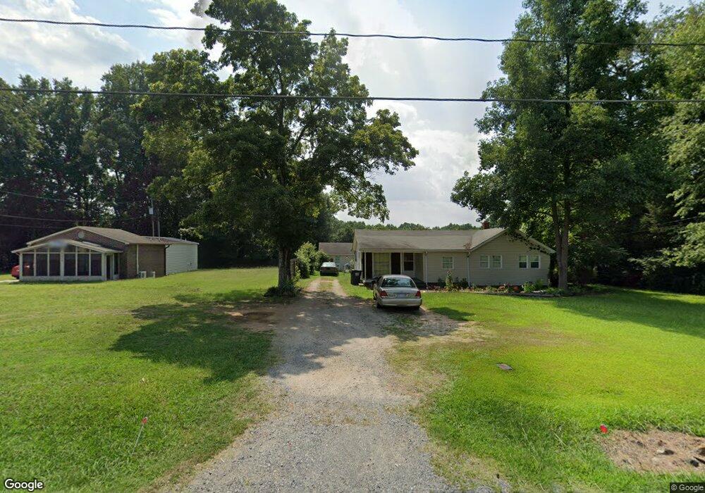
7564 Us Highway 52 Salisbury, NC 28146
Estimated Value: $153,000 - $231,000
--
Bed
--
Bath
1,314
Sq Ft
$135/Sq Ft
Est. Value
About This Home
This home is located at 7564 Us Highway 52, Salisbury, NC 28146 and is currently estimated at $176,875, approximately $134 per square foot. 7564 Us Highway 52 is a home with nearby schools including Rockwell Elementary School, Charles C Erwin Middle School, and East Rowan High School.
Ownership History
Date
Name
Owned For
Owner Type
Purchase Details
Closed on
Apr 7, 2014
Sold by
Miles Joyce M
Bought by
Grubbs Ricky A and Grubbs Carrie K
Current Estimated Value
Home Financials for this Owner
Home Financials are based on the most recent Mortgage that was taken out on this home.
Original Mortgage
$39,900
Outstanding Balance
$30,400
Interest Rate
4.4%
Mortgage Type
Unknown
Estimated Equity
$146,475
Create a Home Valuation Report for This Property
The Home Valuation Report is an in-depth analysis detailing your home's value as well as a comparison with similar homes in the area
Home Values in the Area
Average Home Value in this Area
Purchase History
| Date | Buyer | Sale Price | Title Company |
|---|---|---|---|
| Grubbs Ricky A | $57,000 | None Available |
Source: Public Records
Mortgage History
| Date | Status | Borrower | Loan Amount |
|---|---|---|---|
| Open | Grubbs Ricky A | $39,900 |
Source: Public Records
Tax History Compared to Growth
Tax History
| Year | Tax Paid | Tax Assessment Tax Assessment Total Assessment is a certain percentage of the fair market value that is determined by local assessors to be the total taxable value of land and additions on the property. | Land | Improvement |
|---|---|---|---|---|
| 2025 | $698 | $104,104 | $35,000 | $69,104 |
| 2024 | $698 | $104,104 | $35,000 | $69,104 |
| 2023 | $698 | $104,104 | $35,000 | $69,104 |
| 2022 | $585 | $78,282 | $30,000 | $48,282 |
| 2021 | $585 | $78,282 | $30,000 | $48,282 |
| 2020 | $585 | $78,282 | $30,000 | $48,282 |
| 2019 | $585 | $78,282 | $30,000 | $48,282 |
| 2018 | $527 | $71,061 | $30,000 | $41,061 |
| 2017 | $527 | $71,061 | $30,000 | $41,061 |
| 2016 | $527 | $71,061 | $30,000 | $41,061 |
| 2015 | $535 | $71,061 | $30,000 | $41,061 |
| 2014 | $529 | $73,460 | $19,000 | $54,460 |
Source: Public Records
Map
Nearby Homes
- 170 Lyerly Dr
- 660 Sides Rd
- 1090 Sides St
- 574 Crescent Rd
- 455 Stone Rd
- 175 Birchwood Dr Unit 7
- 165 Birchwood Dr Unit 17
- 495 Gold Knob Rd
- 7660 Pop Basinger Rd
- 0000 Celestial Dr
- 1044 Oak Grove Ln Unit Lot 2
- 145 Willow Dr
- 130 Delinda Dr
- 8450 Red Rd
- 1106 Birch St
- 0 Cornelius Rd
- 1170 Gold Knob Rd
- 316 Hutchins Way
- 1450 Saint Lukes Church Rd
- 190 Teague Rd
- 7550 Us Highway 52
- 7620 Us Highway 52
- 7620 Highway 152 E
- 7530 Us Highway 52
- 7525 Us Highway 52
- 7520 Us Highway 52
- 1075 Cornerstone Ln
- 155 Stone Rd
- L107 Keystone Dr
- Lot107 Keystone Dr
- L109 Keystone Dr
- Lot109 Keystone Dr
- 7645 Us Highway 52
- 7640 Us Highway 52
- 7645 U S 52 Unit NULL
- 225 Stone Rd
- 1043 Cornerstone Ln
- L104 Keystone Dr
- Lot104 Keystone Dr
- L106 Keystone Dr