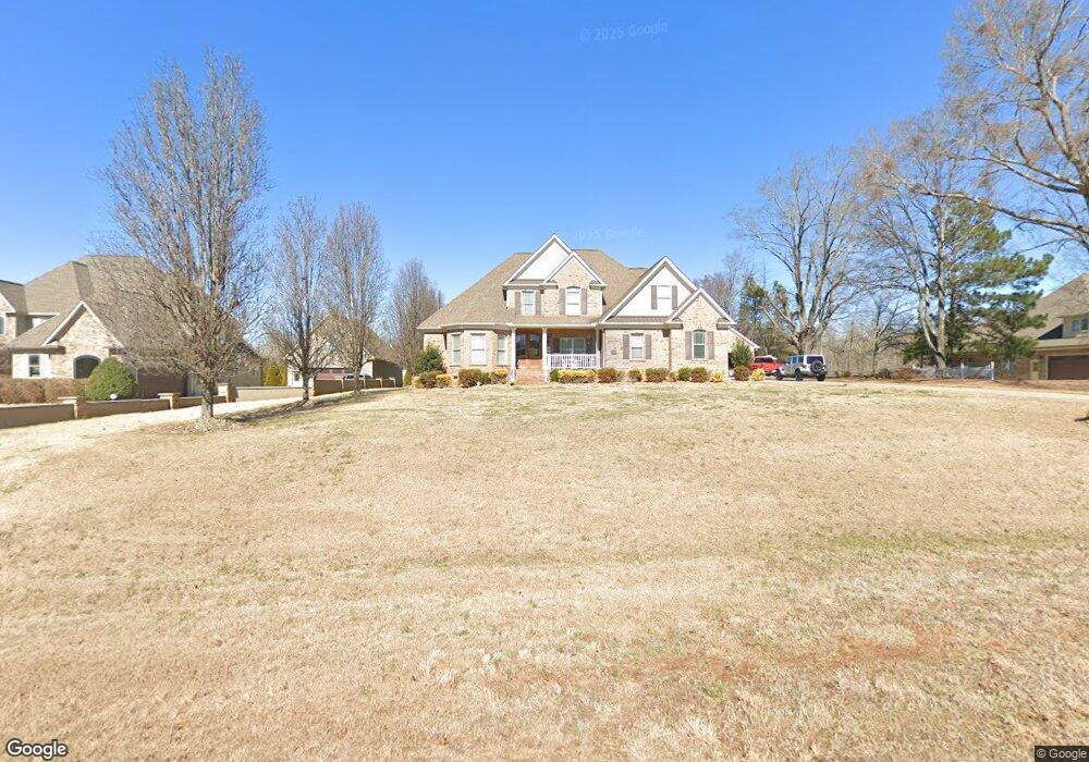
757 Belfast Ct Unit 10 Rock Hill, SC 29730
Estimated Value: $630,000 - $790,000
--
Bed
3
Baths
3,288
Sq Ft
$216/Sq Ft
Est. Value
About This Home
This home is located at 757 Belfast Ct Unit 10, Rock Hill, SC 29730 and is currently estimated at $710,964, approximately $216 per square foot. 757 Belfast Ct Unit 10 is a home located in York County with nearby schools including Lesslie Elementary School, Castle Heights Middle School, and Rock Hill High School.
Ownership History
Date
Name
Owned For
Owner Type
Purchase Details
Closed on
Nov 25, 2019
Sold by
Cronshaw Jeffrey L and Cronshaw Angela T
Bought by
Edwards Clark Dwayne and Edwards Crystal Warren
Current Estimated Value
Home Financials for this Owner
Home Financials are based on the most recent Mortgage that was taken out on this home.
Original Mortgage
$352,000
Outstanding Balance
$278,441
Interest Rate
3.37%
Mortgage Type
New Conventional
Estimated Equity
$432,523
Purchase Details
Closed on
Mar 12, 2008
Sold by
Olde South Homes Llc
Bought by
Cronshaw Jeffrey L and Cronshaw Angela T
Home Financials for this Owner
Home Financials are based on the most recent Mortgage that was taken out on this home.
Original Mortgage
$42,251
Interest Rate
5.68%
Mortgage Type
Credit Line Revolving
Purchase Details
Closed on
Sep 18, 2007
Sold by
Tullamore Llc
Bought by
Olde South Homes Llc
Create a Home Valuation Report for This Property
The Home Valuation Report is an in-depth analysis detailing your home's value as well as a comparison with similar homes in the area
Home Values in the Area
Average Home Value in this Area
Purchase History
| Date | Buyer | Sale Price | Title Company |
|---|---|---|---|
| Edwards Clark Dwayne | $485,000 | None Available | |
| Cronshaw Jeffrey L | $415,000 | None Available | |
| Olde South Homes Llc | $140,800 | Attorney |
Source: Public Records
Mortgage History
| Date | Status | Borrower | Loan Amount |
|---|---|---|---|
| Open | Edwards Clark Dwayne | $352,000 | |
| Previous Owner | Cronshaw Jeffrey L | $42,251 | |
| Previous Owner | Cronshaw Jeffrey L | $352,000 |
Source: Public Records
Tax History Compared to Growth
Tax History
| Year | Tax Paid | Tax Assessment Tax Assessment Total Assessment is a certain percentage of the fair market value that is determined by local assessors to be the total taxable value of land and additions on the property. | Land | Improvement |
|---|---|---|---|---|
| 2024 | $2,708 | $19,285 | $1,400 | $17,885 |
| 2023 | $2,674 | $18,569 | $1,400 | $17,169 |
| 2022 | $2,683 | $18,569 | $1,400 | $17,169 |
| 2021 | -- | $18,569 | $1,400 | $17,169 |
| 2020 | $2,674 | $18,569 | $0 | $0 |
| 2019 | $1,972 | $13,060 | $0 | $0 |
| 2018 | $1,956 | $13,060 | $0 | $0 |
| 2017 | $1,844 | $13,060 | $0 | $0 |
| 2016 | $1,788 | $13,060 | $0 | $0 |
| 2014 | $1,803 | $13,060 | $1,400 | $11,660 |
| 2013 | $1,803 | $14,380 | $2,000 | $12,380 |
Source: Public Records
Map
Nearby Homes
- 508 Bridgestone Ln
- 172 Neely Store Rd
- 3339 Lesslie Hwy Unit 2
- 356 Emma Wood Ln
- 1903 Manning Place
- 3943 Walker Rd
- 3943 Walker Rd Unit LOT ONLY
- 2003 Capel Ct
- 281 Schoolside Dr
- 3943 Walker Road (Land Only)
- 111 Emily Crest Ln
- 611 Pondway Downs
- 1580 Anderson Rd S
- 2999 Starnes Dr
- 161 Billy Claude Cir
- 3886 Lesslie Hwy
- 141 Edenvale Rd
- 1009 Rainbow Cir
- 1034 Neely Store Rd
- 709 Pierce Ct
- 757 Belfast Ct
- 745 Belfast Ct Unit Lot11
- 769 Belfast Ct
- 733 Belfast Ct
- 721 Belfast Ct
- 709 Belfast Ct
- 744 Belfast Ct
- 756 Belfast Ct
- 630 Carollbrook Dr
- 630 Carollbrook Dr Unit 18
- 781 Belfast Ct
- 768 Belfast Ct
- 618 Carollbrook Dr
- 732 Belfast Ct
- 642 Carollbrook Dr
- 720 Belfast Ct
- 606 Carollbrook Dr
- 708 Belfast Ct
- 654 Carollbrook Dr Unit 19,20,21
- 654 Carollbrook Dr