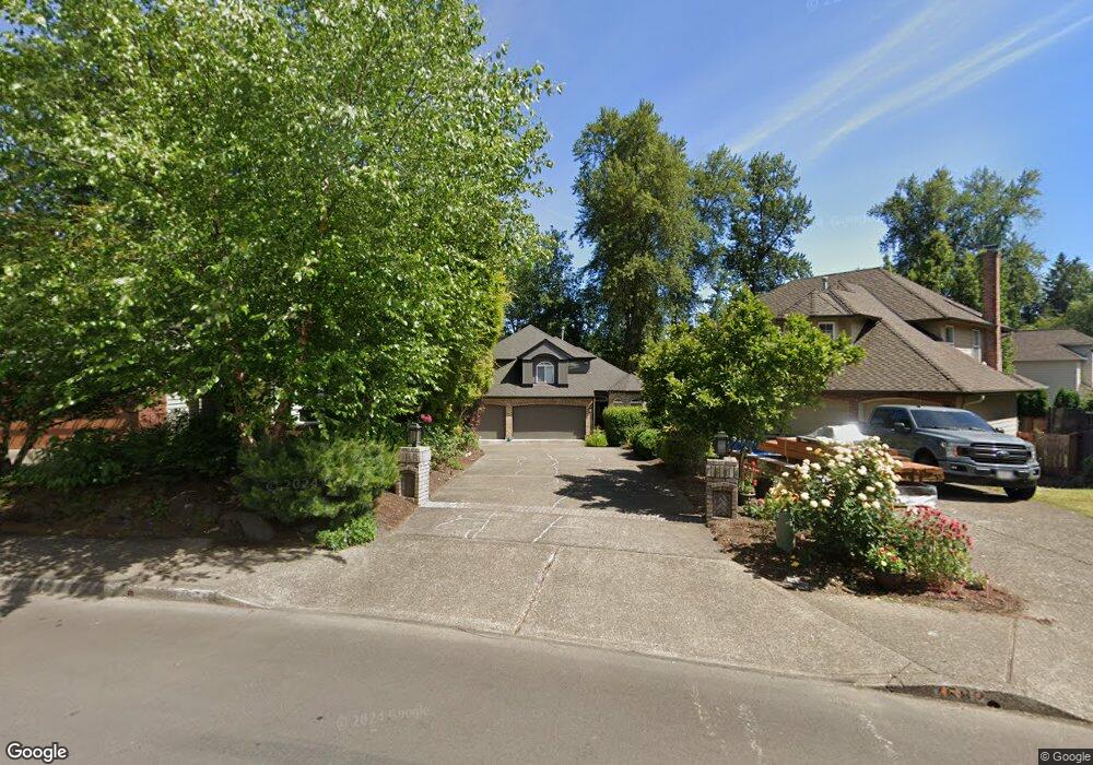
7574 SW Ashford St Portland, OR 97224
Durham Road NeighborhoodEstimated Value: $821,560 - $872,000
5
Beds
3
Baths
3,131
Sq Ft
$271/Sq Ft
Est. Value
About This Home
This home is located at 7574 SW Ashford St, Portland, OR 97224 and is currently estimated at $849,140, approximately $271 per square foot. 7574 SW Ashford St is a home located in Washington County with nearby schools including Durham Elementary School, Twality Middle School, and Tigard High School.
Ownership History
Date
Name
Owned For
Owner Type
Purchase Details
Closed on
Jan 5, 1999
Sold by
Sakaguchi Makoto and Sakaguchi Joan Hall
Bought by
Sakaguchi Makoto and Sakaguchi Joan Hall
Current Estimated Value
Home Financials for this Owner
Home Financials are based on the most recent Mortgage that was taken out on this home.
Original Mortgage
$147,300
Interest Rate
6.66%
Mortgage Type
Purchase Money Mortgage
Purchase Details
Closed on
Mar 21, 1996
Sold by
Sakaguchi Makoto and Sakaguchi Joan Hall
Bought by
Sakaguchi Makoto and Sakaguchi Joan Hall
Create a Home Valuation Report for This Property
The Home Valuation Report is an in-depth analysis detailing your home's value as well as a comparison with similar homes in the area
Home Values in the Area
Average Home Value in this Area
Purchase History
| Date | Buyer | Sale Price | Title Company |
|---|---|---|---|
| Sakaguchi Makoto | -- | Pacific Nw Title | |
| Sakaguchi Makoto | -- | -- |
Source: Public Records
Mortgage History
| Date | Status | Borrower | Loan Amount |
|---|---|---|---|
| Closed | Sakaguchi Makoto | $147,300 |
Source: Public Records
Tax History Compared to Growth
Tax History
| Year | Tax Paid | Tax Assessment Tax Assessment Total Assessment is a certain percentage of the fair market value that is determined by local assessors to be the total taxable value of land and additions on the property. | Land | Improvement |
|---|---|---|---|---|
| 2025 | $9,549 | $560,110 | -- | -- |
| 2024 | $9,293 | $543,800 | -- | -- |
| 2023 | $9,293 | $527,970 | $0 | $0 |
| 2022 | $9,026 | $527,970 | $0 | $0 |
| 2021 | $8,800 | $497,670 | $0 | $0 |
| 2020 | $8,536 | $483,180 | $0 | $0 |
| 2019 | $8,009 | $469,110 | $0 | $0 |
| 2018 | $7,752 | $455,450 | $0 | $0 |
| 2017 | $7,371 | $442,190 | $0 | $0 |
| 2016 | $7,007 | $429,320 | $0 | $0 |
| 2015 | $6,673 | $416,820 | $0 | $0 |
| 2014 | $6,464 | $404,680 | $0 | $0 |
Source: Public Records
Map
Nearby Homes
- 7585 SW Onnaf Ct
- 7946 SW Churchill Way
- 15974 SW 76th Ave
- 14964 SW Belvoir Ct
- 14994 SW Belvoir Ct
- 7744 SW Cornutt St
- 14670 SW 78th Ave
- 8420 SW Norfolk Ct
- 16461 SW Cambridge Ln
- 14611 SW 78th Ave
- 16426 SW Cambridge Ln
- 7988 SW Leiser Ln
- 7913 SW Leiser Ln
- 14544 SW 78th Ave
- 16401 SW Cambridge Ln
- 16447 SW Owlet Terrace
- 16485 SW Cambridge Ln
- 16353 SW Cambridge Ln
- 16491 SW Cambridge Ln
- 8596 SW Schmidt Loop
- 7568 SW Ashford St
- 7582 SW Ashford St
- 15532 SW 76th Ave
- 7562 SW Ashford St
- 7588 SW Ashford St
- 15566 SW 76th Ave
- 7598 SW Ashford St
- 15508 SW 76th Ave
- 7593 SW Ashford St
- 7546 SW Ashford St
- 15588 SW 76th Ave
- 7551 SW Ashford St
- 7633 SW Ashford St
- 7540 SW Ashford St
- 15610 SW 76th Ave
- 7668 SW Ashford St
- 15511 SW 76th Ave
- 7517 SW Ashford St
- 7695 SW Ashford St
- 15622 SW 76th Ave