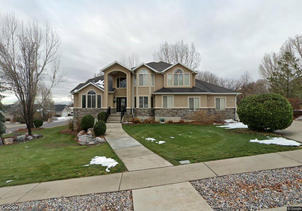
758 Cumberland Ct Alpine, UT 84004
Estimated Value: $1,184,000 - $1,556,000
6
Beds
3
Baths
5,329
Sq Ft
$254/Sq Ft
Est. Value
About This Home
This home is located at 758 Cumberland Ct, Alpine, UT 84004 and is currently estimated at $1,355,303, approximately $254 per square foot. 758 Cumberland Ct is a home located in Utah County with nearby schools including Westfield School, Timberline Middle School, and Lone Peak High School.
Ownership History
Date
Name
Owned For
Owner Type
Purchase Details
Closed on
Aug 5, 2013
Sold by
Marshall Mark and Marshall Deeann
Bought by
King James Robert
Current Estimated Value
Purchase Details
Closed on
Mar 10, 2000
Sold by
Marshall Mark and Marshall Deeann
Bought by
Marshall Mark and Marshall Deeann
Home Financials for this Owner
Home Financials are based on the most recent Mortgage that was taken out on this home.
Original Mortgage
$285,000
Interest Rate
8.27%
Mortgage Type
Construction
Purchase Details
Closed on
Feb 26, 2000
Sold by
Rogers W Don and Rogers Janet S
Bought by
Marshall Mark and Marshall Deeann
Home Financials for this Owner
Home Financials are based on the most recent Mortgage that was taken out on this home.
Original Mortgage
$285,000
Interest Rate
8.27%
Mortgage Type
Construction
Create a Home Valuation Report for This Property
The Home Valuation Report is an in-depth analysis detailing your home's value as well as a comparison with similar homes in the area
Home Values in the Area
Average Home Value in this Area
Purchase History
| Date | Buyer | Sale Price | Title Company |
|---|---|---|---|
| King James Robert | -- | North American Title | |
| Marshall Mark | -- | -- | |
| Marshall Mark | -- | Associated Title Company |
Source: Public Records
Mortgage History
| Date | Status | Borrower | Loan Amount |
|---|---|---|---|
| Previous Owner | Marshall Mark | $285,000 | |
| Previous Owner | Marshall Mark | $30,303 |
Source: Public Records
Tax History Compared to Growth
Tax History
| Year | Tax Paid | Tax Assessment Tax Assessment Total Assessment is a certain percentage of the fair market value that is determined by local assessors to be the total taxable value of land and additions on the property. | Land | Improvement |
|---|---|---|---|---|
| 2025 | $4,492 | $560,945 | $457,400 | $562,500 |
| 2024 | $4,274 | $523,600 | $0 | $0 |
| 2023 | $4,274 | $534,820 | $0 | $0 |
| 2022 | $4,562 | $554,345 | $0 | $0 |
| 2021 | $4,127 | $779,100 | $276,700 | $502,400 |
| 2020 | $4,027 | $744,000 | $251,500 | $492,500 |
| 2019 | $3,442 | $663,700 | $251,500 | $412,200 |
| 2018 | $3,054 | $581,900 | $223,500 | $358,400 |
| 2017 | $3,156 | $320,045 | $0 | $0 |
| 2016 | $3,114 | $294,415 | $0 | $0 |
| 2015 | $3,071 | $274,670 | $0 | $0 |
| 2014 | $2,980 | $263,670 | $0 | $0 |
Source: Public Records
Map
Nearby Homes
- 88 W Cascade Ave
- 868 S Braddock Ln
- 629 S Pheasant Ridge Cir
- 250 S Main St Unit 7
- 250 S Main St Unit 20
- 250 S Main St Unit 25
- 364 E 280 S
- 177 W Canyon Crest Rd
- 201 E Red Pine Dr Unit 17
- 259 Twin River Loop
- 5377 W Evergreen Way
- 682 Healey Blvd
- 5984 W 11200 N Unit 1
- 909 Ridge Ln
- 30 S Main St
- 546 River Meadow Dr
- 5077 W 11000 N
- 5159 W 11000 N
- 48 N 100 E
- 5983 W 11270 N Unit 4
- 734 Cumberland Ct
- 93 Sunset Cir
- 13 Sunset Dr
- 737 Cumberland Ct
- 125 E Sunset Cir
- 22 Sunset Dr
- 96 Sunset Cir
- 713 Cumberland Ct
- 795 Cumberland Way
- 15 Sunset Dr
- 32 W Sunset Dr
- 32 Sunset Dr
- 820 Cumberland Way
- 35 Sunset Dr
- 130 Sunset Cir
- 147 Sunset Cir
- 835 Cumberland Way
- 48 Sunset Dr
- 75 Himalaya Ct
- 687 Rocky Mountain Dr