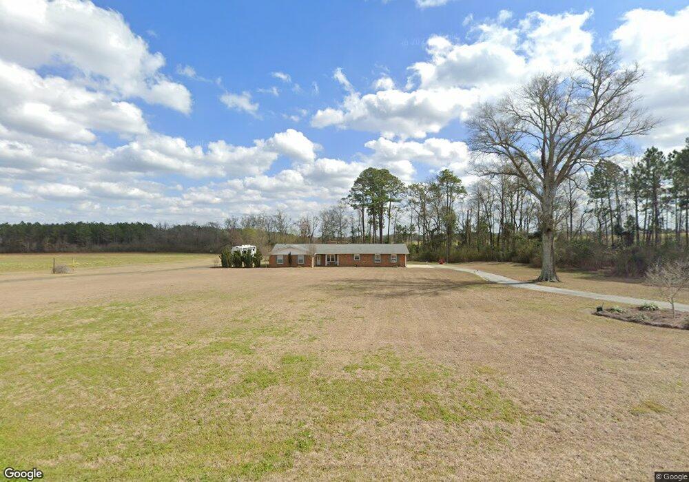
759 Massey Airport Rd Sylvester, GA 31791
Estimated Value: $225,543 - $303,000
3
Beds
2
Baths
1,893
Sq Ft
$144/Sq Ft
Est. Value
About This Home
This home is located at 759 Massey Airport Rd, Sylvester, GA 31791 and is currently estimated at $272,636, approximately $144 per square foot. 759 Massey Airport Rd is a home located in Worth County with nearby schools including Worth County Primary School, Worth County Elementary School, and Worth County Middle School.
Ownership History
Date
Name
Owned For
Owner Type
Purchase Details
Closed on
Feb 2, 2006
Sold by
Thornhill Pearl T
Bought by
Fowler Robert G and Fowler Kelley
Current Estimated Value
Home Financials for this Owner
Home Financials are based on the most recent Mortgage that was taken out on this home.
Original Mortgage
$98,000
Outstanding Balance
$54,974
Interest Rate
6.14%
Mortgage Type
New Conventional
Estimated Equity
$217,662
Purchase Details
Closed on
Mar 24, 1997
Sold by
Glenn Bonnie
Bought by
Irvin Idaouise
Create a Home Valuation Report for This Property
The Home Valuation Report is an in-depth analysis detailing your home's value as well as a comparison with similar homes in the area
Home Values in the Area
Average Home Value in this Area
Purchase History
| Date | Buyer | Sale Price | Title Company |
|---|---|---|---|
| Fowler Robert G | $130,000 | -- | |
| Irvin Idaouise | -- | -- |
Source: Public Records
Mortgage History
| Date | Status | Borrower | Loan Amount |
|---|---|---|---|
| Open | Fowler Robert G | $98,000 |
Source: Public Records
Tax History Compared to Growth
Tax History
| Year | Tax Paid | Tax Assessment Tax Assessment Total Assessment is a certain percentage of the fair market value that is determined by local assessors to be the total taxable value of land and additions on the property. | Land | Improvement |
|---|---|---|---|---|
| 2024 | $1,786 | $55,202 | $5,740 | $49,462 |
| 2023 | $1,271 | $55,202 | $5,740 | $49,462 |
| 2022 | $1,729 | $53,222 | $5,740 | $47,482 |
| 2021 | $1,706 | $53,222 | $5,740 | $47,482 |
| 2020 | $1,709 | $53,222 | $5,740 | $47,482 |
| 2019 | $1,709 | $53,222 | $5,740 | $47,482 |
| 2018 | $1,399 | $48,822 | $5,740 | $43,082 |
| 2017 | $1,399 | $48,822 | $5,740 | $43,082 |
| 2016 | $1,343 | $48,822 | $5,740 | $43,082 |
| 2015 | $1,345 | $48,822 | $5,740 | $43,082 |
| 2014 | $1,345 | $48,822 | $5,740 | $43,082 |
| 2013 | -- | $47,830 | $4,749 | $43,082 |
| 2012 | -- | $47,830 | $4,748 | $43,081 |
Source: Public Records
Map
Nearby Homes
- 107 Gardner Rd
- 103 N Ayers St
- 0 W Pinson St Unit 10582366
- 101 Elm St
- 801 N Washington St
- 710 S Jefferson St
- 1011 N Washington St
- 307 E Pope St
- 128 Airport Rd
- 1007 N Isabella St
- 1102 N Washington St
- 1432 S Ga Hwy 33s
- 203 E Pinson St
- 0 N Isabella St Unit 161570
- 701 N Isabella St
- 316 Bell Rd
- 202 N Westberry St
- 100 Carriage Ln
- 402 N McPhaul St
- 0 Ga Hwy 82 Unit 913408
- 742 Massey Airport Rd
- 2533 Us Highway 82 W
- 2541 Us Highway 82 W
- 814 Massey Airport Rd
- 0 Us Hwy 82 W Tract 4 Unit 134431
- 0 Us Hwy 82 W Tract 5 Unit 134430
- 2545 Us Highway 82 W
- 2557 Us Highway 82 W
- 1610 West St
- 652 Massey Airport Rd
- 646 Massey Airport Rd
- 1208 West St
- 2602 Us Highway 82 W
- 628 Massey Airport Rd
- 2651 Us Highway 82 W
- 2638 Us Highway 82 W
- 1200 West St
- 2661 Us Highway 82 W
- 944 West St
- 942 West St