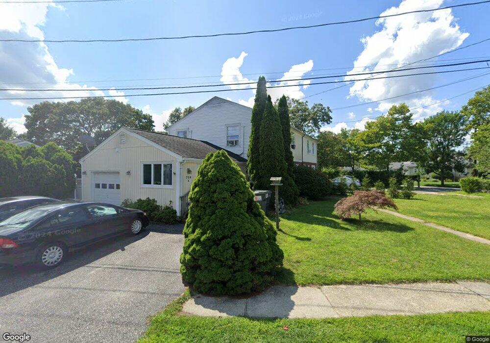
759 Mccord St Unit A Westhampton Beach, NY 11978
Estimated Value: $473,000 - $689,000
3
Beds
2
Baths
1,408
Sq Ft
$403/Sq Ft
Est. Value
About This Home
This home is located at 759 Mccord St Unit A, Westhampton Beach, NY 11978 and is currently estimated at $568,014, approximately $403 per square foot. 759 Mccord St Unit A is a home located in Suffolk County with nearby schools including Westhampton Beach Elementary School, Westhampton Middle School, and Westhampton Beach Senior High School.
Ownership History
Date
Name
Owned For
Owner Type
Purchase Details
Closed on
Jul 8, 2021
Sold by
Cruz Jorge and Cruz Jose
Bought by
759 Mccord Llc
Current Estimated Value
Purchase Details
Closed on
Apr 23, 2015
Sold by
Klos Lori A
Bought by
Turnbull Elizabeth
Home Financials for this Owner
Home Financials are based on the most recent Mortgage that was taken out on this home.
Original Mortgage
$258,000
Interest Rate
3.69%
Mortgage Type
New Conventional
Purchase Details
Closed on
Jul 8, 2009
Sold by
Kos Lori A and Klos Theodore T
Bought by
Klos Lori A
Create a Home Valuation Report for This Property
The Home Valuation Report is an in-depth analysis detailing your home's value as well as a comparison with similar homes in the area
Home Values in the Area
Average Home Value in this Area
Purchase History
| Date | Buyer | Sale Price | Title Company |
|---|---|---|---|
| 759 Mccord Llc | -- | None Available | |
| Turnbull Elizabeth | $322,500 | None Available | |
| Klos Lori A | $125,500 | -- |
Source: Public Records
Mortgage History
| Date | Status | Borrower | Loan Amount |
|---|---|---|---|
| Previous Owner | Turnbull Elizabeth | $258,000 |
Source: Public Records
Tax History Compared to Growth
Tax History
| Year | Tax Paid | Tax Assessment Tax Assessment Total Assessment is a certain percentage of the fair market value that is determined by local assessors to be the total taxable value of land and additions on the property. | Land | Improvement |
|---|---|---|---|---|
| 2024 | $2,021 | $233,400 | $84,300 | $149,100 |
| 2023 | $2,021 | $233,400 | $84,300 | $149,100 |
| 2022 | $1,638 | $233,400 | $84,300 | $149,100 |
| 2021 | $1,638 | $233,400 | $84,300 | $149,100 |
| 2020 | $1,942 | $233,400 | $84,300 | $149,100 |
| 2019 | $1,942 | $0 | $0 | $0 |
| 2018 | -- | $231,500 | $105,400 | $126,100 |
| 2017 | $1,832 | $205,800 | $93,700 | $112,100 |
| 2016 | $2,850 | $205,800 | $93,700 | $112,100 |
| 2015 | -- | $205,800 | $93,700 | $112,100 |
| 2014 | -- | $180,100 | $82,000 | $98,100 |
Source: Public Records
Map
Nearby Homes
- 0 Patrick St
- 4 Evelyn Ct
- 95 N Summit Blvd
- 4 Cooks Ln
- 100 Rogers Ave Unit 701
- 100 Rogers Ave Unit 702
- 100 Rogers Ave Unit 703
- 100 Rogers Ave Unit 101
- 100 Rogers Ave Unit 102
- 100 Rogers Ave Unit 103
- 100 Rogers Ave Unit 201
- 100 Rogers Ave Unit 202
- 100 Rogers Ave Unit 203
- 100 Rogers Ave Unit 601
- 100 Rogers Ave Unit 602
- 100 Rogers Ave Unit 502
- 100 Rogers Ave Unit 503
- 100 Rogers Ave Unit 501
- 100 Rogers Ave Unit 802
- 100 Rogers Ave Unit 903
- 759A Mccord St
- 742 Hamilton Ave
- 756 Mccord St Unit A
- 756 Mccord St Unit B
- 758A Mccord St
- 758 Mccord St Unit B
- 758 Mccord St Unit A
- 744 Hamilton Ave
- 744 Hamilton Ave
- 758B Mccord St
- 724 Hamilton Ave
- 739 Hamilton Ave
- 723 Hamilton Ave
- 754 Mccord St Unit A
- 754 Mccord St Unit B
- 754 Mccord St
- 741 Hamilton Ave
- 746 Hamilton Ave
- 754A Mccord St
- 722 Hamilton Ave