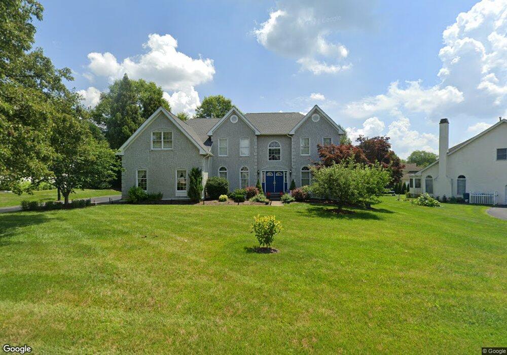
759 Meadowbank Rd Kennett Square, PA 19348
Estimated Value: $934,000 - $1,089,000
5
Beds
4
Baths
4,372
Sq Ft
$233/Sq Ft
Est. Value
About This Home
This home is located at 759 Meadowbank Rd, Kennett Square, PA 19348 and is currently estimated at $1,019,398, approximately $233 per square foot. 759 Meadowbank Rd is a home located in Chester County with nearby schools including Unionville Elementary School, Charles F. Patton Middle School, and Unionville High School.
Ownership History
Date
Name
Owned For
Owner Type
Purchase Details
Closed on
Oct 15, 1999
Sold by
Willowdale Crossing Lp
Bought by
Mawn Michael P and Mawn Victoria B
Current Estimated Value
Home Financials for this Owner
Home Financials are based on the most recent Mortgage that was taken out on this home.
Original Mortgage
$310,400
Outstanding Balance
$93,723
Interest Rate
7.83%
Estimated Equity
$925,675
Create a Home Valuation Report for This Property
The Home Valuation Report is an in-depth analysis detailing your home's value as well as a comparison with similar homes in the area
Home Values in the Area
Average Home Value in this Area
Purchase History
| Date | Buyer | Sale Price | Title Company |
|---|---|---|---|
| Mawn Michael P | $388,002 | -- |
Source: Public Records
Mortgage History
| Date | Status | Borrower | Loan Amount |
|---|---|---|---|
| Open | Mawn Michael P | $310,400 | |
| Closed | Mawn Michael P | $38,800 |
Source: Public Records
Tax History Compared to Growth
Tax History
| Year | Tax Paid | Tax Assessment Tax Assessment Total Assessment is a certain percentage of the fair market value that is determined by local assessors to be the total taxable value of land and additions on the property. | Land | Improvement |
|---|---|---|---|---|
| 2025 | $2,185 | $324,500 | $66,740 | $257,760 |
| 2024 | $2,185 | $324,500 | $66,740 | $257,760 |
| 2023 | $2,185 | $324,500 | $66,740 | $257,760 |
| 2022 | $1,818 | $324,500 | $66,740 | $257,760 |
| 2021 | $2,185 | $324,500 | $66,740 | $257,760 |
| 2020 | $1,758 | $324,500 | $66,740 | $257,760 |
| 2019 | $2,126 | $324,500 | $66,740 | $257,760 |
| 2018 | $2,126 | $324,500 | $66,740 | $257,760 |
| 2017 | $2,126 | $324,500 | $66,740 | $257,760 |
| 2016 | $1,504 | $324,500 | $66,740 | $257,760 |
| 2015 | $1,504 | $324,500 | $66,740 | $257,760 |
| 2014 | $1,504 | $324,500 | $66,740 | $257,760 |
Source: Public Records
Map
Nearby Homes
- 230 Avonwood Rd Unit 117
- 191 W Street Rd
- 312 Riverbirch Cir Unit 802
- 617 Unionville Rd
- 804 N Mill Rd
- 798 Merrimac Ln
- 128 Lantana Dr
- 134 Lantana Dr
- 303 W Locust Ln
- 119 Violet Dr
- 127 Violet Dr
- 205 Aster Cir
- 213 Katsura Dr
- 505 Wisteria Dr
- 711 Potter Dr
- 448 W Locust Ln
- 380 Upland Rd
- 309 Redbud Ln
- 332 Redbud Ln
- 491 N Mill Rd
- 757 Meadowbank Rd
- 761 Meadowbank Rd
- 606 Monticello Ln
- 604 Monticello Ln
- 758 Meadowbank Rd
- 755 Meadowbank Rd
- 608 Monticello Ln
- 831 Waverly Rd
- 756 Meadowbank Rd
- 827 Waverly Rd
- 602 Monticello Ln
- 754 Meadowbank Rd
- 826 Waverly Rd
- 824 Waverly Rd
- 825 Waverly Rd
- 822 Waverly Rd
- 605 Monticello Ln
- 752 Meadowbank Rd
- 607 Monticello Ln
- 820 Waverly Rd