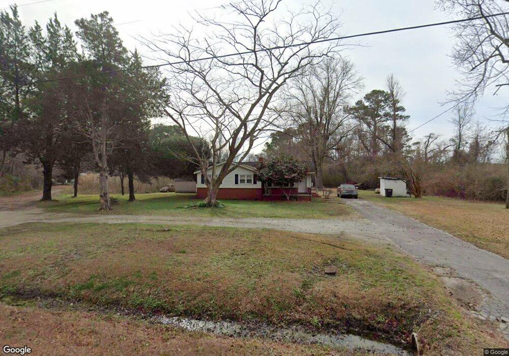
759 Swansboro Loop Rd Swansboro, NC 28584
Estimated Value: $184,011 - $278,000
3
Beds
1
Bath
1,020
Sq Ft
$231/Sq Ft
Est. Value
About This Home
This home is located at 759 Swansboro Loop Rd, Swansboro, NC 28584 and is currently estimated at $235,753, approximately $231 per square foot. 759 Swansboro Loop Rd is a home located in Onslow County with nearby schools including Swansboro Elementary School, Swansboro Middle School, and Swansboro High School.
Ownership History
Date
Name
Owned For
Owner Type
Purchase Details
Closed on
Mar 22, 2006
Sold by
Pinkston Irene
Bought by
Pinkston Jeff and Pinkston Irene
Current Estimated Value
Home Financials for this Owner
Home Financials are based on the most recent Mortgage that was taken out on this home.
Original Mortgage
$126,700
Outstanding Balance
$84,927
Interest Rate
9.55%
Mortgage Type
New Conventional
Estimated Equity
$150,826
Purchase Details
Closed on
Jan 26, 2005
Sold by
Zoretic Sylvia and Rhodes Charles
Bought by
Zoretic Sylvia and Rhodes Charles
Create a Home Valuation Report for This Property
The Home Valuation Report is an in-depth analysis detailing your home's value as well as a comparison with similar homes in the area
Home Values in the Area
Average Home Value in this Area
Purchase History
| Date | Buyer | Sale Price | Title Company |
|---|---|---|---|
| Pinkston Jeff | -- | First American | |
| Zoretic Sylvia | -- | None Available |
Source: Public Records
Mortgage History
| Date | Status | Borrower | Loan Amount |
|---|---|---|---|
| Open | Pinkston Jeff | $126,700 |
Source: Public Records
Tax History Compared to Growth
Tax History
| Year | Tax Paid | Tax Assessment Tax Assessment Total Assessment is a certain percentage of the fair market value that is determined by local assessors to be the total taxable value of land and additions on the property. | Land | Improvement |
|---|---|---|---|---|
| 2025 | $731 | $111,647 | $47,050 | $64,597 |
| 2024 | $731 | $111,647 | $47,050 | $64,597 |
| 2023 | $731 | $111,647 | $47,050 | $64,597 |
| 2022 | $731 | $111,647 | $47,050 | $64,597 |
| 2021 | $594 | $84,270 | $42,050 | $42,220 |
| 2020 | $594 | $84,270 | $42,050 | $42,220 |
| 2019 | $594 | $84,270 | $42,050 | $42,220 |
| 2018 | $594 | $84,270 | $42,050 | $42,220 |
| 2017 | $604 | $89,500 | $43,460 | $46,040 |
| 2016 | $604 | $89,500 | $0 | $0 |
| 2015 | $604 | $89,500 | $0 | $0 |
| 2014 | $604 | $89,500 | $0 | $0 |
Source: Public Records
Map
Nearby Homes
- 233 Belgrade Swansboro Rd
- 239 Belgrade Swansboro Rd
- 307 Joans
- 1476 W Corbett Ave
- 340 Belgrade Swansboro Rd
- 131 Wildcat Pond Rd
- 123 Wildcat Pond Rd
- 354 Belgrade Swansboro Rd
- 4178 Freedom Way
- 25 Pirates Cove Dr
- 274 Norris Rd
- 183 April Ln
- 238 Mill Creek Rd
- 240 Odum Farms Rd
- 44 Pirates Cove Dr
- 111 Hidden Creek Dr
- 101 Walnut Dr
- 250 Watercrest Landing Way
- 311 Catamaran Rd
- 1223 W Corbett Ave
- 752 Swansboro Loop Rd
- 757 Swansboro Loop Rd
- 743 Swansboro Loop Rd
- 216 Brittany Ln
- 211 Brittany
- 214 Brittany
- 211 Brittany
- 724 Swansboro Loop Rd
- 115 Poston Rd
- 212 Brittany
- 212 Brittany Ln
- 121 Poston Rd
- 207 Brittany
- 208 Brittany
- 210 Brittany
- 210 Brittany
- 221 Belgrade Swansboro Rd
- 227 Belgrade Swansboro Rd
- 255 Belgrade Swansboro Rd
- 265 Belgrade Swansboro Rd