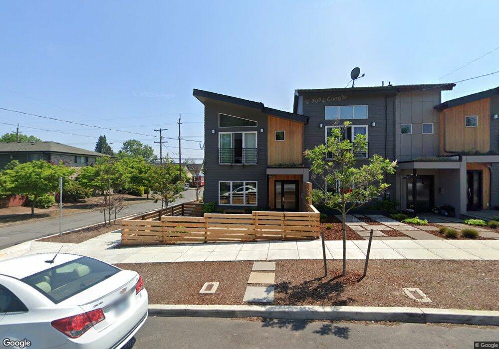
7592 N Curtis Ave Unit 1. Portland, OR 97217
Kenton NeighborhoodEstimated Value: $517,694 - $621,000
4
Beds
4
Baths
1,920
Sq Ft
$306/Sq Ft
Est. Value
About This Home
This home is located at 7592 N Curtis Ave Unit 1., Portland, OR 97217 and is currently estimated at $586,674, approximately $305 per square foot. 7592 N Curtis Ave Unit 1. is a home located in Multnomah County with nearby schools including Peninsula Elementary School, Ockley Green, and Jefferson High School.
Ownership History
Date
Name
Owned For
Owner Type
Purchase Details
Closed on
Nov 6, 2017
Sold by
Elemental Urban Living Llc
Bought by
Sfa Commercial Llc
Current Estimated Value
Purchase Details
Closed on
Dec 9, 2013
Sold by
Beleiotis Tosis
Bought by
Sliders Social Club Llc
Purchase Details
Closed on
Dec 6, 2012
Sold by
Belesiotis Tosis
Bought by
Sliders Social Club Llc
Purchase Details
Closed on
Nov 20, 2006
Sold by
Belesiotis Eleni and Efthimadi Eleni
Bought by
Belesiotis Tosis
Create a Home Valuation Report for This Property
The Home Valuation Report is an in-depth analysis detailing your home's value as well as a comparison with similar homes in the area
Home Values in the Area
Average Home Value in this Area
Purchase History
| Date | Buyer | Sale Price | Title Company |
|---|---|---|---|
| Sfa Commercial Llc | $499,500 | Fidelity National Title | |
| Sliders Social Club Llc | $50,000 | Accommodation | |
| Sliders Social Club Llc | $50,000 | First American | |
| Belesiotis Tosis | -- | None Available |
Source: Public Records
Tax History Compared to Growth
Tax History
| Year | Tax Paid | Tax Assessment Tax Assessment Total Assessment is a certain percentage of the fair market value that is determined by local assessors to be the total taxable value of land and additions on the property. | Land | Improvement |
|---|---|---|---|---|
| 2025 | $4,959 | $184,030 | -- | -- |
| 2024 | $4,780 | $178,670 | -- | -- |
| 2023 | $4,597 | $173,470 | $0 | $0 |
| 2022 | $4,497 | $168,420 | $0 | $0 |
| 2021 | $4,421 | $163,520 | $0 | $0 |
| 2020 | $4,056 | $158,760 | $0 | $0 |
| 2019 | $7,299 | $154,140 | $0 | $0 |
| 2018 | $400 | $149,658 | $0 | $0 |
| 2017 | $383 | $15,330 | $0 | $0 |
| 2016 | $351 | $14,890 | $0 | $0 |
| 2015 | $342 | $14,460 | $0 | $0 |
| 2014 | $1,010 | $42,120 | $0 | $0 |
Source: Public Records
Map
Nearby Homes
- 7327 N Oatman Ave
- 2810 N Watts St
- 2504 N Baldwin St
- 7024 N Villard Ave
- 7817 N Delaware Ave
- 2544 N Watts St
- 2515 N Winchell St
- 2624 N Kilpatrick St
- 2622 N Kilpatrick St
- 2620 N Kilpatrick St
- 6925 N Atlantic Ave
- 3729 N Farragut St
- 2325 N Winchell St
- 8280 N Burrage Ave
- 7385 N Mobile Ave
- 7387 N Mobile Ave
- 7383 N Mobile Ave
- 7379 N Mobile Ave
- 7115 N Chase Ave
- 7827 N Denver Ave
- 7592 N Curtis Ave
- 7576 N Curtis Ave
- 7605 N Peninsular Ave Unit 7611
- 2929 N Russet St
- 3104 N Russet St Unit 3108
- 7620 N Curtis Ave
- 3103 N Russet St Unit 3105
- 7517 N Curtis Ave
- 7622 N Curtis Ave
- 7635 N Peninsular Ave
- 3114 N Russet St
- 7628 N Peninsular Ave Unit 7634
- 7513 N Curtis Ave
- 3011 N Lombard St
- 7613 N Curtis Ave Unit 7615
- 2920 N Baldwin St
- 7509 N Curtis Ave
- 7615-7615 N Curtis Ave Unit 7615
- 3124 N Russet St
- 7621 N Curtis Ave