Estimated Value: $179,861 - $233,000
3
Beds
3
Baths
1,528
Sq Ft
$142/Sq Ft
Est. Value
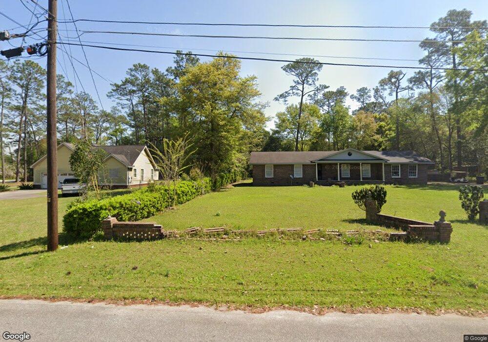
About This Home
This home is located at 76 23rd St NE, Cairo, GA 39828 and is currently estimated at $216,715, approximately $141 per square foot. 76 23rd St NE is a home located in Grady County with nearby schools including Cairo High School.
Ownership History
Date
Name
Owned For
Owner Type
Purchase Details
Closed on
Oct 10, 2022
Sold by
Rogers John W
Bought by
Rogers John W and Seng Chanthy
Current Estimated Value
Purchase Details
Closed on
Aug 15, 2006
Sold by
Vanvanallen Jeffrey Van
Bought by
Rogers John W
Home Financials for this Owner
Home Financials are based on the most recent Mortgage that was taken out on this home.
Original Mortgage
$50,000
Interest Rate
6.73%
Mortgage Type
New Conventional
Purchase Details
Closed on
Jul 19, 1991
Bought by
Allgyer Richard E
Create a Home Valuation Report for This Property
The Home Valuation Report is an in-depth analysis detailing your home's value as well as a comparison with similar homes in the area
Purchase History
| Date | Buyer | Sale Price | Title Company |
|---|---|---|---|
| Rogers John W | -- | -- | |
| Rogers John W | $130,000 | -- | |
| Allgyer Richard E | $60,000 | -- |
Source: Public Records
Mortgage History
| Date | Status | Borrower | Loan Amount |
|---|---|---|---|
| Previous Owner | Rogers John W | $50,000 |
Source: Public Records
Tax History
| Year | Tax Paid | Tax Assessment Tax Assessment Total Assessment is a certain percentage of the fair market value that is determined by local assessors to be the total taxable value of land and additions on the property. | Land | Improvement |
|---|---|---|---|---|
| 2025 | $1,729 | $65,107 | $4,554 | $60,553 |
| 2024 | $1,729 | $59,059 | $4,554 | $54,505 |
| 2023 | $1,699 | $47,570 | $4,800 | $42,770 |
| 2022 | $1,832 | $47,570 | $4,800 | $42,770 |
| 2021 | $1,836 | $47,570 | $4,800 | $42,770 |
| 2020 | $1,765 | $45,590 | $4,800 | $40,790 |
| 2019 | $1,764 | $45,590 | $4,800 | $40,790 |
| 2018 | $1,677 | $45,590 | $4,800 | $40,790 |
| 2017 | $1,613 | $45,590 | $4,800 | $40,790 |
| 2016 | $1,407 | $38,904 | $4,800 | $34,104 |
| 2015 | $1,394 | $38,904 | $4,800 | $34,104 |
| 2014 | $1,394 | $38,904 | $4,800 | $34,104 |
| 2013 | -- | $35,670 | $4,800 | $30,870 |
Source: Public Records
Map
Nearby Homes
- 74 23rd St NE
- 2300 E 84 Hwy
- 2300 Us Highway 84 E
- 2306 Us Highway 84 E
- 2210 U S 84
- 2210 Us Highway 84 E
- 2210 E 84 Hwy
- 70 23rd St NE
- 71 23rd St NE
- 75 24th St NE
- 2215 Pineacre Dr NE
- 2444 Us Highway 84 E
- 2200 Us Highway 84 E
- 64 23rd St NE
- 2301 Us Highway 84 E
- 2205 Pineacre Dr NE
- 2303 Us Highway 84 E
- 2210 Pineacre Dr NE
- 61 24th St NE
- 65 23rd St NE
Your Personal Tour Guide
Ask me questions while you tour the home.