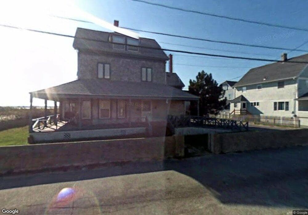
76 A St Hull, MA 02045
Waveland NeighborhoodEstimated Value: $1,405,000 - $1,815,000
5
Beds
3
Baths
2,466
Sq Ft
$659/Sq Ft
Est. Value
About This Home
This home is located at 76 A St, Hull, MA 02045 and is currently estimated at $1,624,995, approximately $658 per square foot. 76 A St is a home located in Plymouth County with nearby schools including Lillian M. Jacobs Elementary School, Memorial Middle School, and Hull High School.
Ownership History
Date
Name
Owned For
Owner Type
Purchase Details
Closed on
May 15, 2025
Sold by
Dennis David
Bought by
76 A St Rt and Dennis
Current Estimated Value
Purchase Details
Closed on
Oct 11, 2017
Sold by
Aimell Llc
Bought by
Dennis David
Purchase Details
Closed on
Sep 13, 2010
Sold by
Heller Amy
Bought by
Aimell Llc
Purchase Details
Closed on
Jul 16, 2010
Sold by
76 A St Rt and Garber
Bought by
Heller Amy
Purchase Details
Closed on
Jul 9, 1993
Sold by
Front Porch Rt and Dennis Alan R
Bought by
Garber Bernard and Garber Bea
Create a Home Valuation Report for This Property
The Home Valuation Report is an in-depth analysis detailing your home's value as well as a comparison with similar homes in the area
Home Values in the Area
Average Home Value in this Area
Purchase History
| Date | Buyer | Sale Price | Title Company |
|---|---|---|---|
| 76 A St Rt | -- | None Available | |
| 76 A St Rt | -- | None Available | |
| Dennis David | $923,930 | -- | |
| Dennis David | $923,930 | -- | |
| Aimell Llc | -- | -- | |
| Aimell Llc | -- | -- | |
| Heller Amy | $735,000 | -- | |
| Heller Amy | $735,000 | -- | |
| Garber Bernard | $265,000 | -- | |
| Garber Bernard | $265,000 | -- |
Source: Public Records
Mortgage History
| Date | Status | Borrower | Loan Amount |
|---|---|---|---|
| Previous Owner | Garber Bernard | $200,000 |
Source: Public Records
Tax History
| Year | Tax Paid | Tax Assessment Tax Assessment Total Assessment is a certain percentage of the fair market value that is determined by local assessors to be the total taxable value of land and additions on the property. | Land | Improvement |
|---|---|---|---|---|
| 2025 | $14,120 | $1,260,700 | $590,200 | $670,500 |
| 2024 | $13,866 | $1,190,200 | $546,500 | $643,700 |
| 2023 | $13,849 | $1,138,000 | $535,600 | $602,400 |
| 2022 | $13,517 | $1,077,900 | $510,000 | $567,900 |
| 2021 | $12,598 | $993,500 | $473,600 | $519,900 |
| 2020 | $11,957 | $932,700 | $437,200 | $495,500 |
| 2019 | $10,587 | $811,300 | $437,200 | $374,100 |
| 2018 | $10,311 | $768,300 | $437,200 | $331,100 |
| 2017 | $10,221 | $745,000 | $437,200 | $307,800 |
| 2016 | $10,043 | $745,000 | $437,200 | $307,800 |
| 2015 | $9,980 | $715,900 | $408,000 | $307,900 |
| 2014 | $9,930 | $715,900 | $408,000 | $307,900 |
Source: Public Records
Map
Nearby Homes
- 76 A St
- 76 A St Unit dir wtrfrnt
- 76 A St Unit summer
- 76 A St Unit house
- 181 Beach Ave
- 72 A St
- 72 A Street (Beach Side)
- 170 Manomet Ave
- 70 A St
- 183 Beach Ave
- 76 A St - Waterfront
- 168 Manomet Ave
- 185 Beach Ave
- 185 Beach Ave Unit House
- 69 A St
- 175 Beach Ave Utilities Included Unit 3
- 175 Beach Ave Oceanfront Unit 7
- 67 A St
- 175 Beach Ave Unit 7
- 175 Beach Ave Unit 6
Your Personal Tour Guide
Ask me questions while you tour the home.