Estimated Value: $344,064 - $400,000
3
Beds
3
Baths
1,828
Sq Ft
$201/Sq Ft
Est. Value
About This Home
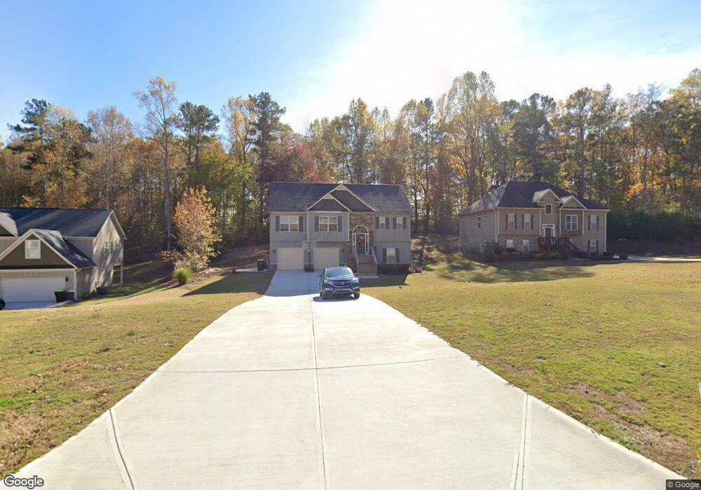
This home is located at 76 Ashley Pointe Dr Unit 13, Hiram, GA 30141 and is currently estimated at $367,766, approximately $201 per square foot. 76 Ashley Pointe Dr Unit 13 is a home located in Paulding County with nearby schools including Sam D. Panter Elementary School, J. A. Dobbins Middle School, and Hiram High School.
Ownership History
Date
Name
Owned For
Owner Type
Purchase Details
Closed on
Jul 20, 2018
Sold by
Arellano Marlon
Bought by
Arellano Marlon and Hernandez Katherin N
Current Estimated Value
Home Financials for this Owner
Home Financials are based on the most recent Mortgage that was taken out on this home.
Original Mortgage
$217,193
Outstanding Balance
$189,749
Interest Rate
4.87%
Mortgage Type
FHA
Estimated Equity
$178,017
Purchase Details
Closed on
Dec 19, 2017
Sold by
Ashley Pointe Hiram Llc
Bought by
Outlook Communities Llc
Home Financials for this Owner
Home Financials are based on the most recent Mortgage that was taken out on this home.
Original Mortgage
$119,500
Interest Rate
3.92%
Mortgage Type
Purchase Money Mortgage
Create a Home Valuation Report for This Property
The Home Valuation Report is an in-depth analysis detailing your home's value as well as a comparison with similar homes in the area
Home Values in the Area
Average Home Value in this Area
Purchase History
| Date | Buyer | Sale Price | Title Company |
|---|---|---|---|
| Arellano Marlon | -- | -- | |
| Arellano Marlon | $221,200 | -- | |
| Outlook Communities Llc | $17,000 | -- |
Source: Public Records
Mortgage History
| Date | Status | Borrower | Loan Amount |
|---|---|---|---|
| Open | Arellano Marlon | $217,193 | |
| Closed | Arellano Marlon | $217,193 | |
| Previous Owner | Outlook Communities Llc | $119,500 |
Source: Public Records
Tax History Compared to Growth
Tax History
| Year | Tax Paid | Tax Assessment Tax Assessment Total Assessment is a certain percentage of the fair market value that is determined by local assessors to be the total taxable value of land and additions on the property. | Land | Improvement |
|---|---|---|---|---|
| 2024 | $3,364 | $138,464 | $16,000 | $122,464 |
| 2023 | $3,743 | $146,108 | $16,000 | $130,108 |
| 2022 | $3,202 | $124,708 | $16,000 | $108,708 |
| 2021 | $2,897 | $101,548 | $16,000 | $85,548 |
| 2020 | $2,764 | $94,908 | $16,000 | $78,908 |
| 2019 | $2,633 | $87,388 | $16,000 | $71,388 |
| 2018 | $936 | $31,080 | $16,000 | $15,080 |
| 2017 | $183 | $6,000 | $6,000 | $0 |
| 2016 | $169 | $5,600 | $5,600 | $0 |
| 2015 | $172 | $5,600 | $5,600 | $0 |
| 2014 | $81 | $2,560 | $2,560 | $0 |
| 2013 | -- | $2,560 | $2,560 | $0 |
Source: Public Records
Map
Nearby Homes
- 115 Ashley Pointe Dr
- 2010 Laird Rd
- 7131 Ridge Rd
- 81 Lawanda Ln
- 18 Thorntree Pass
- 288 Valerie Cir
- 232 Bethel Church Rd
- 6488 Nebo Rd
- 67 Haley Ct
- 6652 Ridge Rd
- 64 Cove Dr
- 7012 Nebo Rd
- 642 Crestworth Crossing
- 6994 Ridge Rd
- 493 Kyles Cir
- 74 Bonds Ct
- 261 Township Dr
- 245 London Ln
- 554 Morningside Dr
- 617 Kyles Cir
- 76 Ashley Pointe Dr
- 60 Ashley Pointe Dr
- 90 Ashley Pointe Dr
- 98 Ashley Pointe Dr
- 98 Ashley Pointe Dr Unit 11
- 44 Ashley Pointe Dr
- 73 Ashley Pointe Dr
- 55 Ashley Pointe Dr Unit 2
- 55 Ashley Pointe Dr
- 55 Ashley Pointe Dr
- 110 Ashley Pointe Dr
- 110 Ashley Pointe Dr Unit 10
- 30 Ashley Pointe Dr
- 11 Ashley Pointe Dr
- 16 Ashley Pointe Dr
- 121 Ashley Pointe Dr
- 118 Ashley Pointe Dr
- 125 Ashley Pointe Dr
- 124 Ashley Pointe Dr
- 131 Ashley Pointe Dr