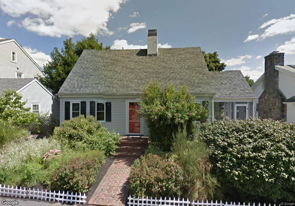
76 Bourne St Jamaica Plain, MA 02130
Jamaica Plain NeighborhoodEstimated Value: $786,000 - $857,000
2
Beds
2
Baths
1,284
Sq Ft
$633/Sq Ft
Est. Value
About This Home
This home is located at 76 Bourne St, Jamaica Plain, MA 02130 and is currently estimated at $812,970, approximately $633 per square foot. 76 Bourne St is a home located in Suffolk County with nearby schools including Brooke Charter School Roslindale, The Croft School - Jamaica Plain, and St. Clare High School.
Ownership History
Date
Name
Owned For
Owner Type
Purchase Details
Closed on
May 7, 2010
Sold by
Haas Teresa M
Bought by
Treat Adam C and Treat Lisa H
Current Estimated Value
Home Financials for this Owner
Home Financials are based on the most recent Mortgage that was taken out on this home.
Original Mortgage
$308,000
Interest Rate
5.03%
Mortgage Type
Purchase Money Mortgage
Purchase Details
Closed on
May 25, 1990
Sold by
Ross Walter
Bought by
Smith Margaret M
Home Financials for this Owner
Home Financials are based on the most recent Mortgage that was taken out on this home.
Original Mortgage
$145,300
Interest Rate
10.13%
Mortgage Type
Purchase Money Mortgage
Create a Home Valuation Report for This Property
The Home Valuation Report is an in-depth analysis detailing your home's value as well as a comparison with similar homes in the area
Home Values in the Area
Average Home Value in this Area
Purchase History
| Date | Buyer | Sale Price | Title Company |
|---|---|---|---|
| Treat Adam C | $385,000 | -- | |
| Smith Margaret M | $161,500 | -- |
Source: Public Records
Mortgage History
| Date | Status | Borrower | Loan Amount |
|---|---|---|---|
| Open | Smith Margaret M | $305,000 | |
| Closed | Treat Adam C | $308,000 | |
| Previous Owner | Smith Margaret M | $145,300 | |
| Previous Owner | Smith Margaret M | $15,000 |
Source: Public Records
Tax History Compared to Growth
Tax History
| Year | Tax Paid | Tax Assessment Tax Assessment Total Assessment is a certain percentage of the fair market value that is determined by local assessors to be the total taxable value of land and additions on the property. | Land | Improvement |
|---|---|---|---|---|
| 2025 | $8,034 | $693,800 | $228,100 | $465,700 |
| 2024 | $7,016 | $643,700 | $221,900 | $421,800 |
| 2023 | $6,459 | $601,400 | $207,300 | $394,100 |
| 2022 | $6,001 | $551,600 | $190,100 | $361,500 |
| 2021 | $5,714 | $535,500 | $184,600 | $350,900 |
| 2020 | $5,117 | $484,600 | $178,300 | $306,300 |
| 2019 | $4,865 | $461,600 | $149,600 | $312,000 |
| 2018 | $4,318 | $412,000 | $149,600 | $262,400 |
| 2017 | $4,279 | $404,100 | $149,600 | $254,500 |
| 2016 | $4,358 | $396,200 | $149,600 | $246,600 |
| 2015 | $4,442 | $366,800 | $149,600 | $217,200 |
| 2014 | $4,041 | $321,200 | $149,600 | $171,600 |
Source: Public Records
Map
Nearby Homes
- 50 Southbourne Rd
- 24 Waterman Rd
- 71 Wyvern St
- 18-20 Northbourne Rd Unit 18
- 105 Neponset Ave Unit 105
- 348-350 Hyde Park Ave Unit 2
- 103 Neponset Ave Unit 103A
- 103-105 Neponset Ave
- 31 Rodman St Unit 2
- 31 Rodman St Unit 1
- 36 Neponset Ave Unit 1
- 602 Canterbury St Unit 14
- 602 Canterbury St Unit 4
- 602 Canterbury St Unit 5
- 602 Canterbury St Unit 2
- 602 Canterbury St Unit 9
- 579 American Legion Hwy
- 158 Wachusett St Unit 3
- 577-579 American Legion Hwy
- 140 Wachusett St
- 66 Bourne St
- 84 Bourne St
- 84 Bourne St Unit 2
- 84 Bourne St Unit 1
- 95 Southbourne Rd
- 47 Eastland Rd
- 43 Eastland Rd
- 69 Bourne St
- 51 Eastland Rd
- 73 Bourne St
- 90 Bourne St
- 85 Southbourne Rd
- 60 Bourne St
- 77 Bourne St
- 81 Southbourne Rd
- 98 Southbourne Rd
- 55 Eastland Rd
- 79 Southbourne Rd
- 79 Southbourne Rd Unit 1
- 79 Southbourne Rd