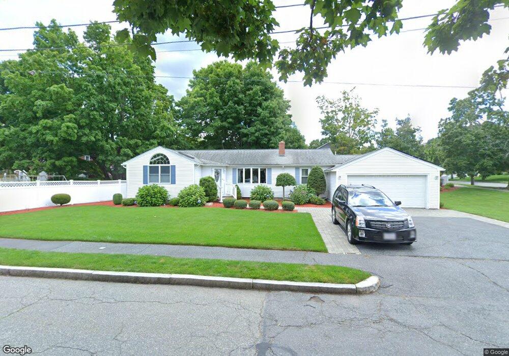
76 Brewster Rd Waltham, MA 02451
North Waltham NeighborhoodEstimated Value: $924,000 - $991,627
3
Beds
2
Baths
2,774
Sq Ft
$345/Sq Ft
Est. Value
About This Home
This home is located at 76 Brewster Rd, Waltham, MA 02451 and is currently estimated at $958,157, approximately $345 per square foot. 76 Brewster Rd is a home located in Middlesex County with nearby schools including Douglas Macarthur Elementary School, John F Kennedy Middle School, and Waltham Sr High School.
Ownership History
Date
Name
Owned For
Owner Type
Purchase Details
Closed on
Jul 6, 1978
Bought by
Young Richard H and Young Margaret
Current Estimated Value
Create a Home Valuation Report for This Property
The Home Valuation Report is an in-depth analysis detailing your home's value as well as a comparison with similar homes in the area
Home Values in the Area
Average Home Value in this Area
Purchase History
| Date | Buyer | Sale Price | Title Company |
|---|---|---|---|
| Young Richard H | $46,900 | -- |
Source: Public Records
Mortgage History
| Date | Status | Borrower | Loan Amount |
|---|---|---|---|
| Open | Young Richard H | $100,000 | |
| Open | Young Richard H | $175,000 | |
| Closed | Young Richard H | $225,000 |
Source: Public Records
Tax History Compared to Growth
Tax History
| Year | Tax Paid | Tax Assessment Tax Assessment Total Assessment is a certain percentage of the fair market value that is determined by local assessors to be the total taxable value of land and additions on the property. | Land | Improvement |
|---|---|---|---|---|
| 2025 | $7,476 | $761,300 | $459,100 | $302,200 |
| 2024 | $7,100 | $736,500 | $438,700 | $297,800 |
| 2023 | $7,034 | $681,600 | $398,100 | $283,500 |
| 2022 | $7,020 | $630,200 | $357,500 | $272,700 |
| 2021 | $6,947 | $613,700 | $357,500 | $256,200 |
| 2020 | $6,802 | $569,200 | $333,100 | $236,100 |
| 2019 | $6,766 | $534,400 | $329,100 | $205,300 |
| 2018 | $8,880 | $486,900 | $304,700 | $182,200 |
| 2017 | $4,398 | $458,500 | $276,300 | $182,200 |
| 2016 | $5,413 | $442,200 | $260,000 | $182,200 |
| 2015 | $5,234 | $398,600 | $227,500 | $171,100 |
Source: Public Records
Map
Nearby Homes
- 14 Benjamin Rd
- 15 Kings Way Unit 25
- 98 Seminole Ave
- 249 Lake St
- 234 Lake St
- 1105 Lexington St Unit 102
- 30 Wampum Ave
- 30 Jacqueline Rd Unit C
- 129 Lake St
- 463 Lincoln St
- 102 Milner St
- 5 April Ln Unit 12
- 92 Milner St
- 28 Hillcrest St
- 14 Piedmont Ave
- 65 Montclair Ave
- 311 Concord Ave
- 11 Autumn Ln
- 28 Goldencrest Ave
- 87 Clocktower Dr Unit 2207
- 29 Banbury Ave Unit 1
- 29 Banbury Ave
- 29 Banbury Ave Unit 29
- 29 Banbury Ave Unit 2
- 66 Brewster Rd
- 45 Banbury Ave
- 36 Banbury Ave
- 67 Brewster Rd
- 21 Banbury Ave
- 46 Banbury Ave
- 26 Banbury Ave
- 61 Brewster Rd
- 94 Brewster Rd
- 55 Banbury Ave
- 56 Whittier Ave
- 56 Whittier Ave Unit A
- 56 Whittier Ave Unit B2
- 91 Brewster Rd
- 15 Banbury Ave
- 48 Berkley St