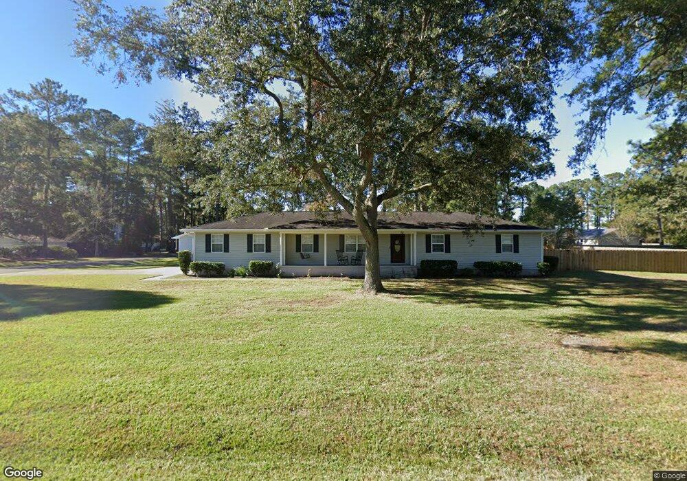
76 Burgess Cir Brunswick, GA 31523
Estimated Value: $296,000 - $335,000
3
Beds
3
Baths
1,680
Sq Ft
$186/Sq Ft
Est. Value
About This Home
This home is located at 76 Burgess Cir, Brunswick, GA 31523 and is currently estimated at $312,904, approximately $186 per square foot. 76 Burgess Cir is a home located in Glynn County with nearby schools including Glyndale Elementary School, Jane Macon Middle School, and Brunswick High School.
Ownership History
Date
Name
Owned For
Owner Type
Purchase Details
Closed on
Jun 1, 2020
Sold by
Davis Betty Jean
Bought by
Henry Virginia E
Current Estimated Value
Home Financials for this Owner
Home Financials are based on the most recent Mortgage that was taken out on this home.
Original Mortgage
$168,250
Outstanding Balance
$148,811
Interest Rate
3.2%
Mortgage Type
New Conventional
Estimated Equity
$164,093
Purchase Details
Closed on
Jan 19, 2005
Sold by
Keene Hollis M
Bought by
Davis Joseph E and Davis Betty Jean
Create a Home Valuation Report for This Property
The Home Valuation Report is an in-depth analysis detailing your home's value as well as a comparison with similar homes in the area
Home Values in the Area
Average Home Value in this Area
Purchase History
| Date | Buyer | Sale Price | Title Company |
|---|---|---|---|
| Henry Virginia E | $177,500 | -- | |
| Davis Joseph E | $156,000 | -- |
Source: Public Records
Mortgage History
| Date | Status | Borrower | Loan Amount |
|---|---|---|---|
| Open | Henry Virginia E | $168,250 |
Source: Public Records
Tax History Compared to Growth
Tax History
| Year | Tax Paid | Tax Assessment Tax Assessment Total Assessment is a certain percentage of the fair market value that is determined by local assessors to be the total taxable value of land and additions on the property. | Land | Improvement |
|---|---|---|---|---|
| 2025 | $3,019 | $120,360 | $19,280 | $101,080 |
| 2024 | $2,481 | $98,920 | $19,280 | $79,640 |
| 2023 | $916 | $87,520 | $12,720 | $74,800 |
| 2022 | $1,323 | $87,520 | $12,720 | $74,800 |
| 2021 | $1,360 | $71,000 | $12,720 | $58,280 |
| 2020 | $1,503 | $52,760 | $12,720 | $40,040 |
| 2019 | $1,503 | $52,760 | $12,720 | $40,040 |
| 2018 | $1,503 | $52,760 | $12,720 | $40,040 |
| 2017 | $1,503 | $52,760 | $12,720 | $40,040 |
| 2016 | $1,391 | $52,760 | $12,720 | $40,040 |
| 2015 | $1,397 | $52,760 | $12,720 | $40,040 |
| 2014 | $1,397 | $52,760 | $12,720 | $40,040 |
Source: Public Records
Map
Nearby Homes
- 118 Dovewood Dr
- 146 Don El St
- 116 Riverwood Rd
- 120 River Ridge Rd
- 180 Pyles Marsh Rd
- 117 Drew Cir
- 804 Avoca Villa Rd
- 6321 New Jesup Hwy
- 116 Burnett Rd Unit A,B,C,D & E
- 101 Water St
- 216 Harvey Rd
- 1020 Lakes Blvd
- 1024 Lakes Blvd
- 1026 Lakes Blvd
- 1038 Lakes Blvd
- 1042 Lakes Blvd
- 1052 Lakes Blvd
- 191 Hunters Point Way
- 130 Stately Oaks Cir
- 12 Hunters Dr
- 69 Burgess Cir
- 101 Sandpiper Rd
- 74 Burgess Cir
- 78 Burgess Cir
- 77 Burgess Cir
- 102 Pelican Rd
- 75 Burgess Cir
- 102 Sandpiper Rd
- RT 3 Pelican Perch Dr
- 79 Burgess Cir
- 103 Sandpiper Rd
- 104 Pelican Rd
- 73 Burgess Cir
- 80 Burgess Cir
- 72 Burgess Cir
- 1602 Pelican Ln
- 104 Sandpiper Rd
- 101 Eagle Rd
- 101 Pelican Rd
- 43 Pelican Rd