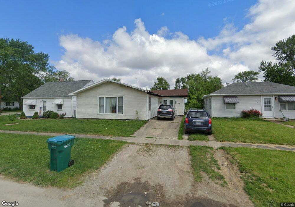
76 Dewitt Ave Mattoon, IL 61938
Estimated Value: $75,000 - $114,000
3
Beds
1
Bath
1,799
Sq Ft
$53/Sq Ft
Est. Value
About This Home
This home is located at 76 Dewitt Ave, Mattoon, IL 61938 and is currently estimated at $95,557, approximately $53 per square foot. 76 Dewitt Ave is a home located in Coles County with nearby schools including Mattoon High School, St. John's Lutheran School, and St Mary School.
Ownership History
Date
Name
Owned For
Owner Type
Purchase Details
Closed on
Oct 23, 2023
Sold by
Integrity Mortgage Note Fund I Llc
Bought by
Integrity Income Fund Llc
Current Estimated Value
Purchase Details
Closed on
Oct 1, 2021
Sold by
Mft Re Holdings Llc
Bought by
Integrity Mortgage Note Fund I Llc
Purchase Details
Closed on
Oct 31, 2019
Sold by
Home Opportunity Llc
Bought by
Mft Re Holdings Llc
Purchase Details
Closed on
Apr 19, 2013
Sold by
Transportation Alliance Bank Inc
Bought by
Home Opportunity Llc
Purchase Details
Closed on
Jun 12, 2012
Sold by
Home Solutions Partners Iv Reo Llc
Bought by
Transportation Alliance Bank Inc
Purchase Details
Closed on
Feb 25, 2009
Sold by
Goetz Larry D
Bought by
Stewardship Fund Lp
Create a Home Valuation Report for This Property
The Home Valuation Report is an in-depth analysis detailing your home's value as well as a comparison with similar homes in the area
Home Values in the Area
Average Home Value in this Area
Purchase History
| Date | Buyer | Sale Price | Title Company |
|---|---|---|---|
| Integrity Income Fund Llc | -- | None Listed On Document | |
| Integrity Income Fund Llc | -- | None Listed On Document | |
| Integrity Mortgage Note Fund I Llc | $16,000 | None Listed On Document | |
| Mft Re Holdings Llc | $7,324 | None Available | |
| Home Opportunity Llc | -- | None Available | |
| Transportation Alliance Bank Inc | $20,126 | None Available | |
| Stewardship Fund Lp | -- | None Available |
Source: Public Records
Tax History
| Year | Tax Paid | Tax Assessment Tax Assessment Total Assessment is a certain percentage of the fair market value that is determined by local assessors to be the total taxable value of land and additions on the property. | Land | Improvement |
|---|---|---|---|---|
| 2024 | $2,246 | $25,943 | $1,403 | $24,540 |
| 2023 | $2,445 | $27,346 | $1,264 | $26,082 |
| 2022 | $2,377 | $26,894 | $1,243 | $25,651 |
| 2021 | $2,335 | $24,229 | $1,120 | $23,109 |
| 2020 | $2,313 | $25,103 | $4,175 | $20,928 |
| 2019 | $2,272 | $24,229 | $4,030 | $20,199 |
| 2018 | $2,230 | $24,229 | $4,030 | $20,199 |
| 2017 | $2,227 | $24,229 | $4,030 | $20,199 |
| 2016 | $2,179 | $24,229 | $4,030 | $20,199 |
| 2015 | $2,119 | $23,754 | $3,951 | $19,803 |
| 2014 | $2,119 | $23,754 | $3,951 | $19,803 |
| 2013 | $2,119 | $23,754 | $3,951 | $19,803 |
Source: Public Records
Map
Nearby Homes
- 304 Dewitt Ave
- 421 Dewitt Ave
- 812 N 8th St Unit 64
- 812 N 8th St Unit 36
- 420 Crestview Dr
- 916 Piatt Ave
- 1401 N 10th St
- 1205 Champaign Ave
- 620 Odd Fellow Rd
- 22 Elm Ridge
- 1001 Wabash Ave
- 1 Brown Ct
- 1101 Wabash Ave
- 1412 Champaign Ave
- 705 Marion Ave
- 1301 Lafayette Ave
- 1312 Edgar Ave
- 1612 Richmond Ave
- 1012 S 6th St
- 1800 Piatt Ave
- 72 Dewitt Ave
- 80 Dewitt Ave Unit AND
- 64 Dewitt Ave
- 68 Dewitt Ave
- 712 N 2nd Division St
- 714 N 2nd Division St
- 701 N 2nd Division St
- 60 Dewitt Ave
- 713 N 1st Division St
- 67 Dewitt Ave
- 716 N 2nd Division St
- 75 Dewitt Ave
- 717 N 1st Division St
- 79 Dewitt Ave
- 713 N 2nd Division St
- 85 Dewitt Ave
- 81 Dewitt Ave
- 84 Dewitt Ave
- 715 N 2nd Division St
- 718 N 2nd Division St
Your Personal Tour Guide
Ask me questions while you tour the home.