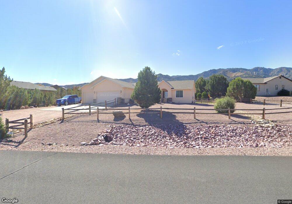
76 Eagle Crest Loop Cañon City, CO 81212
Estimated Value: $605,768 - $711,000
3
Beds
3
Baths
3,568
Sq Ft
$183/Sq Ft
Est. Value
About This Home
This home is located at 76 Eagle Crest Loop, Cañon City, CO 81212 and is currently estimated at $654,192, approximately $183 per square foot. 76 Eagle Crest Loop is a home located in Fremont County with nearby schools including Lincoln School of Science & Technology, Canon City Middle School, and Canon City High School.
Ownership History
Date
Name
Owned For
Owner Type
Purchase Details
Closed on
Sep 16, 2016
Sold by
Mcclure John P and Mcclure Michelle R
Bought by
Willyard Gene O and Willyard Patricia A
Current Estimated Value
Home Financials for this Owner
Home Financials are based on the most recent Mortgage that was taken out on this home.
Original Mortgage
$232,900
Outstanding Balance
$188,535
Interest Rate
3.43%
Mortgage Type
New Conventional
Estimated Equity
$465,657
Purchase Details
Closed on
Aug 10, 2015
Sold by
Metzler Kirby J and Metzler Linda K
Bought by
Mcclure John P and Mcclure Michelle R
Home Financials for this Owner
Home Financials are based on the most recent Mortgage that was taken out on this home.
Original Mortgage
$240,000
Interest Rate
4.06%
Mortgage Type
New Conventional
Create a Home Valuation Report for This Property
The Home Valuation Report is an in-depth analysis detailing your home's value as well as a comparison with similar homes in the area
Home Values in the Area
Average Home Value in this Area
Purchase History
| Date | Buyer | Sale Price | Title Company |
|---|---|---|---|
| Willyard Gene O | $332,900 | Unified Title Company | |
| Mcclure John P | $300,000 | None Available |
Source: Public Records
Mortgage History
| Date | Status | Borrower | Loan Amount |
|---|---|---|---|
| Open | Willyard Gene O | $232,900 | |
| Previous Owner | Mcclure John P | $240,000 | |
| Previous Owner | Metzler Kirby J | $180,500 | |
| Previous Owner | Metzler Kirby J | $39,500 | |
| Previous Owner | Metzler Kirby J | $115,000 |
Source: Public Records
Tax History Compared to Growth
Tax History
| Year | Tax Paid | Tax Assessment Tax Assessment Total Assessment is a certain percentage of the fair market value that is determined by local assessors to be the total taxable value of land and additions on the property. | Land | Improvement |
|---|---|---|---|---|
| 2024 | $2,874 | $36,280 | $0 | $0 |
| 2023 | $2,874 | $32,260 | $0 | $0 |
| 2022 | $2,809 | $32,175 | $0 | $0 |
| 2021 | $2,816 | $33,101 | $0 | $0 |
| 2020 | $2,309 | $27,329 | $0 | $0 |
| 2019 | $2,281 | $27,329 | $0 | $0 |
| 2018 | $2,064 | $24,120 | $0 | $0 |
| 2017 | $1,923 | $24,120 | $0 | $0 |
| 2016 | $1,608 | $21,820 | $0 | $0 |
| 2015 | $1,605 | $21,820 | $0 | $0 |
| 2012 | $1,496 | $21,481 | $3,980 | $17,501 |
Source: Public Records
Map
Nearby Homes
- 142 N Osprey Ct
- 140 N Osprey Ct
- 154 Osprey Ct
- 154 S Osprey Ct
- 141 N Osprey Ct
- 156 Osprey Ct
- 69 Wild Rose Ct
- 156 S Osprey Ct
- 85 Eagle Crest Loop
- 87 Eagle Crest Loop
- 50 Eagle Crest Dr
- 134 Wild Rose Dr
- 132 Wild Rose Dr
- 410/414 Storm Ridge Dr
- 159 Blue Grouse Dr
- 121 Mourning Dove Dr
- 29 Kyndra Ct
- 28 Kyndra Ct
- 27 Kyndra Ct
- TBD Wild Rose Dr
- 72 Eagle Crest Loop Unit 67
- 72 Eagle Crest Loop
- 75 Eagle Crest Loop Unit A
- 75 Eagle Crest Loop
- 136 Osprey Ct
- 150 Osprey Ct
- 136 Osprey Ct Unit C
- 150 Osprey Ct Unit 65
- 77 Eagle Crest Loop
- 73 Wild Rose Ct Unit Lot 70
- 73 Wild Rose Ct
- 142 N Osprey Ct Unit LOT C
- 152 S Osprey Ct
- 161 Wild Rose Dr
- 151 Osprey Ct
- 71 Eagle Crest Loop
- 145 Osprey Ct
- 145 Osprey Ct Unit 19
- 72 Wild Rose Ct Unit 71
- 72 Wild Rose Ct