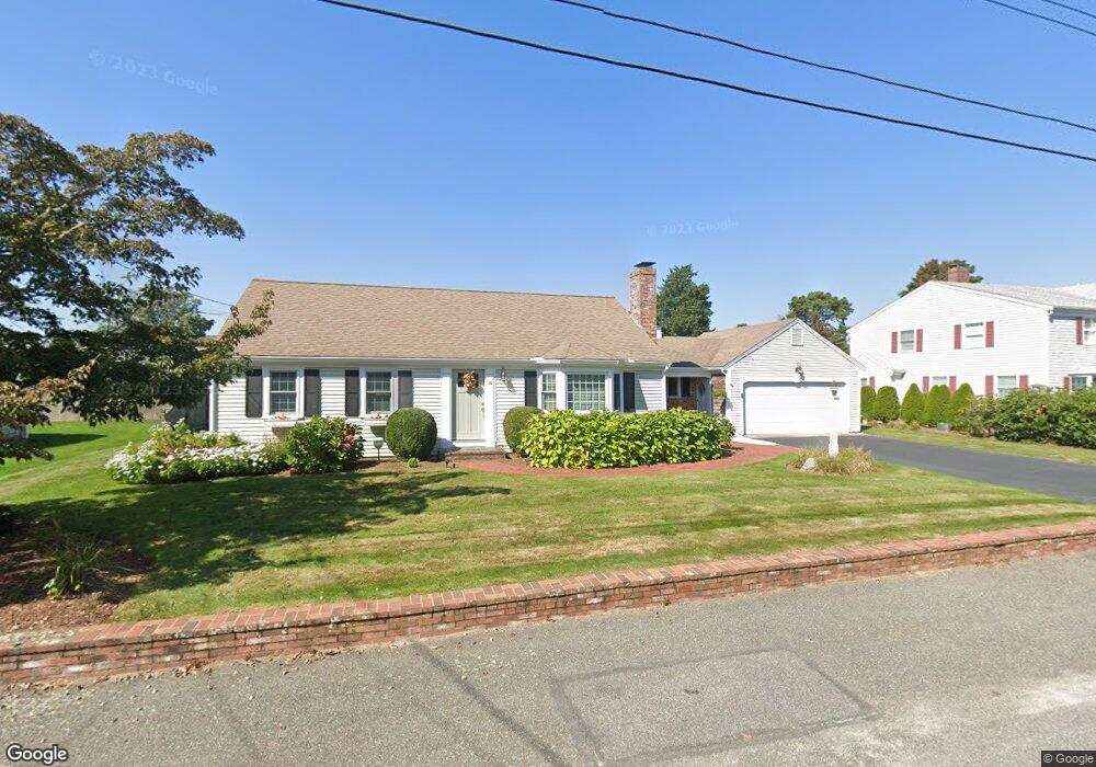
76 Garfield Ln West Dennis, MA 02670
West Dennis NeighborhoodEstimated Value: $972,000 - $1,469,000
2
Beds
2
Baths
1,504
Sq Ft
$834/Sq Ft
Est. Value
About This Home
This home is located at 76 Garfield Ln, West Dennis, MA 02670 and is currently estimated at $1,253,859, approximately $833 per square foot. 76 Garfield Ln is a home located in Barnstable County with nearby schools including Dennis-Yarmouth Regional High School and St. Pius X. School.
Ownership History
Date
Name
Owned For
Owner Type
Purchase Details
Closed on
Sep 6, 2016
Sold by
Wilson George G and Wilson Susan M
Bought by
Wilson Ft
Current Estimated Value
Purchase Details
Closed on
Dec 10, 2010
Sold by
Aniskovich Carol L and Aniskovich Paul P
Bought by
Wilson George G and Wilson Susan M
Home Financials for this Owner
Home Financials are based on the most recent Mortgage that was taken out on this home.
Original Mortgage
$417,000
Interest Rate
4.24%
Mortgage Type
Purchase Money Mortgage
Create a Home Valuation Report for This Property
The Home Valuation Report is an in-depth analysis detailing your home's value as well as a comparison with similar homes in the area
Home Values in the Area
Average Home Value in this Area
Purchase History
| Date | Buyer | Sale Price | Title Company |
|---|---|---|---|
| Wilson Ft | -- | -- | |
| Wilson George G | $552,000 | -- |
Source: Public Records
Mortgage History
| Date | Status | Borrower | Loan Amount |
|---|---|---|---|
| Previous Owner | Wilson George G | $417,000 |
Source: Public Records
Tax History Compared to Growth
Tax History
| Year | Tax Paid | Tax Assessment Tax Assessment Total Assessment is a certain percentage of the fair market value that is determined by local assessors to be the total taxable value of land and additions on the property. | Land | Improvement |
|---|---|---|---|---|
| 2025 | $4,734 | $1,093,300 | $531,600 | $561,700 |
| 2024 | $4,638 | $1,056,400 | $511,200 | $545,200 |
| 2023 | $4,485 | $960,300 | $464,700 | $495,600 |
| 2022 | $4,150 | $741,100 | $376,800 | $364,300 |
| 2021 | $3,646 | $702,600 | $369,400 | $333,200 |
| 2020 | $3,814 | $625,300 | $351,800 | $273,500 |
| 2019 | $3,647 | $585,000 | $344,900 | $240,100 |
| 2018 | $2,699 | $562,200 | $328,300 | $233,900 |
| 2017 | $2,379 | $554,900 | $328,300 | $226,600 |
| 2016 | $3,516 | $538,400 | $344,700 | $193,700 |
| 2015 | $3,446 | $538,400 | $344,700 | $193,700 |
| 2014 | $3,245 | $511,100 | $317,400 | $193,700 |
Source: Public Records
Map
Nearby Homes
- 2 Rita Mary Way
- 181 Pleasant St
- 308 Old Main St
- 745 Willow St
- 14 Schoolhouse Ln
- 209 Main St Unit 3
- 209 Main St Unit 6
- 209 Main St Unit 1
- 209 Main St Unit 2
- 209 Main St Unit 4
- 209 Main St Unit 5
- 40 Kelley Rd
- 45 Seth Ln
- 22 Powhatan Rd
- 17 South St
- 178 School St
- 23 Doric Ave
- 15 Sharon Rd
- 9 Victory Ln
- 29 Bass River Rd
- 80 Garfield Ln
- 184 Uncle Barneys Rd
- 70 Garfield Ln
- 188 Uncle Barneys Rd
- 180 Uncle Barneys Rd
- 61 Garfield Ln
- 67 Garfield Ln
- 55 Garfield Ln
- 86 Garfield Ln
- 64 Garfield Ln
- 188 Uncle Barney's Rd
- 194 Uncle Barneys Rd
- 71 Garfield Ln
- 174 Uncle Barneys Rd
- 48 Porter Ln
- 54 Porter Ln
- 185 Uncle Barneys Rd
- 189 Uncle Barneys Rd
- 51 Garfield Ln
- 44 Porter Ln