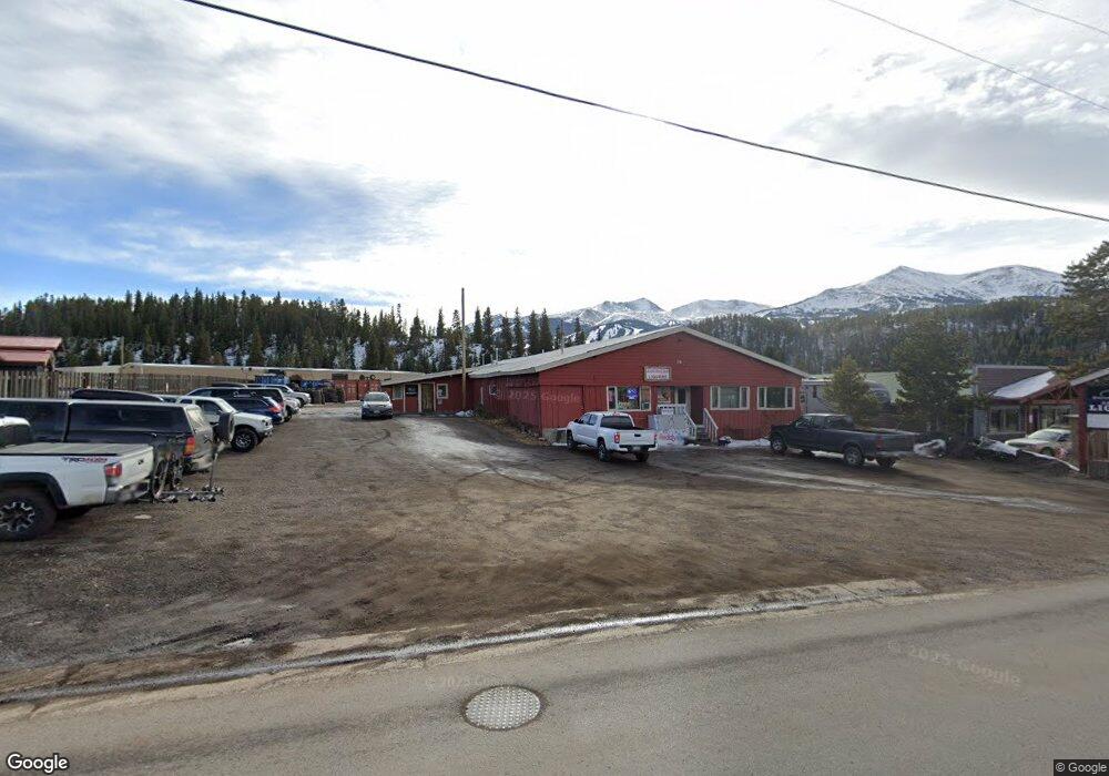
76 Huron Rd Unit 76/78 Breckenridge, CO 80424
Estimated Value: $1,710,529 - $2,006,000
--
Bed
--
Bath
6,901
Sq Ft
$269/Sq Ft
Est. Value
About This Home
This home is located at 76 Huron Rd Unit 76/78, Breckenridge, CO 80424 and is currently estimated at $1,858,265, approximately $269 per square foot. 76 Huron Rd Unit 76/78 is a home located in Summit County with nearby schools including Upper Blue Elementary School, Summit Middle School, and Summit High School.
Ownership History
Date
Name
Owned For
Owner Type
Purchase Details
Closed on
Feb 11, 2016
Sold by
76 Huron Llc
Bought by
78 Huron Llc
Current Estimated Value
Home Financials for this Owner
Home Financials are based on the most recent Mortgage that was taken out on this home.
Original Mortgage
$604,500
Outstanding Balance
$31,592
Interest Rate
4.95%
Mortgage Type
Commercial
Estimated Equity
$1,826,673
Purchase Details
Closed on
May 24, 2012
Sold by
Huron Center Llc
Bought by
76 Huron Llc
Home Financials for this Owner
Home Financials are based on the most recent Mortgage that was taken out on this home.
Original Mortgage
$350,000
Interest Rate
3.93%
Mortgage Type
Commercial
Purchase Details
Closed on
Aug 8, 2005
Sold by
Scr 450 Llp
Bought by
Huron Center Llc
Create a Home Valuation Report for This Property
The Home Valuation Report is an in-depth analysis detailing your home's value as well as a comparison with similar homes in the area
Home Values in the Area
Average Home Value in this Area
Purchase History
| Date | Buyer | Sale Price | Title Company |
|---|---|---|---|
| 78 Huron Llc | $930,000 | Land Title Guarantee Company | |
| 76 Huron Llc | $500,000 | Land Title Guarantee Company | |
| Huron Center Llc | $674,200 | None Available |
Source: Public Records
Mortgage History
| Date | Status | Borrower | Loan Amount |
|---|---|---|---|
| Open | 78 Huron Llc | $604,500 | |
| Previous Owner | 76 Huron Llc | $350,000 |
Source: Public Records
Tax History Compared to Growth
Tax History
| Year | Tax Paid | Tax Assessment Tax Assessment Total Assessment is a certain percentage of the fair market value that is determined by local assessors to be the total taxable value of land and additions on the property. | Land | Improvement |
|---|---|---|---|---|
| 2024 | $19,557 | $421,921 | -- | -- |
| 2023 | $19,557 | $397,547 | $0 | $0 |
| 2022 | $19,330 | $367,749 | $0 | $0 |
| 2021 | $19,136 | $367,749 | $0 | $0 |
| 2020 | $17,593 | $335,309 | $0 | $0 |
| 2019 | $17,343 | $335,309 | $0 | $0 |
| 2018 | $17,067 | $319,711 | $0 | $0 |
| 2017 | $15,610 | $319,711 | $0 | $0 |
| 2016 | $10,159 | $204,907 | $0 | $0 |
| 2015 | $9,833 | $204,907 | $0 | $0 |
| 2014 | $7,174 | $147,511 | $0 | $0 |
| 2013 | -- | $147,511 | $0 | $0 |
Source: Public Records
Map
Nearby Homes
- 47 Forest Cir
- 32 Magnum Bonum Dr
- 24 Magnum Bonum Dr
- 847 Airport Rd Unit 24
- 847 Airport Rd Unit 12
- 847 Airport Rd Unit 18
- 847 Airport Rd Unit 4
- 847 Airport Rd Unit 21
- 847 Airport Rd
- 116 Dyer Trail
- 456 Forest Hills Dr
- 114 Luisa Dr
- 72 Dyer Trail
- 175 Highlands Dr
- 215 Royal Tiger Rd
- 216 N Gold Flake Terrace
- 324 N Main St Unit 5
- 9 Rounds Rd
- 166 Woods Dr Unit 2
- 186 Woods Dr Unit 4
- 76 Huron Rd
- 116 Huron Rd
- 156 Huron Rd Unit A1
- 156 Huron Rd Unit B8,B9,B10
- 87 Reliance Dr
- 88 Reliance Dr
- 86 Reliance Dr
- 89 Reliance Dr
- 36 Magnum Bonum Dr
- 11072 Highway 9 Unit 203
- 11072 Highway 9 Unit 203, 204
- 83 Forest Cir
- 35 Magnum Bontum Dr
- 181 Reliance Dr
- 85 Reliance Dr
- 91 Reliance Dr
- 37 Magnum Bontum Dr
- 90 Reliance Dr
- 84 Reliance Dr
- 34 Magnum Bontum Dr