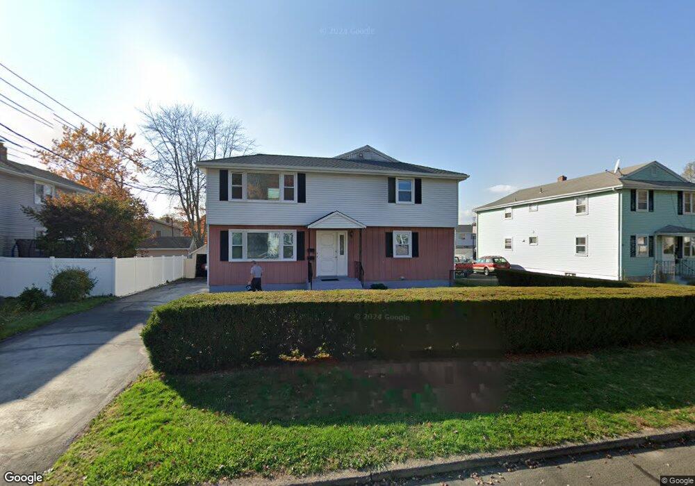
76 Kim Dr New Britain, CT 06053
Estimated Value: $335,846 - $404,000
6
Beds
2
Baths
2,430
Sq Ft
$151/Sq Ft
Est. Value
About This Home
This home is located at 76 Kim Dr, New Britain, CT 06053 and is currently estimated at $365,962, approximately $150 per square foot. 76 Kim Dr is a home located in Hartford County with nearby schools including Holmes School, Pulaski Middle School, and Mountain Laurel Sudbury School.
Ownership History
Date
Name
Owned For
Owner Type
Purchase Details
Closed on
Apr 29, 2020
Sold by
Wojtowicz Edward and Wojtowicz Zenobia
Bought by
Kolodziejczyk Anna
Current Estimated Value
Purchase Details
Closed on
Dec 11, 2001
Sold by
Sarnecki Antoni and Sarnecki Helena
Bought by
Wojtowicz Edward and Wojtowicz Zenobia
Home Financials for this Owner
Home Financials are based on the most recent Mortgage that was taken out on this home.
Original Mortgage
$119,000
Interest Rate
6.67%
Create a Home Valuation Report for This Property
The Home Valuation Report is an in-depth analysis detailing your home's value as well as a comparison with similar homes in the area
Home Values in the Area
Average Home Value in this Area
Purchase History
| Date | Buyer | Sale Price | Title Company |
|---|---|---|---|
| Kolodziejczyk Anna | -- | None Available | |
| Wojtowicz Edward | $159,000 | -- |
Source: Public Records
Mortgage History
| Date | Status | Borrower | Loan Amount |
|---|---|---|---|
| Previous Owner | Wojtowicz Edward | $12,000 | |
| Previous Owner | Wojtowicz Edward | $70,000 | |
| Previous Owner | Wojtowicz Edward | $119,000 |
Source: Public Records
Tax History
| Year | Tax Paid | Tax Assessment Tax Assessment Total Assessment is a certain percentage of the fair market value that is determined by local assessors to be the total taxable value of land and additions on the property. | Land | Improvement |
|---|---|---|---|---|
| 2025 | $6,906 | $176,260 | $56,420 | $119,840 |
| 2024 | $6,978 | $176,260 | $56,420 | $119,840 |
| 2023 | $6,747 | $176,260 | $56,420 | $119,840 |
| 2022 | $5,811 | $117,390 | $25,970 | $91,420 |
| 2021 | $5,811 | $117,390 | $25,970 | $91,420 |
| 2020 | $5,928 | $117,390 | $25,970 | $91,420 |
| 2019 | $5,928 | $117,390 | $25,970 | $91,420 |
| 2018 | $5,928 | $117,390 | $25,970 | $91,420 |
| 2017 | $5,426 | $107,450 | $23,730 | $83,720 |
| 2016 | $5,426 | $107,450 | $23,730 | $83,720 |
| 2015 | $5,265 | $107,450 | $23,730 | $83,720 |
| 2014 | $5,265 | $107,450 | $23,730 | $83,720 |
Source: Public Records
Map
Nearby Homes
- 678 Farmington Ave
- 432 Mcclintock St
- 24 Pentlow Ave
- 40 Hutchinson St
- 2415 Corbin Ave
- 45 Tunxis St
- 23 Lewis Rd
- 482 Commonwealth Ave
- 21 Skipper St
- 57 Merigold Dr
- 234 Pierremount Ave
- 53 Park Dr
- 39 Pendleton Rd
- 178 Alexander Rd
- 182 Francis St
- 1634 Stanley St
- 14 Acton St
- 169 Country Club Rd
- 154 Allen St
- 55 Allen St
Your Personal Tour Guide
Ask me questions while you tour the home.