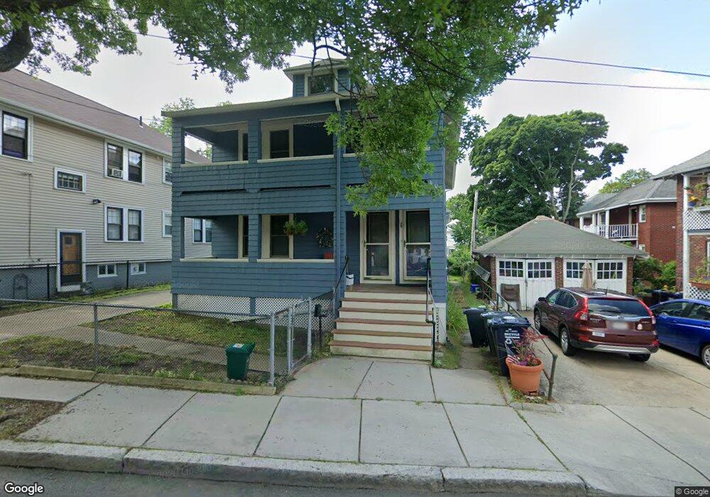
76 Matignon Rd Cambridge, MA 02140
North Cambridge NeighborhoodEstimated Value: $1,625,971 - $2,563,000
5
Beds
3
Baths
2,250
Sq Ft
$928/Sq Ft
Est. Value
About This Home
This home is located at 76 Matignon Rd, Cambridge, MA 02140 and is currently estimated at $2,088,993, approximately $928 per square foot. 76 Matignon Rd is a home located in Middlesex County with nearby schools including International School of Boston and Lesley Ellis School.
Ownership History
Date
Name
Owned For
Owner Type
Purchase Details
Closed on
Apr 3, 1991
Sold by
Watson Barbara M
Bought by
Watson Edward M and Watson Ellen F
Current Estimated Value
Home Financials for this Owner
Home Financials are based on the most recent Mortgage that was taken out on this home.
Original Mortgage
$185,000
Interest Rate
9.2%
Mortgage Type
Purchase Money Mortgage
Create a Home Valuation Report for This Property
The Home Valuation Report is an in-depth analysis detailing your home's value as well as a comparison with similar homes in the area
Home Values in the Area
Average Home Value in this Area
Purchase History
| Date | Buyer | Sale Price | Title Company |
|---|---|---|---|
| Watson Edward M | $18,000 | -- |
Source: Public Records
Mortgage History
| Date | Status | Borrower | Loan Amount |
|---|---|---|---|
| Closed | Watson Edward M | $180,000 | |
| Closed | Watson Edward M | $185,000 | |
| Previous Owner | Watson Edward M | $167,000 |
Source: Public Records
Tax History
| Year | Tax Paid | Tax Assessment Tax Assessment Total Assessment is a certain percentage of the fair market value that is determined by local assessors to be the total taxable value of land and additions on the property. | Land | Improvement |
|---|---|---|---|---|
| 2025 | $8,711 | $1,371,800 | $496,700 | $875,100 |
| 2024 | $8,023 | $1,355,200 | $517,500 | $837,700 |
| 2023 | $7,348 | $1,254,000 | $527,800 | $726,200 |
| 2022 | $6,878 | $1,161,800 | $519,300 | $642,500 |
| 2021 | $6,635 | $1,134,200 | $537,100 | $597,100 |
| 2020 | $6,250 | $1,086,900 | $521,300 | $565,600 |
| 2019 | $5,865 | $987,400 | $465,300 | $522,100 |
| 2018 | $5,492 | $873,200 | $391,900 | $481,300 |
| 2017 | $5,356 | $825,200 | $367,400 | $457,800 |
| 2016 | $5,293 | $757,200 | $318,400 | $438,800 |
| 2015 | $5,304 | $678,300 | $279,900 | $398,400 |
| 2014 | $5,345 | $637,800 | $244,900 | $392,900 |
Source: Public Records
Map
Nearby Homes
- 57 Farragut Ave Unit 2
- 7 Madison Ave
- 22 Madison Ave
- 14 Farragut Ave Unit 1
- 38 Brookford St Unit 2
- 2 Gold Star Ct
- 35 Boulevard Rd Unit 37
- 9-11 Edmunds St
- 97 Elmwood St Unit 313
- 97 Elmwood St Unit 110
- 97 Elmwood St Unit 310
- 30 Clarendon Ave
- 1188 Broadway Unit 403
- 4 Magnolia St
- 3 Seagrave Rd
- 35 Fairmont St Unit 1
- 35 Fairmont St Unit 2
- 35 Fairmont St Unit 3
- 69 Harvey St Unit 1
- 109 Harvey St
- 70 Matignon Rd
- 31 Alewife Brook Pkwy
- 30 Alewife Brook Pkwy
- 30 Alewife Brook Pkwy Unit 30
- 30 Alewife Brook Pkwy Unit 2
- 53 Murray Hill Rd
- 51 Murray Hill Rd
- 51 Murray Hill Rd Unit 51
- 51 Murray Hill Rd Unit 53
- 51 Murray Hill Rd Unit 1
- 66 Matignon Rd
- 29 Alewife Brook Pkwy
- 49 Murray Hill Rd
- 45 Murray Hill Rd
- 43 Murray Hill Rd Unit 43
- 58 Matignon Rd
- 39 Murray Hill Rd
- 54 Matignon Rd
- 54 Matignon Rd Unit 1
- 56 Matignon Rd
Your Personal Tour Guide
Ask me questions while you tour the home.