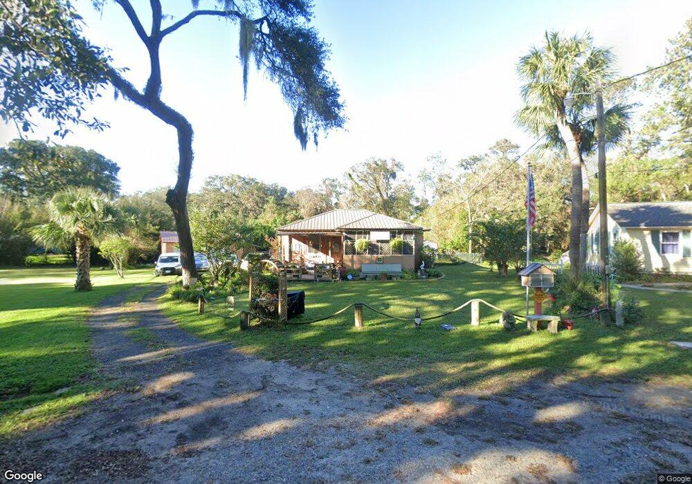
76 Maxwell Ave Saint Simons Island, GA 31522
Estimated Value: $610,000 - $761,000
2
Beds
2
Baths
1,216
Sq Ft
$578/Sq Ft
Est. Value
About This Home
This home is located at 76 Maxwell Ave, Saint Simons Island, GA 31522 and is currently estimated at $702,594, approximately $577 per square foot. 76 Maxwell Ave is a home located in Glynn County with nearby schools including St. Simons Elementary School, Glynn Middle School, and Glynn Academy.
Ownership History
Date
Name
Owned For
Owner Type
Purchase Details
Closed on
Dec 1, 2009
Sold by
Massari Paula Barfield
Bought by
Smyth Tom and Smith Trena
Current Estimated Value
Home Financials for this Owner
Home Financials are based on the most recent Mortgage that was taken out on this home.
Original Mortgage
$300,000
Outstanding Balance
$195,988
Interest Rate
5.01%
Mortgage Type
New Conventional
Estimated Equity
$506,606
Purchase Details
Closed on
Nov 7, 2008
Sold by
Dorothy Ann Wilb
Bought by
Massari Paula Barfield
Create a Home Valuation Report for This Property
The Home Valuation Report is an in-depth analysis detailing your home's value as well as a comparison with similar homes in the area
Home Values in the Area
Average Home Value in this Area
Purchase History
| Date | Buyer | Sale Price | Title Company |
|---|---|---|---|
| Smyth Tom | $300,000 | -- | |
| Massari Paula Barfield | -- | -- |
Source: Public Records
Mortgage History
| Date | Status | Borrower | Loan Amount |
|---|---|---|---|
| Open | Smyth Tom | $300,000 |
Source: Public Records
Tax History Compared to Growth
Tax History
| Year | Tax Paid | Tax Assessment Tax Assessment Total Assessment is a certain percentage of the fair market value that is determined by local assessors to be the total taxable value of land and additions on the property. | Land | Improvement |
|---|---|---|---|---|
| 2025 | $5,240 | $208,920 | $133,040 | $75,880 |
| 2024 | $4,572 | $182,320 | $106,440 | $75,880 |
| 2023 | $3,111 | $168,760 | $95,000 | $73,760 |
| 2022 | $2,727 | $111,760 | $38,000 | $73,760 |
| 2021 | $2,273 | $91,080 | $38,000 | $53,080 |
| 2020 | $2,292 | $91,080 | $38,000 | $53,080 |
| 2019 | $2,292 | $91,080 | $38,000 | $53,080 |
| 2018 | $2,292 | $91,080 | $38,000 | $53,080 |
| 2017 | $2,135 | $82,040 | $38,000 | $44,040 |
| 2016 | $1,565 | $64,600 | $38,000 | $26,600 |
| 2015 | $1,571 | $64,600 | $38,000 | $26,600 |
| 2014 | $1,571 | $64,600 | $38,000 | $26,600 |
Source: Public Records
Map
Nearby Homes
- 104 Youngwood Dr
- 516 Postell Dr
- 105 Ledbetter Ave
- 202 Vassar Point Dr
- 211 Mcintosh Ave
- 123 Redfern Dr
- 121 Killgriffe St
- 2404 Frederica Rd
- 242 Mcintosh Ave
- 102 Sapelo St
- 210 Settlers Rd
- 1704 Frederica Rd Unit 237
- 1704 Frederica Rd Unit 621
- 1704 Frederica Rd Unit 628 + 31 garage
- 1704 Frederica Rd Unit 723
- 1704 Frederica Rd Unit 635
- 1704 Frederica Rd Unit 602
- 524 Wesley Oak Cir
- 217 Settlers Rd
- 159 Ledbetter Ave
- 75 Maxwell Ave
- 77 Maxwell Ave
- 534 Postell Dr
- 532 Postell Dr
- 74 Maxwell Ave
- 614 Postell Dr
- 78 Maxwell Ave
- 530 Postell Dr
- 73 Maxwell Ave
- 73 Maxwell Ave
- 46 Maxwell Ave
- 528 Postell Dr
- 47 Maxwell Ave
- 120 Mcintosh Ave
- 72 Maxwell Ave
- 2201 Frederica Rd
- Lot 2 Mcintosh Ave
- 8 Mcintosh Ave
- 32 Mcintosh Ave
- 10 Mcintosh Ave