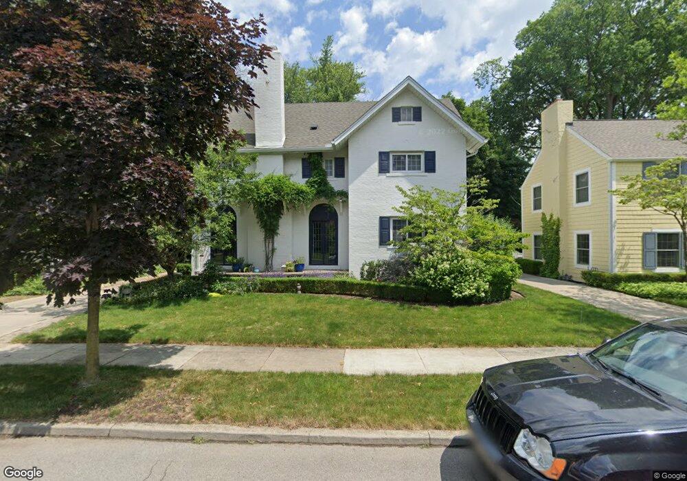
76 Muskoka Rd Grosse Pointe Farms, MI 48236
Estimated Value: $638,068 - $924,000
6
Beds
4
Baths
3,596
Sq Ft
$217/Sq Ft
Est. Value
About This Home
This home is located at 76 Muskoka Rd, Grosse Pointe Farms, MI 48236 and is currently estimated at $779,017, approximately $216 per square foot. 76 Muskoka Rd is a home located in Wayne County with nearby schools including Kerby Elementary School, Brownell Middle School, and Grosse Pointe South High School.
Ownership History
Date
Name
Owned For
Owner Type
Purchase Details
Closed on
Jul 30, 2010
Sold by
Robinson Karen A and Robinson Ben Y
Bought by
Packer Lyne Richard Louis and Packer Lyne Lianne
Current Estimated Value
Purchase Details
Closed on
Jun 30, 1994
Sold by
Vismara John F
Bought by
John F Vismara
Create a Home Valuation Report for This Property
The Home Valuation Report is an in-depth analysis detailing your home's value as well as a comparison with similar homes in the area
Home Values in the Area
Average Home Value in this Area
Purchase History
| Date | Buyer | Sale Price | Title Company |
|---|---|---|---|
| Packer Lyne Richard Louis | $325,000 | Devon Title Agency | |
| John F Vismara | $275,000 | -- |
Source: Public Records
Tax History Compared to Growth
Tax History
| Year | Tax Paid | Tax Assessment Tax Assessment Total Assessment is a certain percentage of the fair market value that is determined by local assessors to be the total taxable value of land and additions on the property. | Land | Improvement |
|---|---|---|---|---|
| 2025 | $5,037 | $301,900 | $0 | $0 |
| 2024 | $5,037 | $283,300 | $0 | $0 |
| 2023 | $4,799 | $257,000 | $0 | $0 |
| 2022 | $8,963 | $232,300 | $0 | $0 |
| 2021 | $8,467 | $208,300 | $0 | $0 |
| 2019 | $8,326 | $213,500 | $0 | $0 |
| 2018 | $4,261 | $205,900 | $0 | $0 |
| 2017 | $7,393 | $200,400 | $0 | $0 |
| 2016 | $7,749 | $196,700 | $0 | $0 |
| 2015 | $15,350 | $169,300 | $0 | $0 |
| 2013 | $14,870 | $148,700 | $0 | $0 |
| 2012 | $3,956 | $148,700 | $30,600 | $118,100 |
Source: Public Records
Map
Nearby Homes
- 81 Moross Rd
- 286 Grosse Pointe Blvd
- 273 Ridge Rd
- 11 Windemere Place Unit 29
- 257 Ridge Rd
- 189 Cloverly Rd
- 343 Beaupre Ave
- 475 Lake Shore Rd
- 130 Merriweather Rd
- 216 Ridge Rd
- 93 Merriweather Rd
- 218 Merriweather Rd
- 59 Fordcroft St
- 265 Williams Ave
- 259 Mount Vernon Ave
- 351 Moselle Place
- 302 Mount Vernon Ave
- 194 Charlevoix Ave
- 314 Mount Vernon Ave
- 317 Mount Vernon Ave