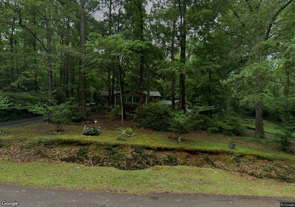
76 Shady Dale Dr Macon, GA 31220
Estimated Value: $253,301 - $432,000
--
Bed
3
Baths
3,882
Sq Ft
$89/Sq Ft
Est. Value
About This Home
This home is located at 76 Shady Dale Dr, Macon, GA 31220 and is currently estimated at $344,575, approximately $88 per square foot. 76 Shady Dale Dr is a home located in Monroe County with nearby schools including Samuel E. Hubbard Elementary School and Mary Persons High School.
Ownership History
Date
Name
Owned For
Owner Type
Purchase Details
Closed on
Jan 12, 2024
Sold by
Wood Hicks Goldie
Bought by
Hicks David L and Hicks Goldie M
Current Estimated Value
Home Financials for this Owner
Home Financials are based on the most recent Mortgage that was taken out on this home.
Original Mortgage
$13,000
Outstanding Balance
$12,773
Interest Rate
6.95%
Mortgage Type
New Conventional
Estimated Equity
$331,803
Purchase Details
Closed on
Sep 15, 1989
Bought by
Hicks Goldie Wood
Create a Home Valuation Report for This Property
The Home Valuation Report is an in-depth analysis detailing your home's value as well as a comparison with similar homes in the area
Home Values in the Area
Average Home Value in this Area
Purchase History
| Date | Buyer | Sale Price | Title Company |
|---|---|---|---|
| Hicks David L | -- | -- | |
| Hicks Goldie Wood | $48,000 | -- |
Source: Public Records
Mortgage History
| Date | Status | Borrower | Loan Amount |
|---|---|---|---|
| Open | Hicks David L | $13,000 |
Source: Public Records
Tax History Compared to Growth
Tax History
| Year | Tax Paid | Tax Assessment Tax Assessment Total Assessment is a certain percentage of the fair market value that is determined by local assessors to be the total taxable value of land and additions on the property. | Land | Improvement |
|---|---|---|---|---|
| 2024 | $2,337 | $95,000 | $3,080 | $91,920 |
| 2023 | $2,048 | $79,680 | $3,080 | $76,600 |
| 2022 | $1,832 | $79,680 | $3,080 | $76,600 |
| 2021 | $1,897 | $79,680 | $3,080 | $76,600 |
| 2020 | $1,945 | $79,680 | $3,080 | $76,600 |
| 2019 | $1,960 | $79,680 | $3,080 | $76,600 |
| 2018 | $1,966 | $79,680 | $3,080 | $76,600 |
| 2017 | $2,316 | $79,680 | $3,080 | $76,600 |
| 2016 | $1,870 | $79,680 | $3,080 | $76,600 |
| 2015 | $1,774 | $79,680 | $3,080 | $76,600 |
| 2014 | $1,711 | $79,680 | $3,080 | $76,600 |
Source: Public Records
Map
Nearby Homes
- 137 Shady Dale Dr
- 2198 Dennis Rd
- 112 Irongate
- Plan 3040 at Barrington Place
- Plan 2700 at Barrington Place
- Plan 2620 at Barrington Place
- Plan 2100 at Barrington Place
- Plan 2316 at Barrington Place
- 1409 Barrington Place Way
- 1302 Barrington Place Cove
- 1122 Irongate
- 1405 Barrington Place Ln
- 1146 Barrington Place Way
- 1150 Barrington Place Way
- 104 Peninsula Ave
- 104 Peninsula Ave Unit LOT 49
- 1154 Barrington Place Way
- 1162 Barrington Place Way
- 1166 Barrington Place Way
- 402 Harbor Cove Dr
- 9140 Shady Dale Dr
- 79 Shady Dale Dr
- 21 Shady Dale Dr
- 140 Shady Dale Dr
- 530 Lower Simmons Rd
- Tract-8 Lower Simmons Rd
- Tract-7 Lower Simmons Rd
- Tract-6 Lower Simmons Rd
- Tract-5 Lower Simmons Rd
- Tract-4 Lower Simmons Rd
- Tract-3 Lower Simmons Rd
- 75.64 Lower Simmons Rd
- - Lower Simmons Rd
- 452 Lower Simmons Rd
- 343 Lower Simmons Rd
- 365 Lower Simmons Rd
- 0 Lower Simmons Rd Unit 7480455
- 188 Shady Dale Dr
- 188 Shady Dale Dr
- 304 Lower Simmons Rd