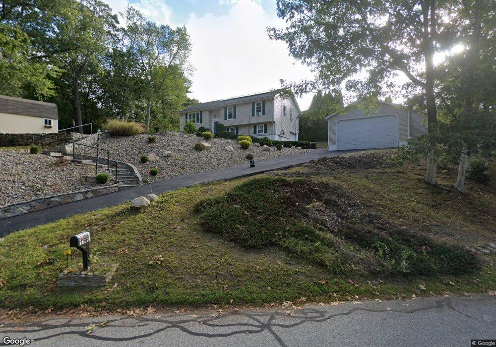
76 Stonybrook Rd Gales Ferry, CT 06335
Estimated Value: $386,000 - $438,000
3
Beds
2
Baths
1,206
Sq Ft
$336/Sq Ft
Est. Value
About This Home
This home is located at 76 Stonybrook Rd, Gales Ferry, CT 06335 and is currently estimated at $405,092, approximately $335 per square foot. 76 Stonybrook Rd is a home located in New London County with nearby schools including Ledyard Middle School, Ledyard High School, and Integrated Day Charter School.
Ownership History
Date
Name
Owned For
Owner Type
Purchase Details
Closed on
Dec 31, 2015
Sold by
Spieler Gary
Bought by
Us Bank Na
Current Estimated Value
Purchase Details
Closed on
Apr 26, 2004
Sold by
Keck Wayne and Keck Linda
Bought by
Andino Luis and Andino Beatriz
Create a Home Valuation Report for This Property
The Home Valuation Report is an in-depth analysis detailing your home's value as well as a comparison with similar homes in the area
Home Values in the Area
Average Home Value in this Area
Purchase History
| Date | Buyer | Sale Price | Title Company |
|---|---|---|---|
| Us Bank Na | -- | -- | |
| Andino Luis | $230,000 | -- | |
| Us Bank Na | -- | -- | |
| Andino Luis | $230,000 | -- |
Source: Public Records
Mortgage History
| Date | Status | Borrower | Loan Amount |
|---|---|---|---|
| Previous Owner | Andino Luis | $226,695 | |
| Previous Owner | Andino Luis | $55,000 | |
| Previous Owner | Andino Luis | $50,000 |
Source: Public Records
Tax History
| Year | Tax Paid | Tax Assessment Tax Assessment Total Assessment is a certain percentage of the fair market value that is determined by local assessors to be the total taxable value of land and additions on the property. | Land | Improvement |
|---|---|---|---|---|
| 2025 | $6,609 | $177,940 | $50,050 | $127,890 |
| 2024 | $6,265 | $177,940 | $50,050 | $127,890 |
| 2023 | $5,760 | $166,670 | $50,050 | $116,620 |
| 2022 | $5,637 | $166,670 | $50,050 | $116,620 |
| 2021 | $5,600 | $166,670 | $50,050 | $116,620 |
| 2020 | $5,589 | $159,810 | $56,560 | $103,250 |
| 2019 | $5,603 | $159,810 | $56,560 | $103,250 |
| 2018 | $5,480 | $159,810 | $56,560 | $103,250 |
| 2017 | $5,200 | $159,810 | $56,560 | $103,250 |
| 2016 | $5,098 | $159,810 | $56,560 | $103,250 |
| 2015 | $4,858 | $159,810 | $56,560 | $103,250 |
| 2014 | $4,598 | $153,790 | $47,880 | $105,910 |
Source: Public Records
Map
Nearby Homes
- 10 Buttercup Ln
- 33 Stonybrook Rd
- 1918 Route 12
- 48 Bittersweet Dr
- 12 Stonybrook Rd
- 3 Holdsworth Rd
- 6 Overlook Rd
- 16 Marlene Dr
- 134 Massapeag Side Rd
- 11 Willow Ln
- 0 Clarks Falls Unit 24089817
- 21 Oakridge Dr
- 7 Barn Rd
- 15 Park Avenue Extension
- 1637 Connecticut 12
- 104 Route 2a
- 6 Route 117
- 6 Riched Ln
- 165 Massapeag Rd
- 4 Millaras Dr
- 5 Buttercup Ln
- 1968 Route 12
- 73 Stonybrook Rd
- 7 Buttercup Ln
- 1970 Route 12
- 70 Stonybrook Rd
- 8 Buttercup Ln
- 65 Stonybrook Rd
- 1972 Route 12
- 4 Buttercup Ln
- 66 Stonybrook Rd
- 1974 Route 12
- 1978 Route 12
- 2 Tanager Ln
- 63 Stonybrook Rd
- 4 Tanager Ln
- 64 Stonybrook Rd
- 7 Bittersweet Dr
- 14 Tanager Ln
- 6 Tanager Ln
Your Personal Tour Guide
Ask me questions while you tour the home.