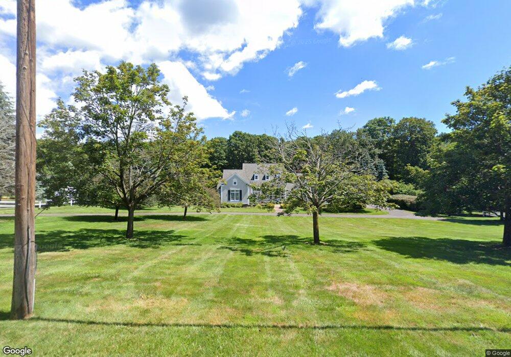
76 Westledge Rd West Simsbury, CT 06092
Estimated Value: $798,000 - $856,000
4
Beds
4
Baths
3,411
Sq Ft
$245/Sq Ft
Est. Value
About This Home
This home is located at 76 Westledge Rd, West Simsbury, CT 06092 and is currently estimated at $836,067, approximately $245 per square foot. 76 Westledge Rd is a home located in Hartford County with nearby schools including Tootin' Hills School, Henry James Memorial School, and Simsbury High School.
Ownership History
Date
Name
Owned For
Owner Type
Purchase Details
Closed on
May 13, 1998
Sold by
Brooke Dev Prop
Bought by
Galle J Scott and Galle Margaret
Current Estimated Value
Home Financials for this Owner
Home Financials are based on the most recent Mortgage that was taken out on this home.
Original Mortgage
$375,000
Interest Rate
7.12%
Create a Home Valuation Report for This Property
The Home Valuation Report is an in-depth analysis detailing your home's value as well as a comparison with similar homes in the area
Home Values in the Area
Average Home Value in this Area
Purchase History
| Date | Buyer | Sale Price | Title Company |
|---|---|---|---|
| Galle J Scott | $155,000 | -- |
Source: Public Records
Mortgage History
| Date | Status | Borrower | Loan Amount |
|---|---|---|---|
| Open | Galle J Scott | $200,000 | |
| Closed | Galle J Scott | $375,000 |
Source: Public Records
Tax History Compared to Growth
Tax History
| Year | Tax Paid | Tax Assessment Tax Assessment Total Assessment is a certain percentage of the fair market value that is determined by local assessors to be the total taxable value of land and additions on the property. | Land | Improvement |
|---|---|---|---|---|
| 2025 | $16,851 | $493,290 | $130,480 | $362,810 |
| 2024 | $16,431 | $493,290 | $130,480 | $362,810 |
| 2023 | $15,302 | $480,900 | $130,480 | $350,420 |
| 2022 | $14,827 | $383,830 | $123,500 | $260,330 |
| 2021 | $14,827 | $383,830 | $123,500 | $260,330 |
| 2020 | $14,236 | $383,830 | $123,500 | $260,330 |
| 2019 | $14,325 | $383,830 | $123,500 | $260,330 |
| 2018 | $14,428 | $383,830 | $123,500 | $260,330 |
| 2017 | $14,652 | $378,030 | $116,210 | $261,820 |
| 2016 | $14,032 | $378,030 | $116,210 | $261,820 |
| 2015 | $14,032 | $378,030 | $116,210 | $261,820 |
| 2014 | $14,040 | $378,030 | $116,220 | $261,810 |
Source: Public Records
Map
Nearby Homes
- 3 Woodchuck Hill Rd
- 45 Westledge Rd
- 106 Hedgehog Ln
- 6 Summerwood Rd
- 153 Westledge Rd
- 72 W Mountain Rd
- 113 Old Farms Rd
- 21 Christmas Tree Hill
- 143 N Mountain Rd
- 107 W Mountain Rd
- 537 Cherry Brook Rd
- 391 Cherry Brook Rd
- 29 Fawnbrook Ln
- 23 Red Fox Run
- 247 Old Farms Rd
- 177 Stratton Brook Rd
- 92 Wright Rd
- 15 Red Fox Run
- 11 Timbercrest Dr
- 3 Glen Hollow Ln
- 78 Westledge Rd
- 69 Westledge Rd
- 00 Woodchuck Hill Rd
- 73 Westledge Rd
- 80 Westledge Rd
- 4 Woodchuck Hill Rd
- 57 Westledge Rd
- 6 Pasture Ln
- 82 Westledge Rd
- 12 Woodchuck Hill Rd
- 7 Woodchuck Hill Rd
- 77 Westledge Rd
- 51 Westledge Rd
- 10 Pasture Ln
- 90 Westledge Rd
- 11 Woodchuck Hill Rd
- 47 Westledge Rd
- 14 Pasture Ln
- 20 Woodchuck Hill Rd
- 7 Pasture Ln