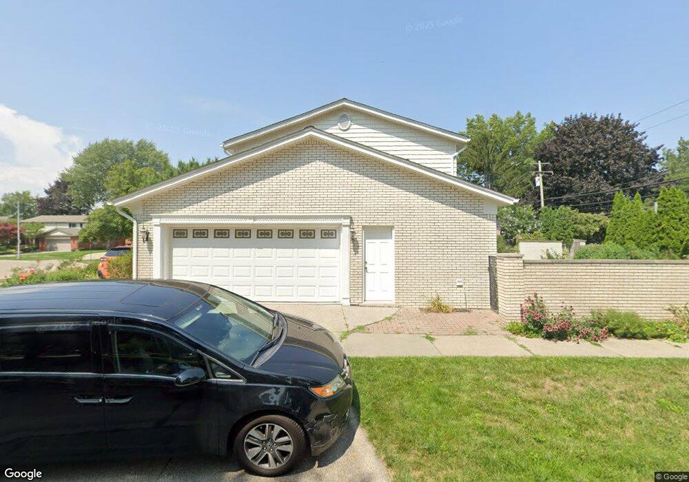
760 Pear Tree Ln Grosse Pointe Woods, MI 48236
Estimated Value: $542,785 - $592,000
3
Beds
3
Baths
2,671
Sq Ft
$211/Sq Ft
Est. Value
About This Home
This home is located at 760 Pear Tree Ln, Grosse Pointe Woods, MI 48236 and is currently estimated at $562,946, approximately $210 per square foot. 760 Pear Tree Ln is a home located in Wayne County with nearby schools including John Monteith Elementary School, Parcells Middle School, and Grosse Pointe North High School.
Ownership History
Date
Name
Owned For
Owner Type
Purchase Details
Closed on
Aug 10, 2006
Sold by
Sniezek David D and Sniezek Rosanna
Bought by
Krol Michael A
Current Estimated Value
Purchase Details
Closed on
May 21, 2001
Sold by
Bongiorno Alexander J
Bought by
Sniezek David D
Create a Home Valuation Report for This Property
The Home Valuation Report is an in-depth analysis detailing your home's value as well as a comparison with similar homes in the area
Home Values in the Area
Average Home Value in this Area
Purchase History
| Date | Buyer | Sale Price | Title Company |
|---|---|---|---|
| Krol Michael A | $455,000 | Lawyers Title Insurance Co | |
| Sniezek David D | -- | -- |
Source: Public Records
Tax History Compared to Growth
Tax History
| Year | Tax Paid | Tax Assessment Tax Assessment Total Assessment is a certain percentage of the fair market value that is determined by local assessors to be the total taxable value of land and additions on the property. | Land | Improvement |
|---|---|---|---|---|
| 2025 | $5,928 | $259,800 | $0 | $0 |
| 2024 | $5,928 | $241,300 | $0 | $0 |
| 2023 | $5,701 | $225,200 | $0 | $0 |
| 2022 | $8,929 | $219,000 | $0 | $0 |
| 2021 | $8,511 | $220,000 | $0 | $0 |
| 2020 | $8,764 | $209,400 | $0 | $0 |
| 2019 | $5,189 | $201,600 | $0 | $0 |
| 2018 | $5,100 | $199,200 | $0 | $0 |
| 2017 | $5,926 | $194,800 | $0 | $0 |
| 2016 | $8,079 | $181,900 | $0 | $0 |
| 2015 | $14,003 | $164,400 | $0 | $0 |
| 2013 | $13,540 | $145,300 | $0 | $0 |
| 2012 | -- | $133,500 | $24,100 | $109,400 |
Source: Public Records
Map
Nearby Homes
- 809 Fairford Rd
- 535 Ballantyne Rd
- 59 Fordcroft St
- 410 Roland Ct
- 587 Lochmoor Blvd
- 565 Lochmoor Blvd
- 963 Lochmoor Blvd
- 463 Colonial Ct
- 745- 749 Lake Shore Rd
- 19980 W Clairview Ct
- 486 Bournemouth Rd
- 475 Lake Shore Rd
- 499 Sunningdale Dr
- 622 Sunningdale Dr
- 419 Maison Rd
- 450 Roland Rd
- 343 Beaupre Ave
- 1597 Newcastle Rd
- 528 Hidden Ln
- 54 Belle Meade St
- 770 Pear Tree Ln
- 19881 W Doyle Place
- 19885 W Doyle Place
- 19869 Wedgewood Dr
- 763 Pear Tree Ln
- 19888 E Doyle Place
- 19891 W Doyle Place
- 19857 Wedgewood Dr
- 726 Pear Tree Ln
- 737 Pear Tree Ln
- 19845 Wedgewood Dr
- 19899 W Doyle Place
- 19900 E Doyle Place
- 19832 Wedgewood Dr
- 716 Pear Tree Ln
- 19831 Edshire Ln
- 25 River Ln
- 19833 Wedgewood Dr
- 19907 W Doyle Place
- 19882 W Doyle Place