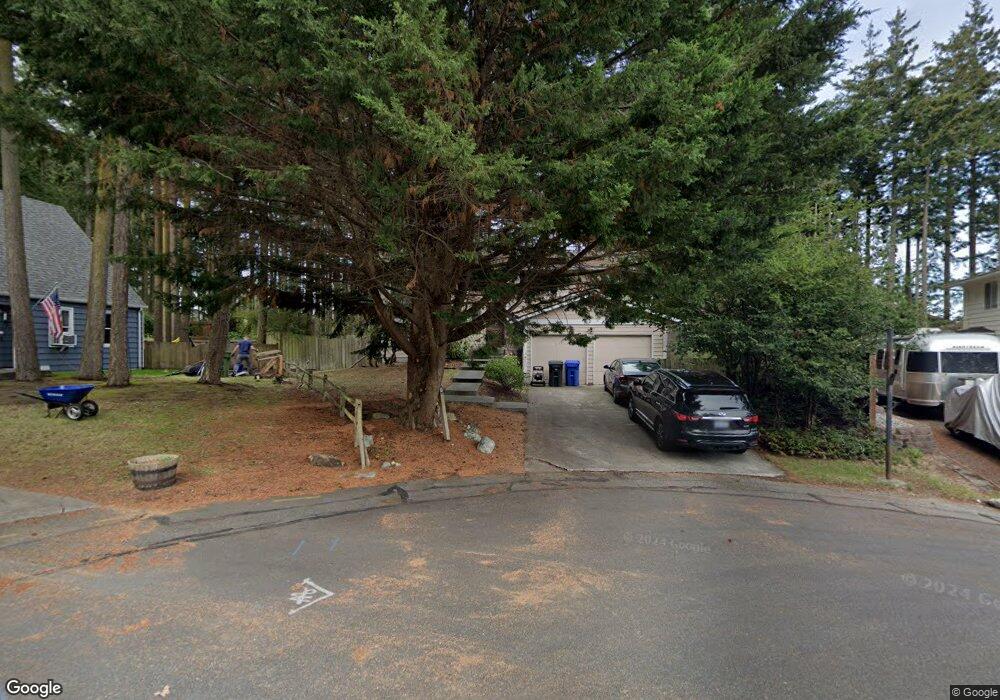
760 SW 12th Ct Oak Harbor, WA 98277
Estimated Value: $516,754 - $576,000
4
Beds
3
Baths
1,976
Sq Ft
$278/Sq Ft
Est. Value
About This Home
This home is located at 760 SW 12th Ct, Oak Harbor, WA 98277 and is currently estimated at $549,189, approximately $277 per square foot. 760 SW 12th Ct is a home located in Island County with nearby schools including Broadview Elementary School, Oak Harbor Middle School, and Oak Harbor High School.
Ownership History
Date
Name
Owned For
Owner Type
Purchase Details
Closed on
Apr 6, 2015
Sold by
Peek Michael S
Bought by
Peek Michael S and Peek Zoe A
Current Estimated Value
Home Financials for this Owner
Home Financials are based on the most recent Mortgage that was taken out on this home.
Original Mortgage
$78,368
Interest Rate
3.02%
Mortgage Type
New Conventional
Create a Home Valuation Report for This Property
The Home Valuation Report is an in-depth analysis detailing your home's value as well as a comparison with similar homes in the area
Home Values in the Area
Average Home Value in this Area
Purchase History
| Date | Buyer | Sale Price | Title Company |
|---|---|---|---|
| Peek Michael S | -- | First Amer Title Island Cnty |
Source: Public Records
Mortgage History
| Date | Status | Borrower | Loan Amount |
|---|---|---|---|
| Closed | Peek Michael S | $78,368 |
Source: Public Records
Tax History Compared to Growth
Tax History
| Year | Tax Paid | Tax Assessment Tax Assessment Total Assessment is a certain percentage of the fair market value that is determined by local assessors to be the total taxable value of land and additions on the property. | Land | Improvement |
|---|---|---|---|---|
| 2025 | $3,885 | $454,347 | $200,000 | $254,347 |
| 2024 | $3,779 | $457,867 | $200,000 | $257,867 |
| 2023 | $3,779 | $447,867 | $190,000 | $257,867 |
| 2022 | $3,523 | $426,680 | $190,000 | $236,680 |
| 2021 | $3,266 | $328,595 | $120,000 | $208,595 |
| 2020 | $3,310 | $303,591 | $100,000 | $203,591 |
| 2019 | $2,853 | $304,534 | $150,000 | $154,534 |
| 2018 | $2,896 | $285,035 | $130,000 | $155,035 |
| 2017 | $2,529 | $254,996 | $110,000 | $144,996 |
| 2016 | $2,431 | $237,011 | $90,000 | $147,011 |
| 2015 | -- | $219,025 | $70,000 | $149,025 |
| 2013 | -- | $208,053 | $55,000 | $153,053 |
Source: Public Records
Map
Nearby Homes
- 942 SW Barrington Dr
- 1121 SW Barrington Dr Unit 3
- 1101 SW Harrier Cir Unit 106
- 1250 SW Heller Rd Unit C1
- 1250 SW Heller St Unit B2
- 30901 State Route 20 Unit D2
- 1380 SW Swantown Ave
- 660 SW Harrier Cir Unit 1
- 915 SW Kimball Dr Unit B3
- 485 SW Bayshore Dr Unit C201
- 984 SW 6th Ave
- 1850 SW Scenic Heights St Unit B304
- 0 XXX
- 0 XXX State Route 20 (Lot 3)
- 2029 Baymont Dr
- 748 SW Heller St
- 1472 SW 10th Ave
- 1700 SW Mulberry Place Unit A302
- 478 SW Judson Dr
- 1651 SW Mulberry Place Unit E204
- 1169 SW Fairhaven Dr
- 743 SW 11th Ct
- 761 SW 12th Ct
- 753 SW 11th Ct
- 1127 SW Fairhaven Dr
- 721 SW 12th Ct
- 1230 SW Ingleside Ct
- 1188 SW Fairhaven Dr
- 771 SW 11th Ct
- 1154 SW Fairhaven Dr
- 1210 SW Ingleside Ct
- 1224 SW Fairhaven Dr
- 1128 SW Fairhaven Dr
- 742 SW 11th Ct
- 783 SW 11th Ct
- 828 SW 13th Ave
- 768 SW 13th Ave
- 1091 SW Fairhaven Dr
- 754 SW 11th Ct