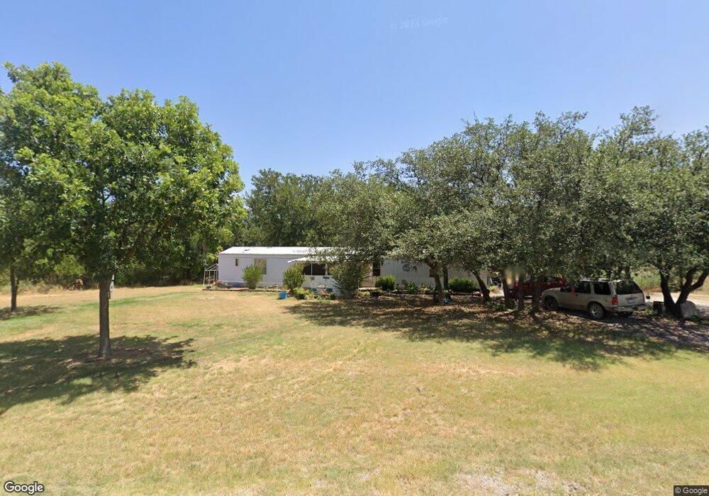
7600 County Road 550 Brownwood, TX 76801
Estimated Value: $134,000 - $181,000
3
Beds
2
Baths
1,216
Sq Ft
$126/Sq Ft
Est. Value
About This Home
This home is located at 7600 County Road 550, Brownwood, TX 76801 and is currently estimated at $153,191, approximately $125 per square foot. 7600 County Road 550 is a home located in Brown County with nearby schools including J.B. Stephens Elementary School, Bangs Middle School, and Bangs High School.
Ownership History
Date
Name
Owned For
Owner Type
Purchase Details
Closed on
Jun 1, 2016
Sold by
Fikes James W
Bought by
Duncan Charles and Duncan Veronica
Current Estimated Value
Home Financials for this Owner
Home Financials are based on the most recent Mortgage that was taken out on this home.
Original Mortgage
$40,000
Outstanding Balance
$31,770
Interest Rate
3.59%
Mortgage Type
Seller Take Back
Estimated Equity
$121,421
Purchase Details
Closed on
May 11, 2015
Sold by
Taber Vicky
Bought by
Fikes James W
Create a Home Valuation Report for This Property
The Home Valuation Report is an in-depth analysis detailing your home's value as well as a comparison with similar homes in the area
Home Values in the Area
Average Home Value in this Area
Purchase History
| Date | Buyer | Sale Price | Title Company |
|---|---|---|---|
| Duncan Charles | -- | None Available | |
| Fikes James W | -- | None Available |
Source: Public Records
Mortgage History
| Date | Status | Borrower | Loan Amount |
|---|---|---|---|
| Open | Duncan Charles | $40,000 |
Source: Public Records
Tax History Compared to Growth
Tax History
| Year | Tax Paid | Tax Assessment Tax Assessment Total Assessment is a certain percentage of the fair market value that is determined by local assessors to be the total taxable value of land and additions on the property. | Land | Improvement |
|---|---|---|---|---|
| 2025 | $1,174 | $94,747 | $0 | $0 |
| 2024 | $1,067 | $112,760 | $22,130 | $90,630 |
| 2023 | $976 | $120,300 | $28,780 | $91,520 |
| 2022 | $642 | $118,100 | $26,580 | $91,520 |
| 2021 | $1,054 | $112,980 | $20,430 | $92,550 |
| 2020 | $1,502 | $87,600 | $6,820 | $80,780 |
| 2019 | $1,696 | $93,240 | $6,820 | $86,420 |
| 2018 | $888 | $48,410 | $6,820 | $41,590 |
| 2017 | $887 | $48,410 | $6,820 | $41,590 |
| 2016 | $887 | $48,410 | $6,820 | $41,590 |
| 2015 | -- | $48,410 | $6,820 | $41,590 |
| 2014 | -- | $48,410 | $6,820 | $41,590 |
Source: Public Records
Map
Nearby Homes
- 7005 County Road 551
- 7850 County Road 551
- 6955 Ennis Dr
- N/A Newcastle Dr
- 7134 Emerald Dr
- TBD Clifden Dr
- 7194 Neal Dr
- TBD Verde Dr
- 6958 Lovers Ln
- 0 Lovers Ln
- 6959 Shamrock Dr
- 6926 Shamrock Dr
- 7143 Dillard Dr
- 6996 Shamrock Dr
- 6944 Shamrock Dr
- 6926 Turner Dr
- Tbd Saint Patrick Dr
- 6912 Ireland Dr
- 6908 Clover Leaf Dr
- 6818 Jordan Ln
- 7610 County Road 550
- 7601 County Road 550
- 7584 County Road 550
- TBD County Road 550
- 7580 County Road 550
- 1130 Cr 550
- 7707 County Road 550
- 14881 Cr 550 Rd
- 7151 County Road 551
- 7251 County Road 551
- 7201 County Road 551
- 7548 County Road 550
- 7401 County Road 550
- 551 Cr
- 7085 County Road 551
- 7055 County Road 551
- 7851 County Road 551
- 0 County Road 551
- TBD County Road 551
- 7275 County Road 551