Estimated Value: $9,047,499
Studio
--
Bath
27,350
Sq Ft
$331/Sq Ft
Est. Value
About This Home
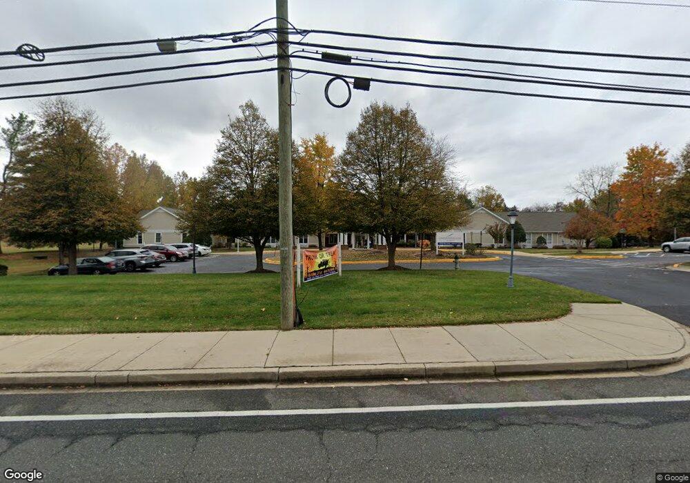
This home is located at 7600 Laurel Bowie Rd, Bowie, MD 20715 and is currently estimated at $9,047,499, approximately $330 per square foot. 7600 Laurel Bowie Rd is a home located in Prince George's County with nearby schools including Rockledge Elementary School, Samuel Ogle Middle School, and Bowie High School.
Ownership History
Date
Name
Owned For
Owner Type
Purchase Details
Closed on
Apr 1, 2003
Sold by
Snh Chs Properties Trust
Bought by
Snh Chs Properties Trust
Current Estimated Value
Purchase Details
Closed on
Nov 7, 2002
Sold by
Heartfields Retmn Comm Bowie Inc
Bought by
Snh Chs Properties Trust
Purchase Details
Closed on
Sep 4, 1998
Sold by
Barrett William C and Barrett Patricia A
Bought by
Heartfields Retmn Comm Bowie Inc
Create a Home Valuation Report for This Property
The Home Valuation Report is an in-depth analysis detailing your home's value as well as a comparison with similar homes in the area
Purchase History
| Date | Buyer | Sale Price | Title Company |
|---|---|---|---|
| Snh Chs Properties Trust | $3,610,000 | -- | |
| Snh Chs Properties Trust | $3,990,000 | -- | |
| Heartfields Retmn Comm Bowie Inc | $200,000 | -- |
Source: Public Records
Tax History
| Year | Tax Paid | Tax Assessment Tax Assessment Total Assessment is a certain percentage of the fair market value that is determined by local assessors to be the total taxable value of land and additions on the property. | Land | Improvement |
|---|---|---|---|---|
| 2025 | $135,572 | $7,884,000 | $627,600 | $7,256,400 |
| 2024 | $135,572 | $7,884,000 | $627,600 | $7,256,400 |
| 2023 | $135,058 | $7,884,000 | $627,600 | $7,256,400 |
| 2022 | $134,270 | $7,884,000 | $627,600 | $7,256,400 |
| 2021 | $128,358 | $7,517,700 | $0 | $0 |
| 2020 | $121,918 | $7,151,400 | $0 | $0 |
| 2019 | $116,050 | $6,785,100 | $627,600 | $6,157,500 |
| 2018 | $112,184 | $6,539,400 | $0 | $0 |
| 2017 | $108,550 | $6,459,900 | $0 | $0 |
| 2016 | -- | $6,048,000 | $0 | $0 |
| 2015 | $67,444 | $5,373,933 | $0 | $0 |
| 2014 | $67,444 | $4,699,867 | $0 | $0 |
Source: Public Records
Map
Nearby Homes
- 12109 Whitehall Dr
- 4005 Woodhaven Ln
- 4003 Woodrow Ln
- 13926 Pecan Ridge Way
- 13928 Pecan Ridge Way
- Monterey II - Craftsman Plan at Pecan Ridge
- Lure Plan at Pecan Ridge
- Pinehurst II Plan at Pecan Ridge
- Annapolis - Craftsman Plan at Pecan Ridge
- Colorado Plan at Pecan Ridge
- Deerfield Plan at Pecan Ridge
- Emory II - Craftsman Plan at Pecan Ridge
- 12409 Rockledge Dr
- 12415 Round Tree Ln
- 7011 Old Chapel Dr
- 13812 Pecan Ridge Way
- 13814 Pecan Ridge Way
- 8121 Triple Crown Rd
- 7709 Old Chapel Dr
- 8512 River Park Rd
- 4723 Ramsgate Ln
- 4721 Ramsgate Ln
- 4719 Ramsgate Ln
- 4725 Ramsgate Ln
- 7700 Laurel Bowie Rd
- 4717 Ramsgate Ln
- 4727 Ramsgate Ln
- 4715 Ramsgate Ln
- 4722 Ramsgate Ln
- 4720 Ramsgate Ln
- 4726 Ramsgate Ln
- 4714 Ramsgate Ln
- 12002 Rockledge Dr
- 4713 Ramsgate Ln
- 12011 Rockledge Dr
- 12004 Rockledge Dr
- 4708 Ramsgate Ln
- 12118 Wilmont Turn
- 12013 Rockledge Dr
- 4711 Ramsgate Ln