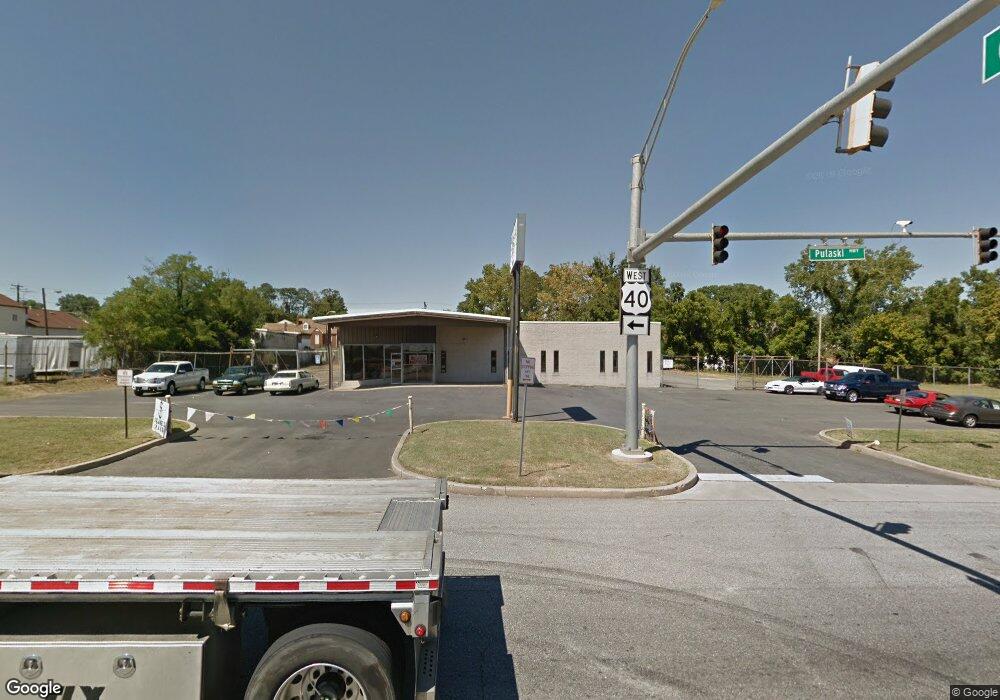
7600 Pulaski Hwy Baltimore, MD 21237
Estimated Value: $2,543,778
--
Bed
--
Bath
7,680
Sq Ft
$331/Sq Ft
Est. Value
About This Home
This home is located at 7600 Pulaski Hwy, Baltimore, MD 21237 and is currently estimated at $2,543,778, approximately $331 per square foot. 7600 Pulaski Hwy is a home located in Baltimore County with nearby schools including Elmwood Elementary School, Golden Ring Middle School, and Overlea High School.
Ownership History
Date
Name
Owned For
Owner Type
Purchase Details
Closed on
Jul 25, 2025
Sold by
Falko Real Estate Llc
Bought by
Akinyemi John A
Current Estimated Value
Purchase Details
Closed on
Aug 22, 2024
Sold by
We Two Incorporated
Bought by
Falko Real Estate Llc
Home Financials for this Owner
Home Financials are based on the most recent Mortgage that was taken out on this home.
Original Mortgage
$1,920,000
Interest Rate
6.78%
Mortgage Type
New Conventional
Purchase Details
Closed on
Oct 4, 1985
Sold by
Raimondo Corpora Tion
Bought by
We Two Incorporated
Create a Home Valuation Report for This Property
The Home Valuation Report is an in-depth analysis detailing your home's value as well as a comparison with similar homes in the area
Home Values in the Area
Average Home Value in this Area
Purchase History
| Date | Buyer | Sale Price | Title Company |
|---|---|---|---|
| Akinyemi John A | -- | Diamond Title Insurance Corpor | |
| Akinyemi John A | -- | Diamond Title Insurance Corpor | |
| Falko Real Estate Llc | $2,400 | Fidelity National Title | |
| Falko Real Estate Llc | $2,400,000 | Fidelity National Title | |
| Falko Real Estate Llc | $2,400,000 | Fidelity National Title | |
| We Two Incorporated | $390,000 | -- |
Source: Public Records
Mortgage History
| Date | Status | Borrower | Loan Amount |
|---|---|---|---|
| Previous Owner | Falko Real Estate Llc | $1,920,000 |
Source: Public Records
Tax History Compared to Growth
Tax History
| Year | Tax Paid | Tax Assessment Tax Assessment Total Assessment is a certain percentage of the fair market value that is determined by local assessors to be the total taxable value of land and additions on the property. | Land | Improvement |
|---|---|---|---|---|
| 2025 | $11,871 | $893,900 | -- | -- |
| 2024 | $11,871 | $873,200 | $0 | $0 |
| 2023 | $5,803 | $852,500 | $560,700 | $291,800 |
| 2022 | $11,420 | $845,067 | $0 | $0 |
| 2021 | $11,135 | $837,633 | $0 | $0 |
| 2020 | $11,135 | $830,200 | $560,700 | $269,500 |
| 2019 | $10,992 | $810,300 | $0 | $0 |
| 2018 | $10,662 | $790,400 | $0 | $0 |
| 2017 | $10,001 | $770,500 | $0 | $0 |
| 2016 | $9,671 | $765,400 | $0 | $0 |
| 2015 | $9,671 | $760,300 | $0 | $0 |
| 2014 | $9,671 | $755,200 | $0 | $0 |
Source: Public Records
Map
Nearby Homes
- 1303 Beatty Ave
- 2000 Longview Ct
- 7403 South Rd
- 1601 Odell Ave
- 1217 64th St
- 7932 Philadelphia Rd
- 2308 Hamiltowne Cir
- 7848 Oakdale Ave
- 2321 Bluegrass Heights Ct
- 8020 Old Philadelphia Rd
- 2354 Hamiltowne Cir
- 8003 Woodhaven Rd
- 5900 Hamilton Ave
- 8006 Woodhaven Ct
- 1535 Rosewick Ave
- 8100 Old Philadelphia Rd
- 8102 Sumter Ave
- 1015 Sumter Ave
- 8029 Duvall Ave
- 0 Sumter Ave
- 7617 Philadelphia Rd
- 7613 Philadelphia Rd
- 7623 Philadelphia Rd
- 7522 Pulaski Hwy
- 7609 Philadelphia Rd
- 7625 Philadelphia Rd
- 7614 Philadelphia Rd
- 7627 Philadelphia Rd
- 7620 Philadelphia Rd
- 7626 Philadelphia Rd
- 7610 Philadelphia Rd
- 7520A Pulaski Hwy
- 7604 Philadelphia Rd
- 7520 Pulaski Hwy
- 7520 Pulaski Hwy
- 7600 Philadelphia Rd
- 7701 Philadelphia Rd
- 7628 Philadelphia Rd
- 1609 Rosedale Heights Ave
- 7605 Pulaski Hwy