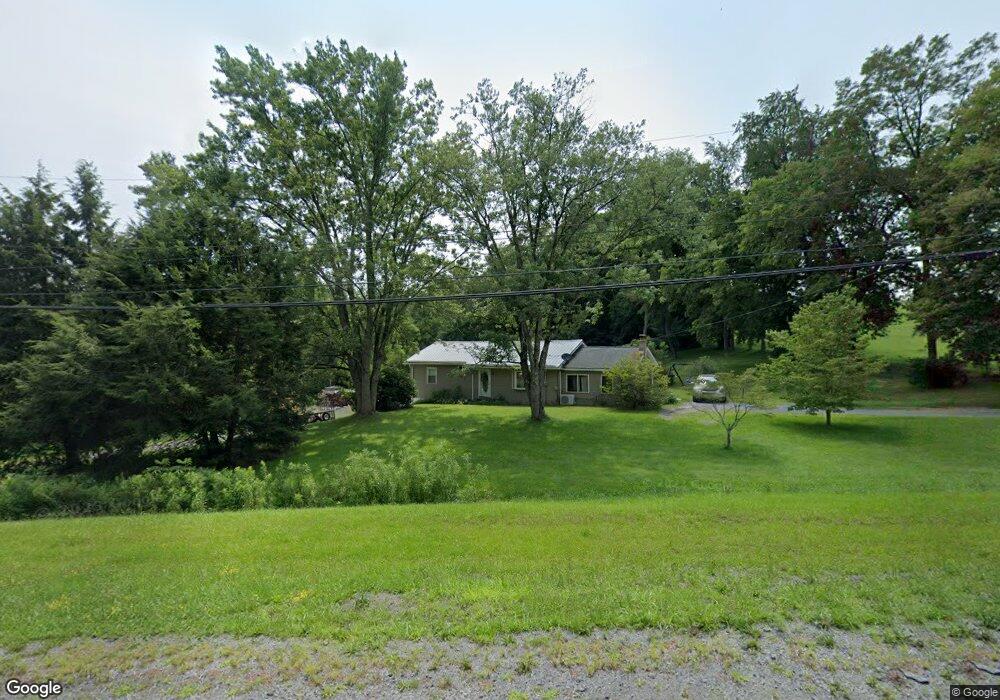
7600 State Route 44 Watsontown, PA 17777
Estimated Value: $71,575 - $225,000
--
Bed
--
Bath
--
Sq Ft
2.26
Acres
About This Home
This home is located at 7600 State Route 44, Watsontown, PA 17777 and is currently estimated at $164,394. 7600 State Route 44 is a home located in Northumberland County with nearby schools including Warrior Run High School, Watsontown Christian Academy, and Beaver Run Parochial School.
Ownership History
Date
Name
Owned For
Owner Type
Purchase Details
Closed on
Oct 26, 2007
Sold by
Deutsche Bank National Trust Co
Bought by
Burrell Shane C
Current Estimated Value
Home Financials for this Owner
Home Financials are based on the most recent Mortgage that was taken out on this home.
Original Mortgage
$77,000
Outstanding Balance
$48,693
Interest Rate
6.37%
Mortgage Type
New Conventional
Estimated Equity
$115,701
Purchase Details
Closed on
Feb 21, 2007
Sold by
Runkle Michael J and Runkle Rosemary Kathleen
Bought by
Deutsche Bank National Turst Co
Create a Home Valuation Report for This Property
The Home Valuation Report is an in-depth analysis detailing your home's value as well as a comparison with similar homes in the area
Home Values in the Area
Average Home Value in this Area
Purchase History
| Date | Buyer | Sale Price | Title Company |
|---|---|---|---|
| Burrell Shane C | $77,000 | None Available | |
| Deutsche Bank National Turst Co | $1,056 | None Available |
Source: Public Records
Mortgage History
| Date | Status | Borrower | Loan Amount |
|---|---|---|---|
| Open | Burrell Shane C | $77,000 |
Source: Public Records
Tax History Compared to Growth
Tax History
| Year | Tax Paid | Tax Assessment Tax Assessment Total Assessment is a certain percentage of the fair market value that is determined by local assessors to be the total taxable value of land and additions on the property. | Land | Improvement |
|---|---|---|---|---|
| 2025 | $2,067 | $16,800 | $2,610 | $14,190 |
| 2024 | $1,919 | $16,800 | $2,610 | $14,190 |
| 2023 | $1,919 | $16,800 | $2,610 | $14,190 |
| 2022 | $1,883 | $16,800 | $2,610 | $14,190 |
| 2021 | $1,843 | $16,800 | $2,610 | $14,190 |
| 2020 | $1,819 | $16,800 | $2,610 | $14,190 |
| 2019 | $1,756 | $16,800 | $2,610 | $14,190 |
| 2018 | $1,742 | $16,800 | $2,610 | $14,190 |
| 2017 | $1,651 | $16,800 | $2,610 | $14,190 |
| 2016 | -- | $16,800 | $2,610 | $14,190 |
| 2015 | -- | $16,800 | $2,610 | $14,190 |
| 2014 | -- | $16,800 | $2,610 | $14,190 |
Source: Public Records
Map
Nearby Homes
- 159 Grandview Dr
- 24 Pennsylvania Ave
- 444 Frederick Dr
- 215 E 8th St
- 818 Main St Unit 820
- 0 Voris Ln
- 2498 Susquehanna Trail
- 0 Susquehanna Trail
- 19 Church St
- 1595 Turbot Ave
- 28 Church St
- 0 Fornwalt Ln Unit 20-100886
- 15429 U S 15
- 221 S Hill Rd
- 0 Paradise Rd
- 1574 White Deer Pike
- 229 Harvey's Ln
- 397 N Hill Rd
- 10491 River Rd
- 1822 White Deer Pike
- 7720 State Route 44
- 7715 State Route 44
- 144 McEwensville Rd
- 120 McEwensville Rd Unit 126 McEwensville Roa
- 120 McEwensville Rd
- 125 S Main St Unit 127
- 145 McEwensville Rd
- 33 Lehman Dr
- 119 S Main St
- 38 Lehman Dr
- 110 S Main St
- 107 S Main St
- 113 S Main St
- 44 Lehman Dr
- 109 S Main St
- 108 S Main St
- 103 S Main St
- 101 S Main St
- 106 S Main St
- 56 Lehman Dr