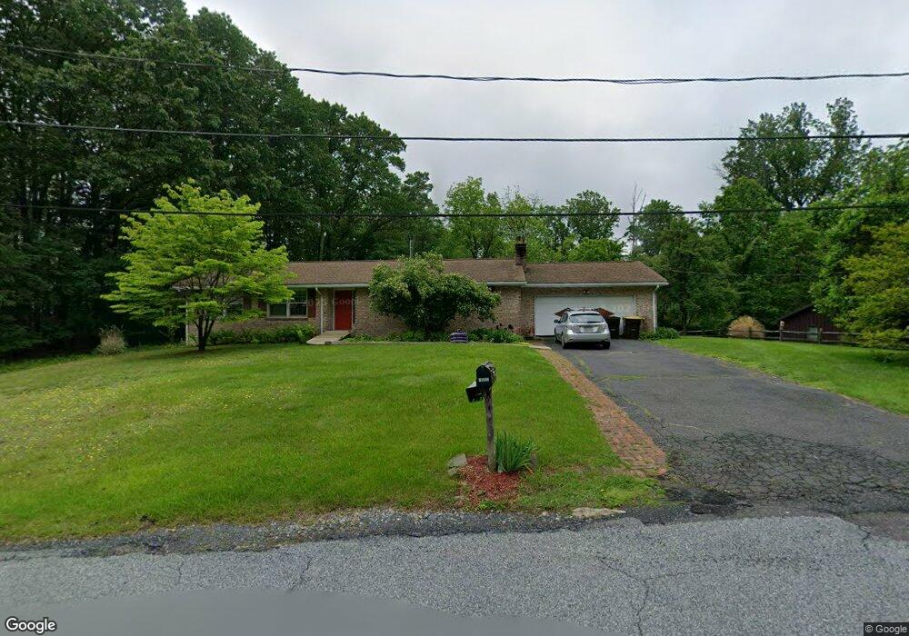
7602 Buhman Rd Zionsville, PA 18092
Lower Milford NeighborhoodEstimated Value: $348,000 - $493,000
3
Beds
2
Baths
1,422
Sq Ft
$297/Sq Ft
Est. Value
About This Home
This home is located at 7602 Buhman Rd, Zionsville, PA 18092 and is currently estimated at $421,691, approximately $296 per square foot. 7602 Buhman Rd is a home located in Lehigh County with nearby schools including Southern Lehigh High School and Chapel Mennonite School.
Ownership History
Date
Name
Owned For
Owner Type
Purchase Details
Closed on
Dec 23, 2011
Sold by
Bahman Ruth N
Bought by
Schulz Rose A
Current Estimated Value
Home Financials for this Owner
Home Financials are based on the most recent Mortgage that was taken out on this home.
Original Mortgage
$80,000
Outstanding Balance
$54,647
Interest Rate
3.98%
Mortgage Type
New Conventional
Estimated Equity
$367,044
Purchase Details
Closed on
Nov 7, 1983
Sold by
Buhman Albert L and Buhman Ruth N
Bought by
Buhman Albert L and Buhman Ruth N
Create a Home Valuation Report for This Property
The Home Valuation Report is an in-depth analysis detailing your home's value as well as a comparison with similar homes in the area
Home Values in the Area
Average Home Value in this Area
Purchase History
| Date | Buyer | Sale Price | Title Company |
|---|---|---|---|
| Schulz Rose A | $110,000 | -- | |
| Buhman Albert L | -- | -- |
Source: Public Records
Mortgage History
| Date | Status | Borrower | Loan Amount |
|---|---|---|---|
| Open | Schulz Rose A | $80,000 |
Source: Public Records
Tax History Compared to Growth
Tax History
| Year | Tax Paid | Tax Assessment Tax Assessment Total Assessment is a certain percentage of the fair market value that is determined by local assessors to be the total taxable value of land and additions on the property. | Land | Improvement |
|---|---|---|---|---|
| 2025 | $4,749 | $215,300 | $72,700 | $142,600 |
| 2024 | $4,749 | $215,300 | $72,700 | $142,600 |
| 2023 | $4,749 | $215,300 | $72,700 | $142,600 |
| 2022 | $4,678 | $215,300 | $142,600 | $72,700 |
| 2021 | $4,571 | $215,300 | $72,700 | $142,600 |
| 2020 | $4,482 | $215,300 | $72,700 | $142,600 |
| 2019 | $4,409 | $215,300 | $72,700 | $142,600 |
| 2018 | $4,409 | $215,300 | $72,700 | $142,600 |
| 2017 | $4,366 | $215,300 | $72,700 | $142,600 |
| 2016 | -- | $215,300 | $72,700 | $142,600 |
| 2015 | -- | $215,300 | $72,700 | $142,600 |
| 2014 | -- | $215,300 | $72,700 | $142,600 |
Source: Public Records
Map
Nearby Homes
- 7921 Corning Rd
- 6335 Sweetbriar Ln
- 4675 E Mill Hill Rd
- 0 Chestnut St
- 117 Concord Dr
- 62 Ashford Ln
- 328 Ashford Ln
- 5722 Kings Hwy S
- 317 Ashford Ln
- 770 Gravel Pike
- 5061 Wendi Dr W
- 1962 Tollgate Rd
- 2563 Wasser Rd
- 4835 Shimerville Rd
- 4434 Taviston Ct E
- 4338 Taviston Ct E Unit Homesite 26
- 4314 Taviston Ct E
- 8769 Spinnerstown Rd
- 5125 Maple Ridge Way
- 4290 Taviston Ct E
- 7580 Buhman Rd
- 7640 Buhman Rd
- 7538 Buhman Rd
- 7663 Buhman Rd
- 7601 Powder Valley Rd
- 5935 Palm Rd
- 7555 Buhman Rd
- 7543 Powder Valley Rd
- 5865 Palm Rd
- 7723 Powder Valley Rd Unit 7737
- 7737 Powder Valley Rd
- 5141 Palm Rd
- 7600 Powder Valley Rd
- 7479 Buhman Rd
- 7661 Carls Hill Rd
- 7461 Powder Valley Rd
- 5934 Palm Rd Unit 5942
- 7545 Buhman Rd
- 7550 Carls Hill Rd
- 5780 Palm Rd