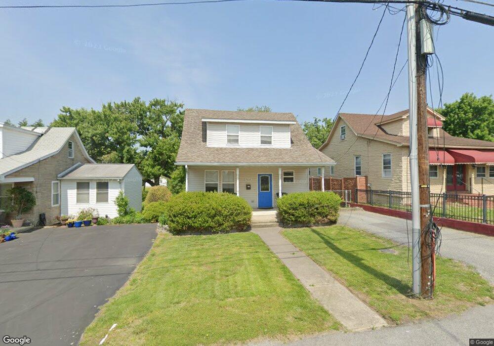
7602 Carson Ave Baltimore, MD 21224
Estimated Value: $163,000 - $293,000
3
Beds
3
Baths
1,113
Sq Ft
$219/Sq Ft
Est. Value
About This Home
This home is located at 7602 Carson Ave, Baltimore, MD 21224 and is currently estimated at $244,010, approximately $219 per square foot. 7602 Carson Ave is a home located in Baltimore County with nearby schools including Berkshire Elementary School, Holabird Middle School, and Dundalk High School.
Ownership History
Date
Name
Owned For
Owner Type
Purchase Details
Closed on
Apr 14, 2010
Sold by
Hunt Howard R
Bought by
Scala Joseph C and Bowers Katherine
Current Estimated Value
Purchase Details
Closed on
Feb 10, 2006
Sold by
Takos Gregory A
Bought by
Hunt Howard R and Hunt Jeanette F
Purchase Details
Closed on
Dec 19, 2005
Sold by
Takos Gregory A
Bought by
Hunt Howard R and Hunt Jeanette F
Purchase Details
Closed on
Jan 14, 2004
Sold by
Neuman Lisa A
Bought by
Takos Gregory A
Purchase Details
Closed on
Jul 19, 2000
Sold by
Wilt Frederick L
Bought by
Neuman Lisa A and Takos Gregory A
Create a Home Valuation Report for This Property
The Home Valuation Report is an in-depth analysis detailing your home's value as well as a comparison with similar homes in the area
Home Values in the Area
Average Home Value in this Area
Purchase History
| Date | Buyer | Sale Price | Title Company |
|---|---|---|---|
| Scala Joseph C | $244,000 | -- | |
| Hunt Howard R | $136,000 | -- | |
| Hunt Howard R | $136,000 | -- | |
| Takos Gregory A | -- | -- | |
| Neuman Lisa A | $91,500 | -- |
Source: Public Records
Tax History
| Year | Tax Paid | Tax Assessment Tax Assessment Total Assessment is a certain percentage of the fair market value that is determined by local assessors to be the total taxable value of land and additions on the property. | Land | Improvement |
|---|---|---|---|---|
| 2025 | $2,325 | $157,333 | -- | -- |
| 2024 | $2,325 | $142,667 | $0 | $0 |
| 2023 | $1,031 | $128,000 | $52,100 | $75,900 |
| 2022 | $2,033 | $126,100 | $0 | $0 |
| 2021 | $1,906 | $124,200 | $0 | $0 |
| 2020 | $1,906 | $122,300 | $52,100 | $70,200 |
| 2019 | $1,912 | $122,033 | $0 | $0 |
| 2018 | $1,911 | $121,767 | $0 | $0 |
| 2017 | $2,086 | $121,500 | $0 | $0 |
| 2016 | $1,985 | $121,500 | $0 | $0 |
| 2015 | $1,985 | $121,500 | $0 | $0 |
| 2014 | $1,985 | $127,200 | $0 | $0 |
Source: Public Records
Map
Nearby Homes
- 7627 Carson Ave
- 7506 Belmont Ave
- 619 N Point Rd
- 900 N Point Rd
- 7503 Cypress Ave
- 7412 Belmont Ave
- 7428 Poplar Ave
- 7416 Poplar Ave
- 7412 Poplar Ave
- 7503 Riddle Ave
- 7406 Poplar Ave
- 1006 Dalton Ave
- 7525 Lange St
- 8031 Bank St
- 7721 Wynbrook Rd
- 8049 Lansdale Rd
- 8013 Gough St
- 8019 Gough St
- 7820 Wynbrook Rd
- 7906 Wynbrook Rd
- 7604 Carson Ave
- 7600 Carson Ave
- 7608 Carson Ave
- 7603 Carson Ave
- 7530 Carson Ave
- 7605 Carson Ave
- 7601 Carson Ave
- 7610 Carson Ave
- 7609 Carson Ave
- 7531 Carson Ave
- 7528 Carson Ave
- 708 Southern Ave
- 7611 Carson Ave
- 7529 Carson Ave
- 7612 Carson Ave
- 7527 Carson Ave
- 7615 Carson Ave
- 7614 Carson Ave
- 7526 Carson Ave
- 7512 Belmont Ave
Your Personal Tour Guide
Ask me questions while you tour the home.