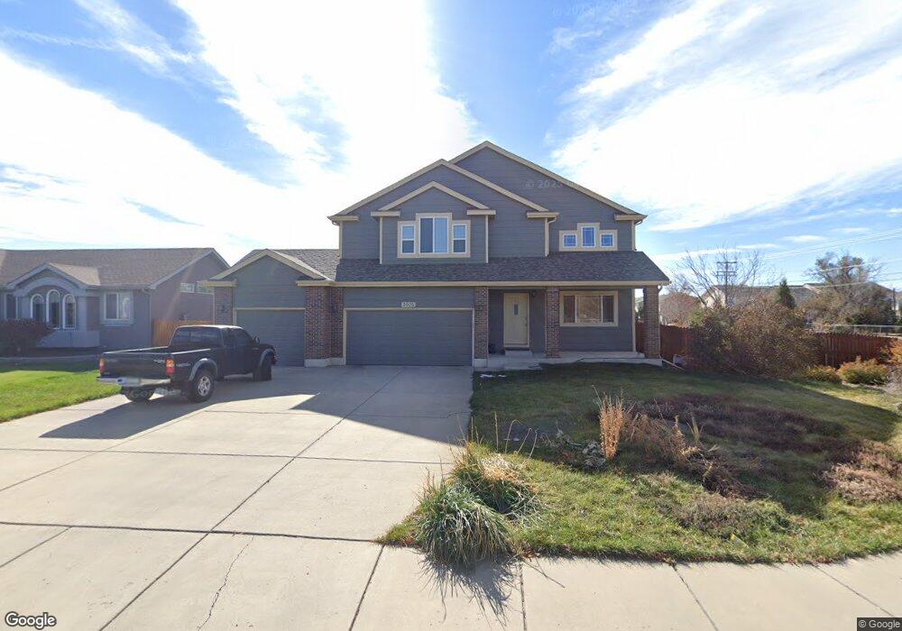
7605 High Gate Dr Fountain, CO 80817
Central Fountain Valley NeighborhoodEstimated Value: $471,754 - $561,000
4
Beds
3
Baths
2,140
Sq Ft
$242/Sq Ft
Est. Value
About This Home
This home is located at 7605 High Gate Dr, Fountain, CO 80817 and is currently estimated at $517,439, approximately $241 per square foot. 7605 High Gate Dr is a home located in El Paso County with nearby schools including Jordahl Elementary School, Fountain Middle School, and Fountain-Fort Carson High School.
Ownership History
Date
Name
Owned For
Owner Type
Purchase Details
Closed on
Mar 7, 2025
Sold by
Bailey Cynthia C and Bailey James D
Bought by
Bailey Cynthia C
Current Estimated Value
Home Financials for this Owner
Home Financials are based on the most recent Mortgage that was taken out on this home.
Original Mortgage
$233,555
Outstanding Balance
$228,724
Interest Rate
6.12%
Mortgage Type
New Conventional
Estimated Equity
$288,715
Purchase Details
Closed on
Jan 18, 2008
Sold by
Gendron Homes Inc
Bought by
Bailey James D and Bailey Cynthia C
Home Financials for this Owner
Home Financials are based on the most recent Mortgage that was taken out on this home.
Original Mortgage
$213,600
Interest Rate
6.11%
Mortgage Type
Unknown
Create a Home Valuation Report for This Property
The Home Valuation Report is an in-depth analysis detailing your home's value as well as a comparison with similar homes in the area
Home Values in the Area
Average Home Value in this Area
Purchase History
| Date | Buyer | Sale Price | Title Company |
|---|---|---|---|
| Bailey Cynthia C | -- | None Listed On Document | |
| Bailey James D | $267,000 | Stewart Title |
Source: Public Records
Mortgage History
| Date | Status | Borrower | Loan Amount |
|---|---|---|---|
| Open | Bailey Cynthia C | $233,555 | |
| Previous Owner | Bailey James D | $213,600 |
Source: Public Records
Tax History Compared to Growth
Tax History
| Year | Tax Paid | Tax Assessment Tax Assessment Total Assessment is a certain percentage of the fair market value that is determined by local assessors to be the total taxable value of land and additions on the property. | Land | Improvement |
|---|---|---|---|---|
| 2025 | $1,812 | $34,140 | -- | -- |
| 2024 | $1,641 | $33,590 | $6,570 | $27,020 |
| 2022 | $1,479 | $25,350 | $5,180 | $20,170 |
| 2021 | $1,374 | $26,080 | $5,330 | $20,750 |
| 2020 | $1,132 | $21,030 | $4,650 | $16,380 |
| 2019 | $1,110 | $21,030 | $4,650 | $16,380 |
| 2018 | $1,000 | $18,290 | $4,100 | $14,190 |
| 2017 | $988 | $18,290 | $4,100 | $14,190 |
| 2016 | $994 | $18,390 | $4,300 | $14,090 |
| 2015 | $996 | $18,390 | $4,300 | $14,090 |
| 2014 | $987 | $18,330 | $4,300 | $14,030 |
Source: Public Records
Map
Nearby Homes
- 7354 Countryside Grove
- 7355 Countryside Grove
- 10677 Traders Pkwy
- 7427 Middle Bay Way
- 119 & 121 E Ohio Ave
- 10733 Calista Way
- 10684 Calista Way
- 10594 Traders Pkwy
- 10747 Hidden Prairie Pkwy
- 10797 Hidden Prairie Pkwy
- 10807 Hidden Prairie Pkwy
- 7770 Del Ray Bay St
- 10994 Tidal Run Cir
- 11081 Buckhead Place
- 505 E Missouri Ave
- 508 E Ohio Ave
- 10898 Hidden Prairie Pkwy
- 11426 Melden Way
- 7338 Benecia Dr
- 7347 Benecia Dr
- 7633 High Gate Dr
- 10382 Buck Rake Ct
- 7647 High Gate Dr
- 7211 Country Side Grove
- 7215 Country Side Grove
- 10366 Buck Rake Ct
- 7219 Country Side Grove
- 7219 Countryside Grove
- 7223 Country Side Grove
- 10367 Buck Rake Ct
- 7227 Country Side Grove
- 10515 Jimmy Camp Rd Unit 10525
- 7675 High Gate Dr
- 7646 High Gate Dr
- 10503 Country Park Point
- 10350 Buck Rake Ct
- 10507 Country Park Point
- 7231 Country Side Grove
- 10507 Country Park
- 7231 Countryside Grove