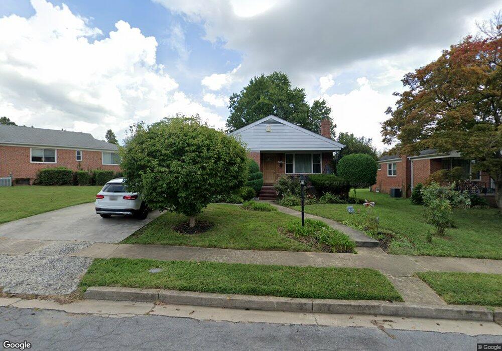
7605 Lorry Ln Pikesville, MD 21208
Estimated Value: $419,000 - $602,000
3
Beds
5
Baths
1,952
Sq Ft
$266/Sq Ft
Est. Value
About This Home
This home is located at 7605 Lorry Ln, Pikesville, MD 21208 and is currently estimated at $519,707, approximately $266 per square foot. 7605 Lorry Ln is a home located in Baltimore County with nearby schools including Wellwood International Elementary, Pikesville Middle School, and Pikesville High School.
Ownership History
Date
Name
Owned For
Owner Type
Purchase Details
Closed on
Oct 9, 2024
Sold by
Laskey Linda M and Keller Susan M
Bought by
Jmp-Blp Llc
Current Estimated Value
Purchase Details
Closed on
Aug 12, 2011
Sold by
Byalaya Yuliya and Magnis Alexander
Bought by
Byalaya Yuliya
Purchase Details
Closed on
Aug 27, 2004
Sold by
Borukhov Leonid
Bought by
Byalaya Yuliya and Magnis Alexander
Purchase Details
Closed on
Aug 30, 1996
Sold by
Goldman Edmund W
Bought by
Borupkov Leonid and Vishnevskaya Natalya
Create a Home Valuation Report for This Property
The Home Valuation Report is an in-depth analysis detailing your home's value as well as a comparison with similar homes in the area
Home Values in the Area
Average Home Value in this Area
Purchase History
| Date | Buyer | Sale Price | Title Company |
|---|---|---|---|
| Jmp-Blp Llc | -- | None Listed On Document | |
| Jmp-Blp Llc | -- | None Listed On Document | |
| Byalaya Yuliya | -- | Granite Title Associates Inc | |
| Byalaya Yuliya | $272,000 | -- | |
| Byalaya Yuliya | $272,000 | -- | |
| Borupkov Leonid | $118,000 | -- |
Source: Public Records
Tax History
| Year | Tax Paid | Tax Assessment Tax Assessment Total Assessment is a certain percentage of the fair market value that is determined by local assessors to be the total taxable value of land and additions on the property. | Land | Improvement |
|---|---|---|---|---|
| 2025 | $5,059 | $379,200 | $83,100 | $296,100 |
| 2024 | $5,059 | $356,333 | $0 | $0 |
| 2023 | $2,433 | $333,467 | $0 | $0 |
| 2022 | $4,484 | $310,600 | $83,100 | $227,500 |
| 2021 | $4,403 | $298,733 | $0 | $0 |
| 2020 | $4,403 | $286,867 | $0 | $0 |
| 2019 | $3,894 | $275,000 | $83,100 | $191,900 |
| 2018 | $3,802 | $262,400 | $0 | $0 |
| 2017 | $3,539 | $249,800 | $0 | $0 |
| 2016 | $2,935 | $237,200 | $0 | $0 |
| 2015 | $2,935 | $237,200 | $0 | $0 |
| 2014 | $2,935 | $237,200 | $0 | $0 |
Source: Public Records
Map
Nearby Homes
- 7617 Seven Mile Ln
- 3306 Greenvale Rd
- 7618 Carla Rd
- 3215 Northbrook Rd
- 3102 Hatton Rd
- 3312 Bonnie Rd
- 7420 Park Heights Ave
- 3309 Olympia Ave
- 7240 Park Heights Ave Unit 209
- 1 Slade Ave Unit 304
- 1 Slade Ave Unit 203
- 3204 Timberfield Ln
- 7111 Park Heights Ave Unit 104
- 7111 Park Heights Ave Unit 305
- 7111 Park Heights Ave Unit 709
- 7111 Park Heights Ave Unit 812
- 3207 Midfield Rd
- 7121 Park Heights Ave Unit 210
- 7121 Park Heights Ave Unit 707
- 7121 Park Heights Ave Unit 603
Your Personal Tour Guide
Ask me questions while you tour the home.