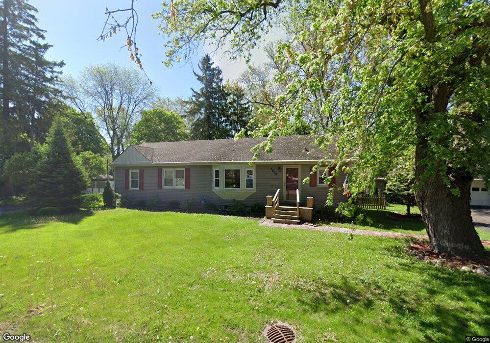
7606 West Rd Washington, MI 48094
Estimated Value: $224,174 - $315,000
Studio
--
Bath
1,166
Sq Ft
$231/Sq Ft
Est. Value
About This Home
This home is located at 7606 West Rd, Washington, MI 48094 and is currently estimated at $269,044, approximately $230 per square foot. 7606 West Rd is a home located in Macomb County with nearby schools including Cross Of Glory Lutheran School.
Ownership History
Date
Name
Owned For
Owner Type
Purchase Details
Closed on
Jul 10, 2025
Sold by
Monte John D and Monte Tracey J
Bought by
Monte John D and Monte Tracey J
Current Estimated Value
Purchase Details
Closed on
Feb 6, 2004
Sold by
Monte Tracey J and Campagna Tracey J
Bought by
Monte John D and Monte Tracey J
Home Financials for this Owner
Home Financials are based on the most recent Mortgage that was taken out on this home.
Original Mortgage
$50,000
Interest Rate
5.71%
Mortgage Type
New Conventional
Create a Home Valuation Report for This Property
The Home Valuation Report is an in-depth analysis detailing your home's value as well as a comparison with similar homes in the area
Home Values in the Area
Average Home Value in this Area
Purchase History
| Date | Buyer | Sale Price | Title Company |
|---|---|---|---|
| Monte John D | -- | None Listed On Document | |
| Monte John D | -- | None Listed On Document | |
| Monte John D | -- | Investors Title Ins Corp |
Source: Public Records
Mortgage History
| Date | Status | Borrower | Loan Amount |
|---|---|---|---|
| Previous Owner | Monte John D | $50,000 |
Source: Public Records
Tax History
| Year | Tax Paid | Tax Assessment Tax Assessment Total Assessment is a certain percentage of the fair market value that is determined by local assessors to be the total taxable value of land and additions on the property. | Land | Improvement |
|---|---|---|---|---|
| 2025 | $1,335 | $118,600 | $0 | $0 |
| 2024 | $13 | $111,300 | $0 | $0 |
| 2023 | $1,229 | $104,800 | $0 | $0 |
| 2022 | $1,708 | $95,400 | $0 | $0 |
| 2021 | $1,670 | $91,400 | $0 | $0 |
| 2020 | $1,138 | $87,900 | $0 | $0 |
| 2019 | $1,533 | $76,300 | $0 | $0 |
| 2018 | $1,457 | $76,100 | $0 | $0 |
| 2017 | $1,449 | $73,300 | $33,000 | $40,300 |
| 2016 | $1,451 | $73,300 | $0 | $0 |
| 2015 | -- | $58,000 | $0 | $0 |
| 2013 | $1,520 | $51,700 | $18,000 | $33,700 |
| 2012 | $1,520 | $45,800 | $0 | $0 |
Source: Public Records
Map
Nearby Homes
- 7340 Smale St
- 58106 Delmar
- 00 Wicker
- 000 Wicker
- 7427 Emerson
- 58019 Van Dyke Rd
- 7380 Emerson
- 0 Cathey Unit Lot 4
- 0 Cathey Unit Lot 5
- 59601 Van Dyke Rd
- 57714 Abraham Dr
- 57136 Megan Dr
- 58843 Gallery Ct Unit 28
- 57911 Lancaster Rd
- 8767 Grove St
- 8743 Grove St
- 59779 Glacier Spring Dr S
- 57289 Yorkshire Dr
- 59438 Holly Ct Unit 62
- 29 Mile
Your Personal Tour Guide
Ask me questions while you tour the home.