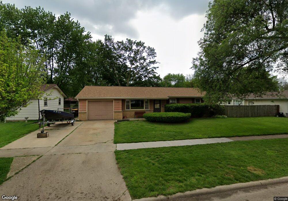
7608 Suffield Rd Loves Park, IL 61111
Estimated Value: $186,000 - $205,000
3
Beds
1
Bath
1,383
Sq Ft
$143/Sq Ft
Est. Value
About This Home
This home is located at 7608 Suffield Rd, Loves Park, IL 61111 and is currently estimated at $197,083, approximately $142 per square foot. 7608 Suffield Rd is a home located in Winnebago County with nearby schools including Rock Cut Elementary School, Harlem Middle School, and Harlem High School.
Ownership History
Date
Name
Owned For
Owner Type
Purchase Details
Closed on
Oct 20, 2015
Sold by
Gunderson Mark A and Gunderson Sheila D
Bought by
Gilligan Floyd Robert
Current Estimated Value
Home Financials for this Owner
Home Financials are based on the most recent Mortgage that was taken out on this home.
Original Mortgage
$81,600
Outstanding Balance
$61,557
Interest Rate
4%
Mortgage Type
New Conventional
Estimated Equity
$135,526
Purchase Details
Closed on
Jun 30, 1995
Bought by
Gilligan Floyd Robert
Create a Home Valuation Report for This Property
The Home Valuation Report is an in-depth analysis detailing your home's value as well as a comparison with similar homes in the area
Home Values in the Area
Average Home Value in this Area
Purchase History
| Date | Buyer | Sale Price | Title Company |
|---|---|---|---|
| Gilligan Floyd Robert | $78,000 | -- | |
| Gilligan Floyd Robert | $78,000 | -- |
Source: Public Records
Mortgage History
| Date | Status | Borrower | Loan Amount |
|---|---|---|---|
| Open | Gilligan Floyd Robert | $81,600 | |
| Closed | Gilligan Floyd Robert | $80,500 |
Source: Public Records
Tax History
| Year | Tax Paid | Tax Assessment Tax Assessment Total Assessment is a certain percentage of the fair market value that is determined by local assessors to be the total taxable value of land and additions on the property. | Land | Improvement |
|---|---|---|---|---|
| 2024 | $3,500 | $53,321 | $4,874 | $48,447 |
| 2023 | $3,258 | $47,355 | $4,329 | $43,026 |
| 2022 | $3,138 | $43,191 | $3,948 | $39,243 |
| 2021 | $3,413 | $40,170 | $3,672 | $36,498 |
| 2020 | $3,134 | $38,265 | $3,498 | $34,767 |
| 2019 | $3,206 | $36,653 | $3,351 | $33,302 |
| 2018 | $3,303 | $35,451 | $3,241 | $32,210 |
| 2017 | $3,273 | $33,756 | $3,152 | $30,604 |
| 2016 | $3,221 | $33,084 | $3,089 | $29,995 |
| 2015 | $3,191 | $32,505 | $3,035 | $29,470 |
| 2014 | $2,305 | $32,505 | $3,035 | $29,470 |
Source: Public Records
Map
Nearby Homes
- 7502 Buffalo Grove Rd
- 5101 Pebble Ln
- 5014 Rockberry Rd
- 5132 Pebble Ln
- 5141 Pebble Ln
- 5228 Marble Dr
- 0000 N Alpine Rd
- 1914 Plateau Ave
- 5331 Quartz Dr
- 7270 N Alpine Rd
- 8405 Centaur Dr
- 2107 Rivington Lot 39 Rd
- 5261 Bunker Hill Ct
- 5683 Rockport Rd
- 5128 Morning Glory Ln Unit 32
- 8420 Bobolink Dr
- 5785 Jackies Dr
- 5616 Jackies Dr
- 5788 Jackies Dr
- 1534 Roosevelt Rd
- 7604 Suffield Rd
- 2305 Devon Ave
- 7613 Eastmont Ave
- 7617 Eastmont Ave
- 7600 Suffield Rd
- 7609 Eastmont Ave
- 7609 Suffield Rd
- 7605 Suffield Rd
- 2313 Devon Ave
- 7605 Eastmont Ave
- 7520 Suffield Rd
- 7601 Suffield Rd
- 2304 Devon Ave
- 7701 Eastmont Ave
- 7513 Suffield Rd
- 7601 Eastmont Ave
- 7516 Suffield Rd
- 2319 Devon Ct
- 2212 Maple Ave
- 7705 Eastmont Ave
Your Personal Tour Guide
Ask me questions while you tour the home.