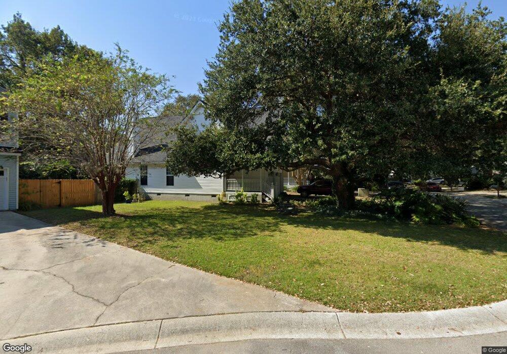
761 Shell Sand Cir Charleston, SC 29412
James Island NeighborhoodEstimated Value: $661,676 - $751,000
3
Beds
3
Baths
1,832
Sq Ft
$385/Sq Ft
Est. Value
About This Home
This home is located at 761 Shell Sand Cir, Charleston, SC 29412 and is currently estimated at $705,169, approximately $384 per square foot. 761 Shell Sand Cir is a home located in Charleston County with nearby schools including Harbor View Elementary School, Camp Road Middle, and Charleston Development Academy.
Ownership History
Date
Name
Owned For
Owner Type
Purchase Details
Closed on
Jun 18, 2008
Sold by
Minger Melissa F and Minger John W
Bought by
Chihocky John D and Chihocky Cathy A
Current Estimated Value
Home Financials for this Owner
Home Financials are based on the most recent Mortgage that was taken out on this home.
Original Mortgage
$195,000
Outstanding Balance
$125,067
Interest Rate
6.04%
Mortgage Type
Purchase Money Mortgage
Estimated Equity
$580,102
Purchase Details
Closed on
Apr 23, 2003
Sold by
Delatte Stephen James and Delatte Gwendolyn G
Bought by
Minger Melissa F and Minger John W
Create a Home Valuation Report for This Property
The Home Valuation Report is an in-depth analysis detailing your home's value as well as a comparison with similar homes in the area
Home Values in the Area
Average Home Value in this Area
Purchase History
| Date | Buyer | Sale Price | Title Company |
|---|---|---|---|
| Chihocky John D | $275,000 | -- | |
| Minger Melissa F | $211,000 | -- |
Source: Public Records
Mortgage History
| Date | Status | Borrower | Loan Amount |
|---|---|---|---|
| Open | Chihocky John D | $195,000 |
Source: Public Records
Tax History Compared to Growth
Tax History
| Year | Tax Paid | Tax Assessment Tax Assessment Total Assessment is a certain percentage of the fair market value that is determined by local assessors to be the total taxable value of land and additions on the property. | Land | Improvement |
|---|---|---|---|---|
| 2024 | $1,670 | $12,320 | $0 | $0 |
| 2023 | $1,670 | $12,320 | $0 | $0 |
| 2022 | $1,542 | $12,320 | $0 | $0 |
| 2021 | $1,616 | $12,320 | $0 | $0 |
| 2020 | $1,675 | $12,320 | $0 | $0 |
| 2019 | $1,493 | $10,710 | $0 | $0 |
| 2017 | $1,442 | $10,710 | $0 | $0 |
| 2016 | $1,383 | $10,710 | $0 | $0 |
| 2015 | $1,429 | $10,710 | $0 | $0 |
| 2014 | $1,248 | $0 | $0 | $0 |
| 2011 | -- | $0 | $0 | $0 |
Source: Public Records
Map
Nearby Homes
- 793 Shell Sand Rd
- 825 Shutes Folly Dr
- 777 Lake Frances Dr
- 525 Yellow Tower Terrace
- 975 Harbor View Rd
- 969 Harbor View Rd
- 1077 Harbor View Rd
- 816 Porcari St
- 881 Kushiwah Creek Dr
- 804 Porcari St
- 1110 Darwin St
- 1026 Fort Sumter Dr
- 3009 Allison Cove Dr
- 924 White Point Blvd
- 897 Kushiwah Creek Ct
- 1129 Quail Dr
- 965 Mooring Dr
- 620 N Shore Dr
- 1149 Quail Dr
- 643 N Shore Dr
- 757 Shell Sand Cir
- 765 Shell Sand Cir
- 765 Shell Sand Rd
- 762 Shell Sand Cir
- 758 Shell Sand Cir
- 766 Shell Sand Cir
- 762 Shell Sand Rd
- 773 Shell Sand Cir
- 754 Shell Sand Cir
- 743 Shell Sand Cir
- 747 Shell Sand Cir
- 749 Shell Sand Cir
- 1012 Harbor Oaks Dr
- 770 Shell Sand Cir
- 766 Shell Sand Rd
- 1010 Harbor Oaks Dr
- 1008 Harbor Oaks Dr
- 783 Shell Sand Cir
- 1006 Harbor Oaks Dr
- 1006 Harbor Oaks Dr Unit 4