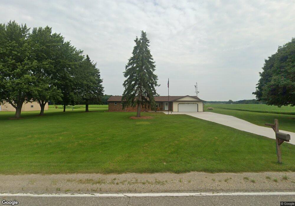
7610 Barnes Rd Millington, MI 48746
Estimated Value: $261,531 - $336,000
3
Beds
2
Baths
1,526
Sq Ft
$193/Sq Ft
Est. Value
About This Home
This home is located at 7610 Barnes Rd, Millington, MI 48746 and is currently estimated at $293,883, approximately $192 per square foot. 7610 Barnes Rd is a home with nearby schools including Meachum Elementary, Millington Junior High School, and Millington High School.
Ownership History
Date
Name
Owned For
Owner Type
Purchase Details
Closed on
Jul 29, 2025
Sold by
Platt Jeffrey A
Bought by
Platt Jeffrey A and Jeffrey A Platt Revocable Living Trust
Current Estimated Value
Purchase Details
Closed on
Jul 11, 2023
Sold by
Platt Jeffrey A
Bought by
Platt Jeffrey A
Purchase Details
Closed on
Jul 19, 2012
Sold by
Platt Kenneth A and Platt Dorothy V
Bought by
Platt Jeffrey A and Platt Kirsten C
Home Financials for this Owner
Home Financials are based on the most recent Mortgage that was taken out on this home.
Original Mortgage
$50,000
Interest Rate
3.6%
Mortgage Type
New Conventional
Create a Home Valuation Report for This Property
The Home Valuation Report is an in-depth analysis detailing your home's value as well as a comparison with similar homes in the area
Home Values in the Area
Average Home Value in this Area
Purchase History
| Date | Buyer | Sale Price | Title Company |
|---|---|---|---|
| Platt Jeffrey A | -- | None Listed On Document | |
| Platt Jeffrey A | -- | None Listed On Document | |
| Platt Jeffrey A | -- | None Listed On Document | |
| Platt Jeffrey A | -- | First American Title Insuran |
Source: Public Records
Mortgage History
| Date | Status | Borrower | Loan Amount |
|---|---|---|---|
| Previous Owner | Platt Jeffrey A | $50,000 |
Source: Public Records
Tax History Compared to Growth
Tax History
| Year | Tax Paid | Tax Assessment Tax Assessment Total Assessment is a certain percentage of the fair market value that is determined by local assessors to be the total taxable value of land and additions on the property. | Land | Improvement |
|---|---|---|---|---|
| 2025 | $596 | $138,400 | $0 | $0 |
| 2024 | $596 | $131,700 | $0 | $0 |
| 2023 | $1,874 | $121,500 | $0 | $0 |
| 2022 | $1,783 | $107,400 | $0 | $0 |
| 2021 | $524 | $95,300 | $0 | $0 |
| 2020 | $1,712 | $85,300 | $0 | $0 |
| 2019 | $1,627 | $78,900 | $0 | $0 |
| 2018 | $1,440 | $75,100 | $0 | $0 |
| 2017 | $1,036 | $76,000 | $0 | $0 |
| 2016 | $1,004 | $70,600 | $0 | $0 |
| 2015 | $9 | $68,100 | $0 | $0 |
| 2014 | $9 | $49,400 | $0 | $0 |
| 2013 | -- | $46,800 | $0 | $0 |
Source: Public Records
Map
Nearby Homes
- 6294 Millington Rd
- 8260 Birch Run Rd
- 6014 Birch Run Rd
- 9654 Birch Run Rd
- 0000 Birch Run Rd
- VL 0320 Birch Run Rd
- 8833 Brewer Rd
- 5625 Birch Run Rd
- 8879 Fulmer Rd
- 10147 S Bray Rd
- 5035 Millington Rd
- VL Fulmer Rd
- V/L Murphy Lake Rd
- 00 E Willard Rd
- 7066 Buell Rd
- 5145 Arbela Rd
- 7440 Irish Rd
- 7464 Irish Rd
- 6129 Lake Rd
- 8515 Blocher St
- 7620 Barnes Rd
- 7569 Barnes Rd
- 7751 Barnes Rd
- 7525 Barnes Rd
- 9024 Belsay Rd
- 9060 Belsay Rd
- 7625 Barnes Rd
- 7625 Barnes Rd
- 9027 Belsay Rd
- 8997 Belsay Rd
- 8974 N Belsay Rd
- 9051 Belsay Rd
- 9092 Belsay Rd
- 8965 N Belsay Rd
- 9096 Belsay Rd
- 6456 Barnes Rd
- 8945 Belsay Rd
- 9099 Belsay Rd
- 6410 Barnes Rd
- 6450 Barnes Rd