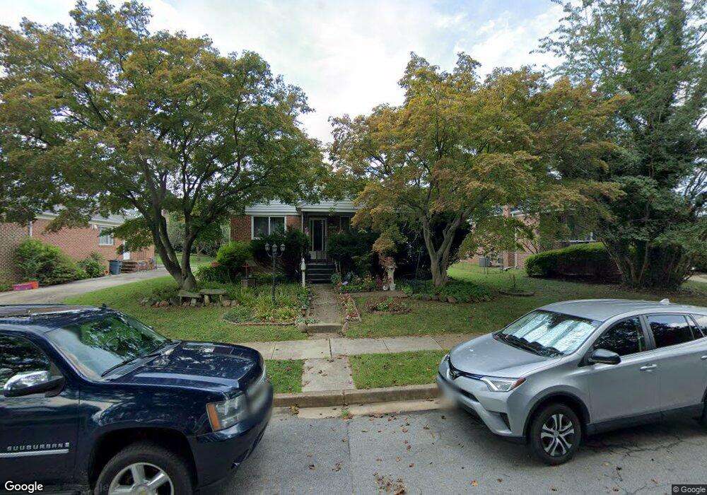
7612 Lorry Ln Pikesville, MD 21208
Estimated Value: $434,000 - $460,000
--
Bed
1
Bath
1,260
Sq Ft
$355/Sq Ft
Est. Value
About This Home
This home is located at 7612 Lorry Ln, Pikesville, MD 21208 and is currently estimated at $446,674, approximately $354 per square foot. 7612 Lorry Ln is a home located in Baltimore County with nearby schools including Wellwood International Elementary, Pikesville Middle School, and Pikesville High School.
Ownership History
Date
Name
Owned For
Owner Type
Purchase Details
Closed on
Jan 22, 2020
Sold by
Mandish Michael and Estate Of Ethel S Scholle
Bought by
Highsmith Brenda
Current Estimated Value
Purchase Details
Closed on
Feb 7, 2013
Sold by
Scholle Ethel S
Bought by
Scholle Ethel S
Purchase Details
Closed on
Nov 2, 2005
Sold by
Scholle Ethel S
Bought by
Scholle Ethel S
Purchase Details
Closed on
Aug 3, 2005
Sold by
Shirakoon Mehrzad
Bought by
Scholle Ethel S
Purchase Details
Closed on
Dec 28, 2004
Sold by
Schuster Moe
Bought by
Shirakoon Mehrzad
Create a Home Valuation Report for This Property
The Home Valuation Report is an in-depth analysis detailing your home's value as well as a comparison with similar homes in the area
Home Values in the Area
Average Home Value in this Area
Purchase History
| Date | Buyer | Sale Price | Title Company |
|---|---|---|---|
| Highsmith Brenda | -- | None Available | |
| Scholle Ethel S | -- | None Available | |
| Scholle Ethel S | -- | -- | |
| Scholle Ethel S | $293,000 | -- | |
| Shirakoon Mehrzad | $215,000 | -- | |
| Shirakoon Mehrzad | $215,000 | -- |
Source: Public Records
Tax History Compared to Growth
Tax History
| Year | Tax Paid | Tax Assessment Tax Assessment Total Assessment is a certain percentage of the fair market value that is determined by local assessors to be the total taxable value of land and additions on the property. | Land | Improvement |
|---|---|---|---|---|
| 2025 | $3,896 | $309,900 | $81,400 | $228,500 |
| 2024 | $3,896 | $292,100 | $0 | $0 |
| 2023 | $1,947 | $274,300 | $0 | $0 |
| 2022 | $3,727 | $256,500 | $81,400 | $175,100 |
| 2021 | $3,628 | $244,233 | $0 | $0 |
| 2020 | $3,500 | $231,967 | $0 | $0 |
| 2019 | $2,663 | $219,700 | $81,400 | $138,300 |
| 2018 | $3,134 | $216,467 | $0 | $0 |
| 2017 | $3,025 | $213,233 | $0 | $0 |
| 2016 | $2,911 | $210,000 | $0 | $0 |
| 2015 | $2,911 | $210,000 | $0 | $0 |
| 2014 | $2,911 | $210,000 | $0 | $0 |
Source: Public Records
Map
Nearby Homes
- 7612 Carla Rd
- 7618 Carla Rd
- 3302 Northbrook Rd
- 3211 Hatton Rd
- 3213 Hatton Rd
- 3221 Shelburne Rd
- 3312 Bonnie Rd
- 7420 Park Heights Ave
- 3313 Claran Rd
- 7380 Park Heights Ave
- 3207 Midfield Rd
- 7035 Wallis Ave
- 7240 Park Heights Ave Unit 209
- 7240 Park Heights Ave Unit 105
- 7111 Park Heights Ave Unit 103
- 7111 Park Heights Ave Unit 305
- 2906 Oakton Ct
- 7814 Ridge Terrace
- 7121 Park Heights Ave Unit 206
- 7121 Park Heights Ave Unit 210
- 7610 Lorry Ln
- 7608 Lorry Ln
- 7619 Seven Mile Ln
- 3318 Lee Ct
- 3312 Smith Ave
- 3312 Smith Ave Unit A
- 3312 Smith Ave Unit B
- 3312 Smith Ave
- 7606 Lorry Ln
- 3312B Smith Ave
- 3316 Lee Ct
- 7607 Lorry Ln
- 7604 Lorry Ln
- 3314 Lee Ct
- 7611 Seven Mile Ln
- 3315 Lee Ct
- 7602 Lorry Ln
- 7605 Lorry Ln
- 3312 Lee Ct
- 7615 Seven Mile Ln