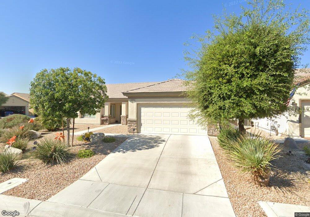
7613 Island Rail Dr North Las Vegas, NV 89084
Aliante NeighborhoodEstimated Value: $424,877 - $458,000
2
Beds
2
Baths
1,908
Sq Ft
$232/Sq Ft
Est. Value
About This Home
This home is located at 7613 Island Rail Dr, North Las Vegas, NV 89084 and is currently estimated at $441,719, approximately $231 per square foot. 7613 Island Rail Dr is a home located in Clark County with nearby schools including Vincent L. Triggs Elementary School, Anthony Saville Middle School, and Shadow Ridge High School.
Ownership History
Date
Name
Owned For
Owner Type
Purchase Details
Closed on
Jan 9, 2008
Sold by
Tobor Judy
Bought by
Tobor Judy and Judy Tabor Living Trust
Current Estimated Value
Purchase Details
Closed on
Feb 14, 2005
Sold by
Pn Ii Inc
Bought by
Tobor Judy
Home Financials for this Owner
Home Financials are based on the most recent Mortgage that was taken out on this home.
Original Mortgage
$333,847
Outstanding Balance
$170,136
Interest Rate
5.79%
Mortgage Type
Unknown
Estimated Equity
$271,583
Create a Home Valuation Report for This Property
The Home Valuation Report is an in-depth analysis detailing your home's value as well as a comparison with similar homes in the area
Home Values in the Area
Average Home Value in this Area
Purchase History
| Date | Buyer | Sale Price | Title Company |
|---|---|---|---|
| Tobor Judy | -- | None Available | |
| Tobor Judy | $374,442 | Lawyers Title Of Nevada |
Source: Public Records
Mortgage History
| Date | Status | Borrower | Loan Amount |
|---|---|---|---|
| Open | Tobor Judy | $333,847 |
Source: Public Records
Tax History Compared to Growth
Tax History
| Year | Tax Paid | Tax Assessment Tax Assessment Total Assessment is a certain percentage of the fair market value that is determined by local assessors to be the total taxable value of land and additions on the property. | Land | Improvement |
|---|---|---|---|---|
| 2025 | $2,503 | $111,175 | $31,238 | $79,937 |
| 2024 | $2,431 | $111,175 | $31,238 | $79,937 |
| 2023 | $1,957 | $110,031 | $34,545 | $75,486 |
| 2022 | $2,360 | $97,954 | $29,033 | $68,921 |
| 2021 | $2,291 | $92,602 | $27,195 | $65,407 |
| 2020 | $2,218 | $90,758 | $26,093 | $64,665 |
| 2019 | $2,191 | $89,285 | $25,725 | $63,560 |
| 2018 | $2,091 | $82,968 | $22,050 | $60,918 |
| 2017 | $2,816 | $83,097 | $22,400 | $60,697 |
| 2016 | $1,957 | $77,789 | $16,975 | $60,814 |
| 2015 | $1,953 | $63,413 | $14,280 | $49,133 |
| 2014 | $1,896 | $54,020 | $11,200 | $42,820 |
Source: Public Records
Map
Nearby Homes
- 7617 Fieldfare Dr
- 3109 Frigate Way
- 7741 Fruit Dove St Unit 4
- 3220 Flinthead Dr
- 7804 Island Rail Dr
- 7649 Broadwing Dr
- 7469 Crested Quail St
- 3305 Flyway Ct
- 7713 Songster St
- 3312 Lapwing Dr
- 2822 Horned Owl Way
- 2508 Mourning Warbler Ave
- 7905 Grey Teal St
- 7921 Fantail Dr
- 7633 Lily Trotter St
- 7713 Lily Trotter St
- 3405 Kingbird Dr
- 7453 Widewing Dr
- 7757 Coast Jay St
- 7465 Widewing Dr
- 7617 Island Rail Dr
- 3117 Frigate Way
- 3117 Frigate Way Unit n/a
- 3113 Frigate Way
- 7621 Island Rail Dr
- 7621 Island Rail Dr Unit n/a
- 3121 Frigate Way
- 7612 Island Rail Dr
- 7616 Island Rail Dr
- 3125 Frigate Way
- 3105 Frigate Way
- 3105 Frigate Way Unit n/a
- 3129 Frigate Way
- 3033 Frigate Way
- 7620 Island Rail Dr
- 7625 Island Rail Dr
- 7625 Island Rail Dr Unit n/a
- 3029 Frigate Way
- 7624 Island Rail Dr
- 7613 Fieldfare Dr