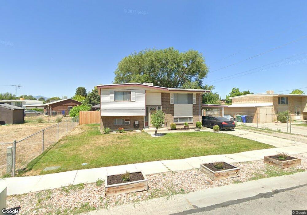
7616 Uranium Dr West Jordan, UT 84084
Estimated Value: $440,000 - $505,000
5
Beds
2
Baths
1,826
Sq Ft
$252/Sq Ft
Est. Value
About This Home
This home is located at 7616 Uranium Dr, West Jordan, UT 84084 and is currently estimated at $459,694, approximately $251 per square foot. 7616 Uranium Dr is a home located in Salt Lake County with nearby schools including Majestic Elementary Arts Academy, West Jordan Middle School, and West Jordan High School.
Ownership History
Date
Name
Owned For
Owner Type
Purchase Details
Closed on
Oct 19, 2000
Sold by
Lee Sandy A
Bought by
West Adam J and Romero Brandy N
Current Estimated Value
Home Financials for this Owner
Home Financials are based on the most recent Mortgage that was taken out on this home.
Original Mortgage
$126,155
Outstanding Balance
$46,139
Interest Rate
7.96%
Mortgage Type
FHA
Estimated Equity
$413,555
Create a Home Valuation Report for This Property
The Home Valuation Report is an in-depth analysis detailing your home's value as well as a comparison with similar homes in the area
Home Values in the Area
Average Home Value in this Area
Purchase History
| Date | Buyer | Sale Price | Title Company |
|---|---|---|---|
| West Adam J | -- | Superior Title |
Source: Public Records
Mortgage History
| Date | Status | Borrower | Loan Amount |
|---|---|---|---|
| Open | West Adam J | $126,155 |
Source: Public Records
Tax History Compared to Growth
Tax History
| Year | Tax Paid | Tax Assessment Tax Assessment Total Assessment is a certain percentage of the fair market value that is determined by local assessors to be the total taxable value of land and additions on the property. | Land | Improvement |
|---|---|---|---|---|
| 2025 | $1,880 | $390,800 | $127,200 | $263,600 |
| 2024 | $1,880 | $361,800 | $117,100 | $244,700 |
| 2023 | $1,883 | $341,400 | $112,600 | $228,800 |
| 2022 | $1,966 | $350,800 | $110,400 | $240,400 |
| 2021 | $1,731 | $281,100 | $84,800 | $196,300 |
| 2020 | $1,625 | $247,700 | $73,300 | $174,400 |
| 2019 | $1,471 | $219,800 | $73,300 | $146,500 |
| 2018 | $1,336 | $198,100 | $70,100 | $128,000 |
| 2017 | $1,232 | $181,800 | $70,100 | $111,700 |
| 2016 | $1,179 | $163,500 | $70,100 | $93,400 |
| 2015 | $1,203 | $162,600 | $74,800 | $87,800 |
| 2014 | $1,077 | $143,400 | $66,800 | $76,600 |
Source: Public Records
Map
Nearby Homes
- 7645 S 1960 W
- 2062 W 7705 S
- 2169 W 7600 S
- 1829 W 7600 S Unit G301
- 1817 W 7600 S Unit I204
- 1801 W 7600 S Unit C201
- 1805 W 7600 S Unit D204
- 2386 W 7680 S
- 7693 S Redwood Rd
- 1678 Leland Dr
- 7647 S 2500 W
- 7279 S Kenadi Ct
- 2510 W Jordan Meadows Ln
- 1718 W Trey Way Unit 2
- 7657 Sunrise Place E
- 2573 Jordan Meadows Ln
- 7700 S 1530 W Unit 4
- 7150 Camelot Way
- 7149 S Camelot Way
- 1951 W 7125 S
- 7606 Uranium Dr
- 2038 Coppergate Cir
- 2044 Coppergate Cir
- 2053 W 7600 S
- 2044 W Coppergate Cir
- 7613 Uranium Dr
- 7603 Uranium Dr
- 7629 Uranium Dr
- 7629 S Uranium Dr
- 2067 W 7600 S
- 2050 Coppergate Cir
- 2050 W Coppergate Cir
- 7635 Uranium Dr
- 7635 S Uranium Dr
- 7592 Uranium Dr
- 7592 S Uranium Dr
- 2033 Coppergate Cir
- 2042 W 7600 S
- 7613 S 2090 W
- 7629 S Bilbo Ave