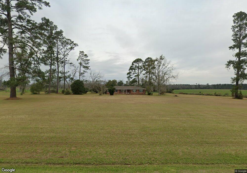
7617 Adel Hwy Morven, GA 31638
Estimated Value: $225,000 - $796,000
--
Bed
--
Bath
2,020
Sq Ft
$228/Sq Ft
Est. Value
About This Home
This home is located at 7617 Adel Hwy, Morven, GA 31638 and is currently estimated at $459,875, approximately $227 per square foot. 7617 Adel Hwy is a home with nearby schools including North Brooks Elementary School.
Ownership History
Date
Name
Owned For
Owner Type
Purchase Details
Closed on
May 20, 2013
Sold by
Billingsley Jesse R and Billingsley Mary D
Bought by
Conservation Use Covenant Recording
Current Estimated Value
Purchase Details
Closed on
Mar 5, 2012
Sold by
Billingsley Jesse R
Bought by
Billingsley Jesse R
Home Financials for this Owner
Home Financials are based on the most recent Mortgage that was taken out on this home.
Original Mortgage
$150,000
Interest Rate
3.9%
Mortgage Type
New Conventional
Purchase Details
Closed on
Mar 16, 2009
Bought by
Affidavit Of Title Facts
Purchase Details
Closed on
Jul 9, 1996
Bought by
Parrott Val Alan and Parrott Bonnie C
Purchase Details
Closed on
Nov 14, 1994
Sold by
Parrott Alan
Bought by
Parrott Val Alan and Parrott Bonnie
Create a Home Valuation Report for This Property
The Home Valuation Report is an in-depth analysis detailing your home's value as well as a comparison with similar homes in the area
Home Values in the Area
Average Home Value in this Area
Purchase History
| Date | Buyer | Sale Price | Title Company |
|---|---|---|---|
| Conservation Use Covenant Recording | -- | -- | |
| Billingsley Jesse R | -- | -- | |
| Billingsley Jesse R | $379,000 | -- | |
| Affidavit Of Title Facts | -- | -- | |
| Parrott Val Alan | -- | -- | |
| Parrott Val Alan | $55,000 | -- |
Source: Public Records
Mortgage History
| Date | Status | Borrower | Loan Amount |
|---|---|---|---|
| Previous Owner | Billingsley Jesse R | $150,000 | |
| Previous Owner | Billingsley Jesse R | $179,000 |
Source: Public Records
Tax History Compared to Growth
Tax History
| Year | Tax Paid | Tax Assessment Tax Assessment Total Assessment is a certain percentage of the fair market value that is determined by local assessors to be the total taxable value of land and additions on the property. | Land | Improvement |
|---|---|---|---|---|
| 2024 | $2,314 | $142,120 | $80,840 | $61,280 |
| 2023 | $2,186 | $126,600 | $69,560 | $57,040 |
| 2022 | $2,305 | $121,760 | $66,280 | $55,480 |
| 2021 | $2,004 | $101,880 | $55,040 | $46,840 |
| 2020 | $2,836 | $102,120 | $55,040 | $47,080 |
| 2019 | $1,775 | $86,560 | $44,880 | $41,680 |
| 2018 | $2,555 | $87,480 | $45,000 | $42,480 |
| 2017 | $1,707 | $86,160 | $45,000 | $41,160 |
| 2016 | $1,718 | $86,600 | $45,000 | $41,600 |
| 2015 | -- | $81,708 | $41,920 | $39,788 |
| 2014 | -- | $82,948 | $41,920 | $41,028 |
| 2013 | -- | $82,948 | $41,920 | $41,028 |
Source: Public Records
Map
Nearby Homes
- 4386 Studstill Rd
- 85 Hitch St
- 11439 Adel Hwy
- 168 Azalea St
- 237 Turkey Ridge Ln
- 51 Green Lake Cir
- 17 Green Lake Cir
- 471 Jamar Trail
- 295 Sunflower
- 288 Jamar Trail
- 270 Jamar Trail
- 248 Jamar Trail
- 61 Trail of Hawk Rd
- 1440 Peach Rd
- 6818 Troupeville Rd
- 6211 Hardee Dr
- 16000 Valdosta Hwy
- 8262 Troupeville Rd
- Tract 2 Hall Webb Rd
- 916 Robinson Rd