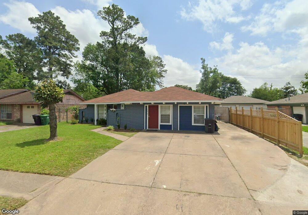
7618 Parker Rd Houston, TX 77016
East Little York NeighborhoodEstimated Value: $188,000 - $216,000
3
Beds
2
Baths
1,669
Sq Ft
$119/Sq Ft
Est. Value
About This Home
This home is located at 7618 Parker Rd, Houston, TX 77016 and is currently estimated at $199,384, approximately $119 per square foot. 7618 Parker Rd is a home located in Harris County with nearby schools including Shadydale Elementary School, Forest Brook Middle, and North Forest High School.
Ownership History
Date
Name
Owned For
Owner Type
Purchase Details
Closed on
Sep 6, 2019
Sold by
Armstrong Patricia Scott
Bought by
Mouton Dowayne
Current Estimated Value
Purchase Details
Closed on
Jun 24, 2002
Sold by
Tillman Lemuel P and Tillman Joann
Bought by
Mouton Dowayne R and Mouton Laquita D
Home Financials for this Owner
Home Financials are based on the most recent Mortgage that was taken out on this home.
Original Mortgage
$62,991
Interest Rate
6.89%
Create a Home Valuation Report for This Property
The Home Valuation Report is an in-depth analysis detailing your home's value as well as a comparison with similar homes in the area
Home Values in the Area
Average Home Value in this Area
Purchase History
| Date | Buyer | Sale Price | Title Company |
|---|---|---|---|
| Mouton Dowayne | -- | Stewart Title Houston Div | |
| Mouton Dowayne R | -- | Stewart Title |
Source: Public Records
Mortgage History
| Date | Status | Borrower | Loan Amount |
|---|---|---|---|
| Previous Owner | Mouton Dowayne R | $62,991 | |
| Closed | Mouton Dowayne R | $3,499 |
Source: Public Records
Tax History Compared to Growth
Tax History
| Year | Tax Paid | Tax Assessment Tax Assessment Total Assessment is a certain percentage of the fair market value that is determined by local assessors to be the total taxable value of land and additions on the property. | Land | Improvement |
|---|---|---|---|---|
| 2025 | $888 | $172,977 | $45,228 | $127,749 |
| 2024 | $888 | $172,977 | $45,228 | $127,749 |
| 2023 | $888 | $184,759 | $45,228 | $139,531 |
| 2022 | $1,645 | $160,801 | $37,991 | $122,810 |
| 2021 | $1,583 | $120,728 | $25,327 | $95,401 |
| 2020 | $1,495 | $105,793 | $18,815 | $86,978 |
| 2019 | $1,420 | $100,087 | $13,749 | $86,338 |
| 2018 | $736 | $66,740 | $12,374 | $54,366 |
| 2017 | $1,173 | $66,740 | $12,374 | $54,366 |
| 2016 | $1,066 | $63,895 | $12,374 | $51,521 |
| 2015 | $539 | $57,033 | $12,374 | $44,659 |
| 2014 | $539 | $51,193 | $12,374 | $38,819 |
Source: Public Records
Map
Nearby Homes
- 7618 Boggess Rd
- 10125 Rebel Rd
- 10206 Cheeves Dr
- 10101 Rebel Rd
- 10106 Cheeves Dr
- 8022 Yoe St
- 7603 Caddo Rd
- 10035 Tiger Flower Ln
- 7639 Bigwood St
- 7402 Yoe St
- 7818 Laurel Gem Dr
- 7827 Laurel Gem Dr
- 7823 Laurel Gem Dr
- 7821 Laurel Gem Dr
- 7812 Laurel Gem Dr
- 7830 Laurel Gem Dr
- 7824 Laurel Gem Dr
- 7819 Laurel Gem Dr
- 7815 Laurel Gem Dr
- 7717 Bigwood St
- 7614 Parker Rd
- 7609 Charlesmont St
- 7626 Parker Rd
- 7605 Charlesmont St
- 7613 Charlesmont St
- 7617 Charlesmont St
- 7606 Parker Rd
- 7630 Parker Rd
- 7601 Charlesmont St
- 7617 Parker Rd
- 7621 Charlesmont St
- 7613 Parker Rd
- 7621 Parker Rd
- 7634 Parker Rd
- 7609 Parker Rd
- 7625 Parker Rd
- 7625 Charlesmont St
- 7605 Parker Rd
- 10137 Rebel Rd
- 7629 Parker Rd