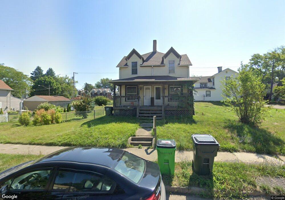
762 S Arch Ave Alliance, OH 44601
Estimated Value: $77,000 - $120,000
4
Beds
2
Baths
1,728
Sq Ft
$54/Sq Ft
Est. Value
About This Home
This home is located at 762 S Arch Ave, Alliance, OH 44601 and is currently estimated at $92,792, approximately $53 per square foot. 762 S Arch Ave is a home located in Stark County with nearby schools including Alliance Elementary School at Rockhill, Alliance Intermediate School at Northside, and Alliance Middle School.
Ownership History
Date
Name
Owned For
Owner Type
Purchase Details
Closed on
May 12, 2022
Sold by
Ace & G Properties Ltd
Bought by
From Mega Rentals Ltd
Current Estimated Value
Purchase Details
Closed on
May 26, 2011
Sold by
Wells Fargo Bank Na
Bought by
Ace & G Properties Ltd
Purchase Details
Closed on
Apr 12, 2011
Sold by
Wayne Homer J
Bought by
Wells Fargo Bank Na
Purchase Details
Closed on
Nov 1, 2006
Sold by
Wayne Homer J
Bought by
Thurmond Earl C
Home Financials for this Owner
Home Financials are based on the most recent Mortgage that was taken out on this home.
Original Mortgage
$71,000
Interest Rate
6.27%
Mortgage Type
Seller Take Back
Purchase Details
Closed on
Aug 6, 1996
Sold by
John H Amerser Trst
Bought by
Wayne Homer J
Create a Home Valuation Report for This Property
The Home Valuation Report is an in-depth analysis detailing your home's value as well as a comparison with similar homes in the area
Home Values in the Area
Average Home Value in this Area
Purchase History
| Date | Buyer | Sale Price | Title Company |
|---|---|---|---|
| From Mega Rentals Ltd | -- | Pfendler Christopher C | |
| Ace & G Properties Ltd | $10,600 | Accuttitle Agency Inc | |
| Wells Fargo Bank Na | $28,000 | None Available | |
| Thurmond Earl C | $72,000 | None Available | |
| Wayne Homer J | $5,000 | -- |
Source: Public Records
Mortgage History
| Date | Status | Borrower | Loan Amount |
|---|---|---|---|
| Previous Owner | Thurmond Earl C | $71,000 |
Source: Public Records
Tax History Compared to Growth
Tax History
| Year | Tax Paid | Tax Assessment Tax Assessment Total Assessment is a certain percentage of the fair market value that is determined by local assessors to be the total taxable value of land and additions on the property. | Land | Improvement |
|---|---|---|---|---|
| 2025 | -- | $24,150 | $2,940 | $21,210 |
| 2024 | -- | $24,150 | $2,940 | $21,210 |
| 2023 | $509 | $12,360 | $1,510 | $10,850 |
| 2022 | $512 | $12,360 | $1,510 | $10,850 |
| 2021 | $514 | $12,360 | $1,510 | $10,850 |
| 2020 | $467 | $10,510 | $1,300 | $9,210 |
| 2019 | $461 | $10,510 | $1,300 | $9,210 |
| 2018 | $517 | $10,510 | $1,300 | $9,210 |
| 2017 | $428 | $9,530 | $1,090 | $8,440 |
| 2016 | $431 | $9,530 | $1,090 | $8,440 |
| 2015 | $514 | $9,530 | $1,090 | $8,440 |
| 2014 | $200 | $4,170 | $1,050 | $3,120 |
| 2013 | $100 | $4,170 | $1,050 | $3,120 |
Source: Public Records
Map
Nearby Homes
- 452 E Summit St
- 1005 S Freedom Ave
- 432 S Linden Ave
- 807 S Union Ave
- 1175 S Freedom Ave
- 1044 S Liberty Ave
- V/L S Fredeom Ave
- 442 S Liberty Ave
- 814 Milner St
- 356 E Broadway St
- 551 South St
- 427 S Union Ave
- 831 Wade Ave
- 140 W Summit St
- 1437 S Linden Ave
- 1395 S Webb Ave
- 361 E Main St
- 729 Waugh St
- 1475 Chatauqua Ct
- 815 Grace St
- 764 S Arch Ave
- 324 E Grant St
- 742 S Arch Ave
- 757 S Linden Ave
- 767 S Linden Ave
- 747 S Linden Ave
- 771 S Arch Ave
- 726 S Arch Ave
- 739 S Linden Ave
- 805 S Linden Ave
- 725 S Linden Ave
- 248 E Grant St
- 718 S Arch Ave
- 815 S Linden Ave
- 713 S Linden Ave
- 825 S Linden Ave
- 327 E Summit St
- 702 S Arch Ave
- 234 E Grant St
- 234 E Grant St