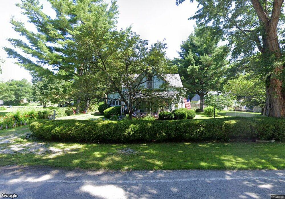
7620 Mooresville Rd West Newton, IN 46183
West Newton NeighborhoodEstimated Value: $138,000 - $294,000
3
Beds
2
Baths
1,900
Sq Ft
$121/Sq Ft
Est. Value
About This Home
This home is located at 7620 Mooresville Rd, West Newton, IN 46183 and is currently estimated at $230,006, approximately $121 per square foot. 7620 Mooresville Rd is a home located in Marion County with nearby schools including West Newton Elementary School, Decatur Middle School, and Decatur Central High School.
Ownership History
Date
Name
Owned For
Owner Type
Purchase Details
Closed on
Jun 25, 2007
Sold by
First Bank Richmond
Bought by
Morksbary Loueva
Current Estimated Value
Home Financials for this Owner
Home Financials are based on the most recent Mortgage that was taken out on this home.
Original Mortgage
$90,000
Outstanding Balance
$55,753
Interest Rate
6.42%
Mortgage Type
New Conventional
Estimated Equity
$174,253
Purchase Details
Closed on
Dec 29, 2006
Sold by
Alexander Ronald J
Bought by
First Bank Richmondna
Create a Home Valuation Report for This Property
The Home Valuation Report is an in-depth analysis detailing your home's value as well as a comparison with similar homes in the area
Home Values in the Area
Average Home Value in this Area
Purchase History
| Date | Buyer | Sale Price | Title Company |
|---|---|---|---|
| Morksbary Loueva | -- | None Available | |
| First Bank Richmondna | $110,000 | None Available |
Source: Public Records
Mortgage History
| Date | Status | Borrower | Loan Amount |
|---|---|---|---|
| Open | Morksbary Loueva | $90,000 |
Source: Public Records
Tax History Compared to Growth
Tax History
| Year | Tax Paid | Tax Assessment Tax Assessment Total Assessment is a certain percentage of the fair market value that is determined by local assessors to be the total taxable value of land and additions on the property. | Land | Improvement |
|---|---|---|---|---|
| 2024 | $2,197 | $204,600 | $20,200 | $184,400 |
| 2023 | $2,197 | $182,600 | $20,200 | $162,400 |
| 2022 | $1,955 | $160,600 | $20,200 | $140,400 |
| 2021 | $1,136 | $91,900 | $20,200 | $71,700 |
| 2020 | $782 | $86,500 | $20,200 | $66,300 |
| 2019 | $806 | $78,200 | $20,200 | $58,000 |
| 2018 | $754 | $73,000 | $20,200 | $52,800 |
| 2017 | $710 | $69,000 | $20,200 | $48,800 |
| 2016 | $690 | $68,100 | $20,200 | $47,900 |
| 2014 | $580 | $65,800 | $20,200 | $45,600 |
| 2013 | $585 | $65,800 | $20,200 | $45,600 |
Source: Public Records
Map
Nearby Homes
- 6545 W Southport Rd
- 7544 Reynolds Rd
- 6908 Mendenhall Rd
- 6700 #7 W Ralston Rd
- 6700 #2 W Ralston Rd
- 6700 #4 W Ralston Rd
- 6700 #6 W Ralston Rd
- 6700 #3 W Ralston Rd
- 5924 Sable Dr
- 7717 Camby Rd
- 5837 Jackie Ln
- 7604 Cloudy Ct
- 7611 Cloudy Ct
- 5825 Jackie Ln
- 5819 Jackie Ln
- 7957 Camby Rd
- 5908 Cabot Dr
- 6811 Cordova Dr
- 8107 Wagman St
- 6911 Littleton Dr
- 7620 S Mooresville Rd
- 7610 Mooresville Rd
- 7614 S Mooresville Rd
- 7610 S Mooresville Rd
- 7611 Mooresville Rd
- 7616 Mooresville Rd
- 7616 S Mooresville Rd
- 7211 N Pearl St
- 7613 Hayworth Rd
- 7205 N Pearl St
- 7623 Mooresville Rd
- 7630 Mooresville Rd
- 7341 S Pearl St
- 7625 Hayworth Rd
- 7629 Mooresville Rd
- 7739 Mendenhall Rd
- 7200 N Pearl St
- 7731 Mendenhall Rd
- 7322 S Pearl St
- 7635 Mooresville Rd