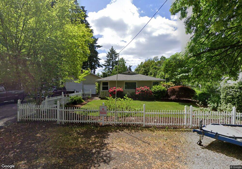
7620 SW Cedarcrest St Portland, OR 97223
Estimated Value: $506,000 - $548,000
3
Beds
2
Baths
1,500
Sq Ft
$352/Sq Ft
Est. Value
About This Home
This home is located at 7620 SW Cedarcrest St, Portland, OR 97223 and is currently estimated at $527,787, approximately $351 per square foot. 7620 SW Cedarcrest St is a home located in Washington County with nearby schools including Metzger Elementary School, Thomas R. Fowler Middle School, and Tigard High School.
Ownership History
Date
Name
Owned For
Owner Type
Purchase Details
Closed on
Oct 23, 1998
Sold by
Wellock Charles R and Wellock Mary Lou
Bought by
Wellock Charles R and Wellock Marylou
Current Estimated Value
Home Financials for this Owner
Home Financials are based on the most recent Mortgage that was taken out on this home.
Original Mortgage
$67,300
Interest Rate
6.6%
Mortgage Type
Purchase Money Mortgage
Create a Home Valuation Report for This Property
The Home Valuation Report is an in-depth analysis detailing your home's value as well as a comparison with similar homes in the area
Home Values in the Area
Average Home Value in this Area
Purchase History
| Date | Buyer | Sale Price | Title Company |
|---|---|---|---|
| Wellock Charles R | -- | Ticor Title Insurance |
Source: Public Records
Mortgage History
| Date | Status | Borrower | Loan Amount |
|---|---|---|---|
| Closed | Wellock Charles R | $67,300 |
Source: Public Records
Tax History Compared to Growth
Tax History
| Year | Tax Paid | Tax Assessment Tax Assessment Total Assessment is a certain percentage of the fair market value that is determined by local assessors to be the total taxable value of land and additions on the property. | Land | Improvement |
|---|---|---|---|---|
| 2026 | $3,687 | $236,680 | -- | -- |
| 2025 | $3,687 | $229,790 | -- | -- |
| 2024 | $3,562 | $223,100 | -- | -- |
| 2023 | $3,562 | $216,610 | $0 | $0 |
| 2022 | $3,417 | $216,610 | $0 | $0 |
| 2021 | $3,337 | $204,190 | $0 | $0 |
| 2020 | $3,238 | $198,250 | $0 | $0 |
| 2019 | $3,166 | $192,480 | $0 | $0 |
| 2018 | $3,022 | $186,880 | $0 | $0 |
| 2017 | $2,911 | $181,440 | $0 | $0 |
| 2016 | $2,771 | $176,160 | $0 | $0 |
| 2015 | $2,664 | $171,030 | $0 | $0 |
| 2014 | $2,583 | $166,050 | $0 | $0 |
Source: Public Records
Map
Nearby Homes
- 7480 SW Taylors Ferry Rd
- 7849 SW Birch St
- 7080 SW Taylors Ferry Rd
- 8925 SW 80th Ave
- 8770 SW 71st Place
- 7830 SW Hemlock St
- 9335 SW 69th Ave
- 6985 SW Florence Ln
- 7375 SW Ashdale Dr
- 10022 SW 72nd Ave
- 9825 SW Ventura Ct
- 10125 SW 72nd Ave
- 7402 SW Locust St
- 6551 SW Taylors Ferry Rd
- 7705 SW Alden St
- 6512 SW Taylors Ferry Rd
- 10200 SW 70th Ave
- 6405 SW Radcliffe St
- 10010 SW Hall Blvd Unit 5
- 10534 SW 80th Ave
- 7630 SW Cedarcrest St
- 7625 SW Cedarcrest St
- 7606 SW Cedarcrest St
- 7617 SW Cedarcrest St
- 7640 SW Cedarcrest St
- 9279 SW 75th Ave
- 7645 SW Cedarcrest St
- 7650 SW Cedarcrest St
- 7514 SW Cedarcrest St
- 9255 SW 75th Ave
- 7548 SW Cedarcrest St
- 7619 SW Chestnut St
- 7655 SW Cedarcrest St
- 7621 SW Chestnut St
- 9239 SW 75th Ave
- 7566 SW Cedarcrest St
- 7615 SW Chestnut St
- 7670 SW Cedarcrest St
- 9284 SW 75th Ave
- 9400 SW 77th Ave