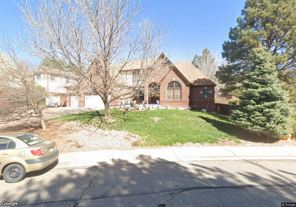
7623 W 70th Dr Arvada, CO 80004
Scenic Heights NeighborhoodEstimated Value: $1,166,983 - $1,241,000
5
Beds
5
Baths
5,483
Sq Ft
$219/Sq Ft
Est. Value
About This Home
This home is located at 7623 W 70th Dr, Arvada, CO 80004 and is currently estimated at $1,198,746, approximately $218 per square foot. 7623 W 70th Dr is a home located in Jefferson County with nearby schools including Secrest Elementary School, Peck Elementary School, and Arvada K-8.
Ownership History
Date
Name
Owned For
Owner Type
Purchase Details
Closed on
Dec 8, 2011
Sold by
Baker Fred A and Baker Milaine A
Bought by
Bettis Jeremy R and Bettis Amy S
Current Estimated Value
Home Financials for this Owner
Home Financials are based on the most recent Mortgage that was taken out on this home.
Original Mortgage
$339,200
Outstanding Balance
$233,479
Interest Rate
4.14%
Mortgage Type
New Conventional
Estimated Equity
$965,267
Purchase Details
Closed on
Nov 11, 1993
Sold by
Ferguson Construction Company
Bought by
Baker Fred A and Baker Milaine A
Home Financials for this Owner
Home Financials are based on the most recent Mortgage that was taken out on this home.
Original Mortgage
$260,000
Interest Rate
6.88%
Create a Home Valuation Report for This Property
The Home Valuation Report is an in-depth analysis detailing your home's value as well as a comparison with similar homes in the area
Home Values in the Area
Average Home Value in this Area
Purchase History
| Date | Buyer | Sale Price | Title Company |
|---|---|---|---|
| Bettis Jeremy R | $424,000 | Htco | |
| Baker Fred A | $337,673 | Land Title |
Source: Public Records
Mortgage History
| Date | Status | Borrower | Loan Amount |
|---|---|---|---|
| Open | Bettis Jeremy R | $339,200 | |
| Previous Owner | Baker Fred A | $260,000 |
Source: Public Records
Tax History Compared to Growth
Tax History
| Year | Tax Paid | Tax Assessment Tax Assessment Total Assessment is a certain percentage of the fair market value that is determined by local assessors to be the total taxable value of land and additions on the property. | Land | Improvement |
|---|---|---|---|---|
| 2024 | $6,677 | $68,836 | $22,834 | $46,002 |
| 2023 | $6,677 | $68,836 | $22,834 | $46,002 |
| 2022 | $5,130 | $52,383 | $16,829 | $35,554 |
| 2021 | $5,215 | $53,890 | $17,313 | $36,577 |
| 2020 | $4,616 | $47,837 | $13,214 | $34,623 |
| 2019 | $4,554 | $47,837 | $13,214 | $34,623 |
| 2018 | $4,777 | $48,783 | $11,179 | $37,604 |
| 2017 | $4,373 | $48,783 | $11,179 | $37,604 |
| 2016 | $4,279 | $44,967 | $8,407 | $36,560 |
| 2015 | $3,925 | $44,967 | $8,407 | $36,560 |
| 2014 | $3,925 | $38,762 | $6,190 | $32,572 |
Source: Public Records
Map
Nearby Homes
- 7769 W 70th Dr
- 7555 W 69th Place
- 6902 Ammons St
- 7021 Saulsbury St
- 6913 Teller Ct
- 7049 Reed Ct
- 8306 W 71st Place
- 6958 Brentwood Ct
- 8090 W 68th Ave
- 7390 W 74th Place
- 8366 W 71st Place
- 8371 W 70th Ave
- 6948 W 70th Ave
- 6705 Upham St
- 7454 Upham Ct
- 6685 Upham St
- 7162 Quay St
- 6781 Quay Ct
- 7126 Dudley Dr
- 6801 Carr St
- 7633 W 70th Dr
- 7613 W 70th Dr
- 7610 W 70th Dr
- 7650 W 70th Dr
- 7643 W 70th Dr
- 7690 W 70th Dr
- 7653 W 70th Dr
- 7730 W 70th Dr
- 7770 W 70th Dr
- 7475 W 70th Ave
- 7849 W 70th Dr
- 7690 W 71st Ave
- 7465 W 70th Ave
- 7485 W 70th Ave
- 7495 W 70th Ave
- 7810 W 70th Dr
- 7484 W 70th Ave
- 7455 W 70th Ave
- 7474 W 70th Ave
- 7445 W 70th Ave